Colorado Weather: Winter quickly returns on Friday with rain changing to snow in the Denver metro area
Snow will cause winter driving conditions in the mountains through Saturday morning while Denver and the Front Range sees rain change to slushy snow by Friday evening.
Rain chances for the Denver, Boulder, and Fort Collins areas will increase throughout the day and will eventually come close to 100%.

And as rain chances increase, temperatures will gradually decrease and eventually drop into the 30s. This will cause the rain to change into snow before 7 p.m. Snow could be falling anywhere along the Front Range for the Friday evening commute and minor accumulation is expected on elevated surfaces like rooftops, vehicles, and grass. Roads are expected to only be wet below 6,000 feet.
It's a different story in the high country where the return of winter weather has prompted the first Winter Weather Advisory in weeks. Nearly every mountain area in Colorado is under the advisory through 9 a.m. Saturday including the entire I-70 mountain corridor. The heaviest accumulation will be west of Vail Pass with 6-12 inches of snow. Locations farther east like the mountains of Summit County, the Winter Park area, and the Rocky Mountain National Park region will get 4-10 inches.
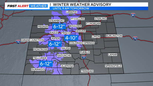
Closer to the metro area, the foothills of Jefferson, Boulder, and Larimer Counties are also under a Winter Weather Advisory for up to 10 inches of snow mostly above 7,500 feet.

Any snow accumulation below 6,000 feet will be limited to 1-2 inches.
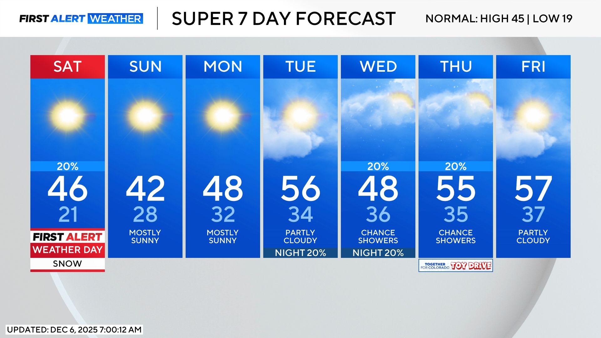
The storm responsible for the winter weather will be slow to depart Colorado on Saturday and therefore most of the day will be cloudy and cool with a continued chance for rain and snow mostly in the morning.
Brighter and warmer weather will return on Sunday and will continue into early next week.