Denver Weather: Spilt Week With A Cool Start And Warm Finish
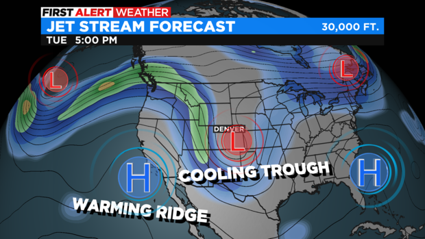
DENVER (CBS)- The final full week of May will be half and half. Starting out with a cool and unsettled weather pattern with showers and isolated thunderstorms on Monday and Tuesday. Then much warmer and drier weather will take control by Thursday. A look at the jet stream map shows a cooling trough of low pressure that will control Colorado's weather for the first half of the week.
The best chance for rain over the Denver metro area will be on Tuesday. While there is a chance for showers in the morning, most of the rain is expected to be in the afternoon and evening. Keep in mind the chance for rain overall is about 60% so some neighbors may completely miss out on the moisture.
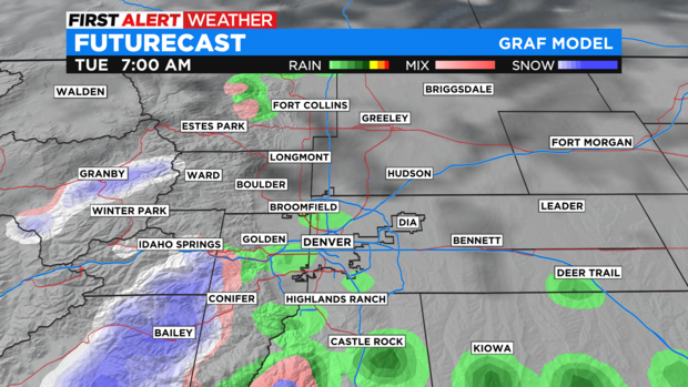
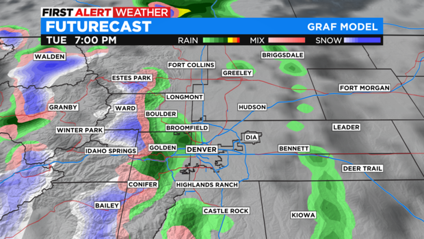
The snow level Monday night into Tuesday will stay above at least 7,000 feet. Locations above 9,000 feet including mountain passes like Loveland, Berthoud, Vail, and the approaches to the Eisenhower Tunnel on I-70 may get 1-2 inches of snow Monday night and another 1-3 inches on Tuesday.
The mountains in southern Colorado will get far more snow. The Sangre de Cristo Mountains, the Wet Mountains, and the Pikes Peak area above 10,000 feet should get 5-10 inches of snow. These areas have a Winter Weather Advisory from 12 p.m. Monday until 6 p.m. Tuesday.

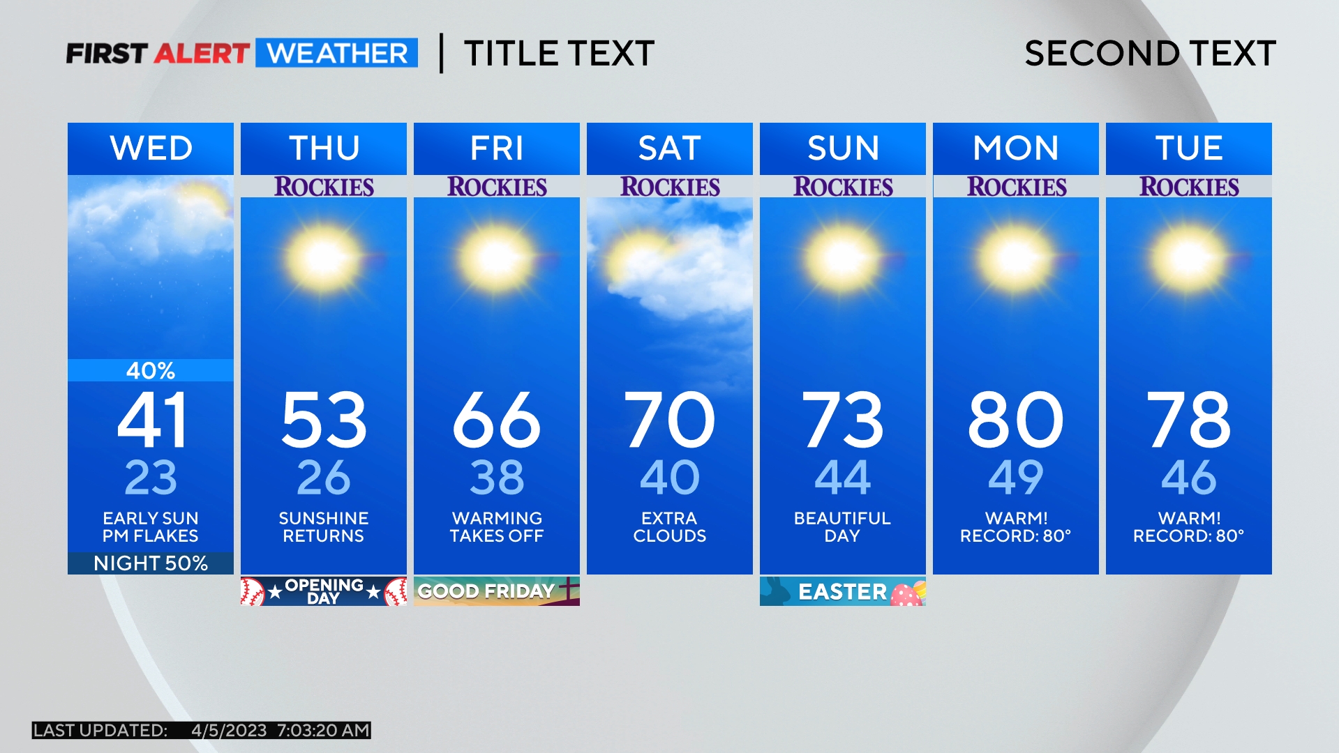
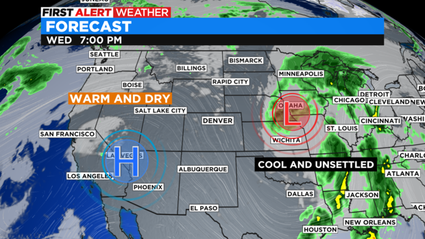
By Wednesday, a ridge of high pressure will begin to push out the cool pattern and bring in above normal temperatures for most of the state for the end of the week ahead.
In fact, by Thursday the Denver metro area will see a string of 80 degree highs through Saturday.