Colorado Weather: Warming Trend Before Next Arctic Blast
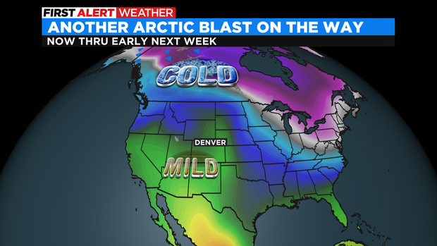
DENVER(CBS)- Get ready for a wild ride over the next several days! On the weather map we have a warming ridge of high pressure that will bring in some major snow melting for Friday on thru the weekend.
Temperatures for the next three days will be in the 50s over the Denver metro area almost reaching 60 by Sunday.
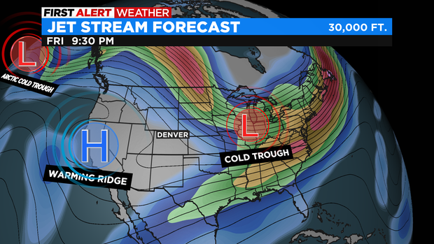
After that we have a big low pressure trough that carves out a huge chunk of the country. This will open the door for another surge of very cold Arctic Air to ooze in over most of the country including Colorado. Temperatures will tumble below freezing Monday night and not get back to above 32 degrees until Friday next week. Overnight lows for Tuesday and Wednesday will likely drop below zero for many across eastern Colorado.
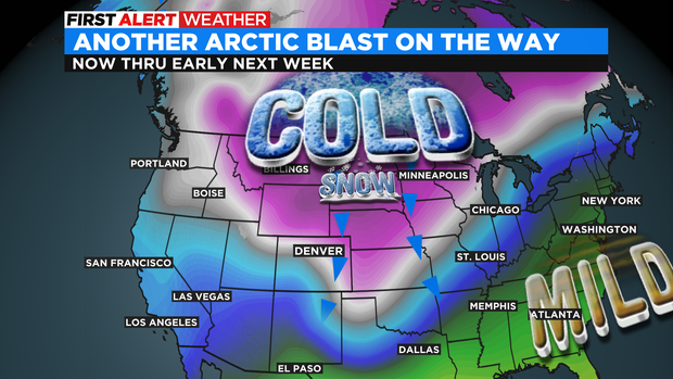
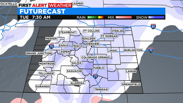
Along with this big change there will be a blast of snow. The storm is still 4 days away so a lot could change between now and Tuesday but, early model data shows a possible 3 to 6 inch snow fall for the Denver metro area by Tuesday night along with more heading into Wednesday.