Colorado Weather: Warmer Friday before extreme cold wave

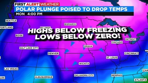
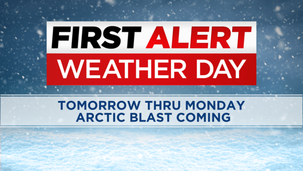
We have a First Alert Weather Day posted for Saturday and Sunday. The start of the Arctic cold change happens on Saturday as temperatures get colder along with light snow and freezing drizzle. Sunday into Monday will be the bitter cold plunge that sends highs into the single digits and lows below zero.
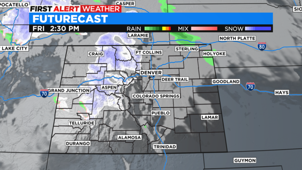
Friday will be the mild day before the major cold wave takes over. There will be snow in the mountains with high clouds over the plains.
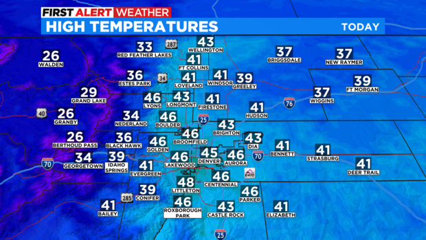
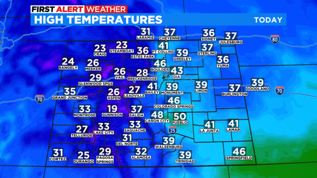
Across eastern Colorado temperatures will be in the the 30s and 40s to finish the week.
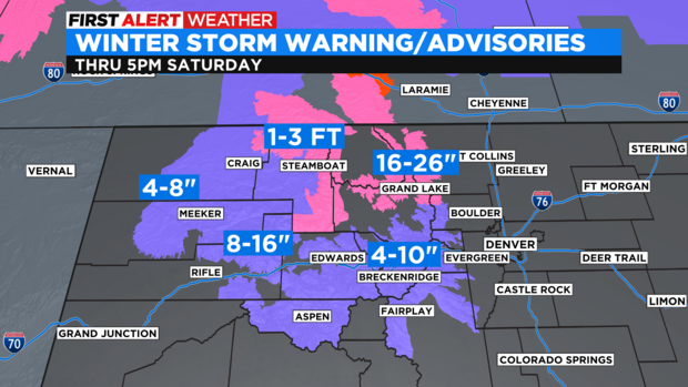
At the same time snow will be ramping up in the northern and central mountains where Winter Storm Warnings and Advisories are in place thru Saturday afternoon. Some areas from Steamboat across Rabbit Ears Pass into Rocky Mountain National Park could see 1 to 2 feet of snow with a few of the highest peaks coming in up to 3 feet!
The Polar cold temps will be easing in over the weekend dropping temperatures on Saturday with light snow over the Denver metro area.
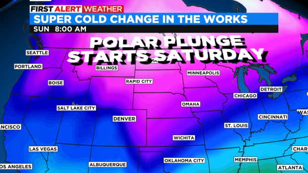
Sunday temperatures across the eastern side of the state will drop big time and get even colder on Monday.
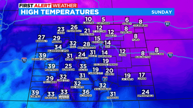
By Monday the Denver metro area and eastern Colorado will experience the coldest of the cold wave. With highs in the single digits and lows below zero.