Colorado Weather: Unusually Warm Ahead Of Big Pattern Change Starting Wednesday
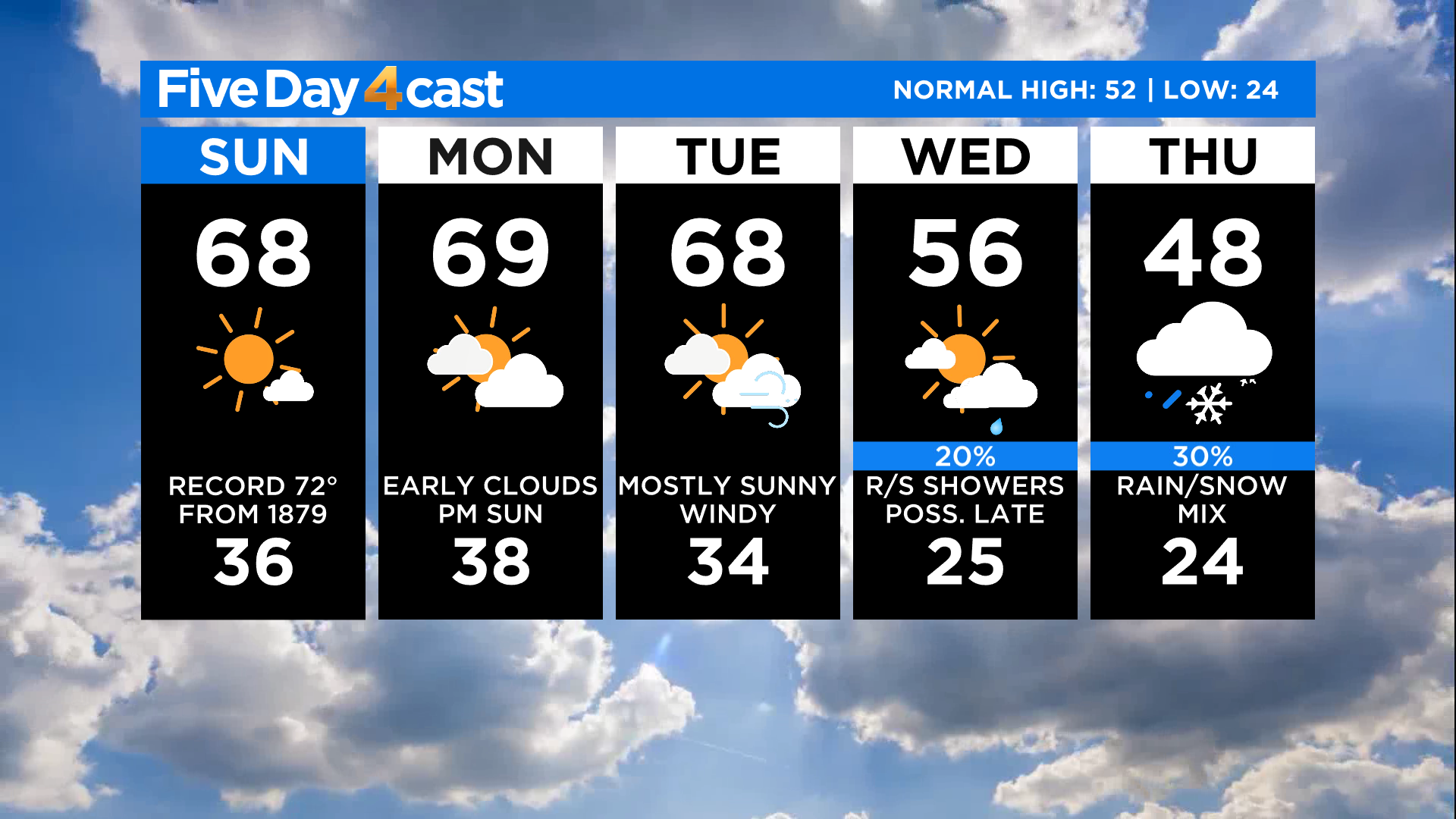
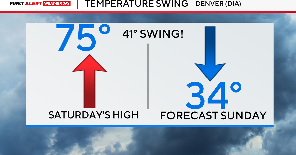
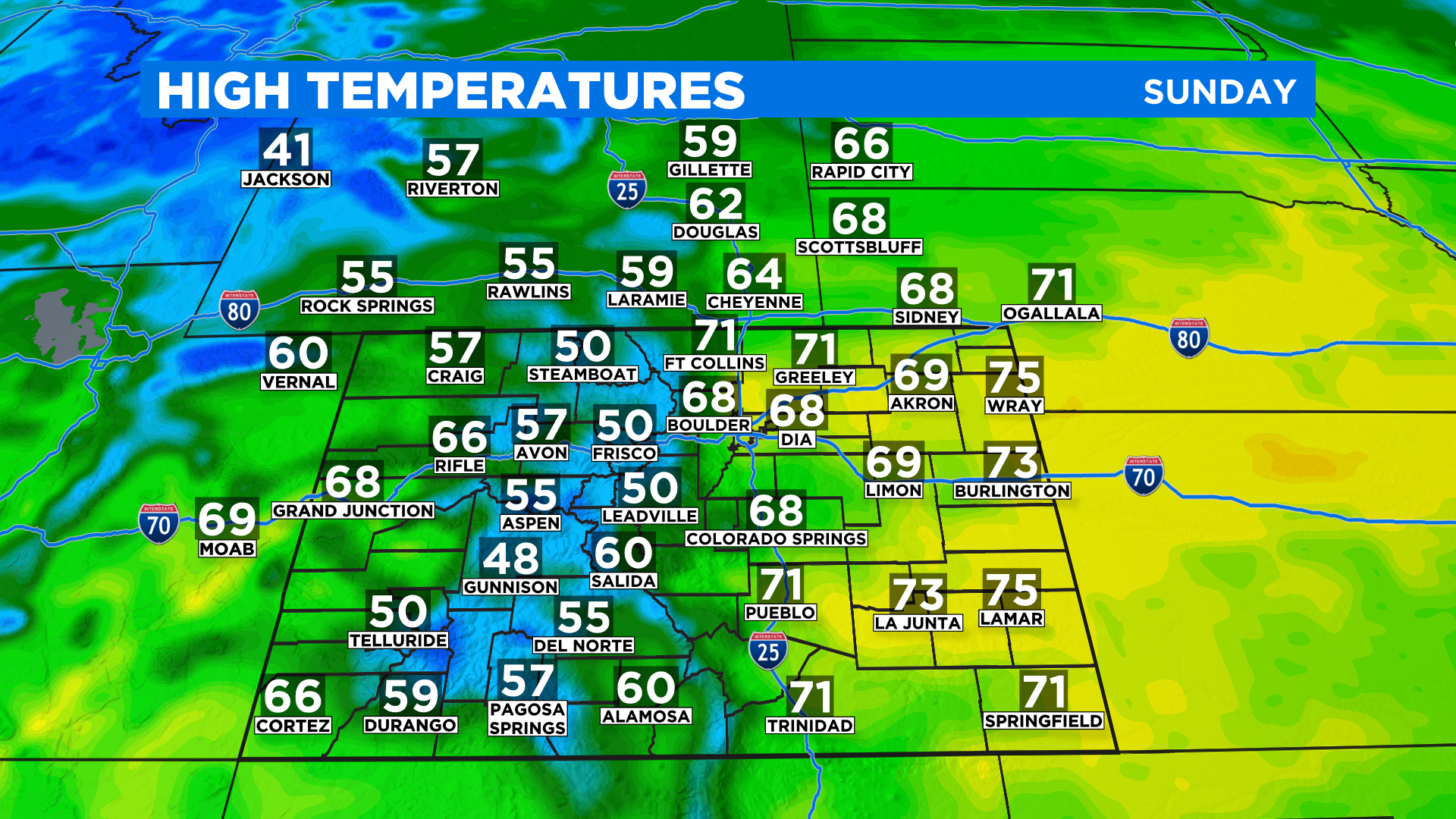
DENVER (CBS4) - The official high in Denver on Saturday was 66 degrees and we'll be around there or even a little higher from now through Tuesday. In fact the entire state is running anywhere from 10-20 degrees above normal for early March.
Today's record for Denver is 72 degrees and it is an old one, dating all the way back to 1879. We will probably miss that by a few degrees due to occasional mid and high-level clouds today. But if we catch a break from the cloud cover then the record could be reached.
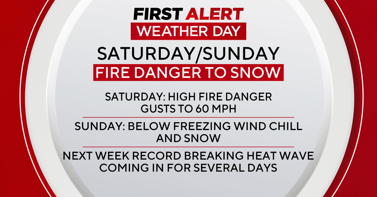
Over the next several days it will be windy from time to time as a big shift in the weather pattern starts to take shape. Because it's unusually warm combined with the ongoing drought we will see some concern over the fire danger.
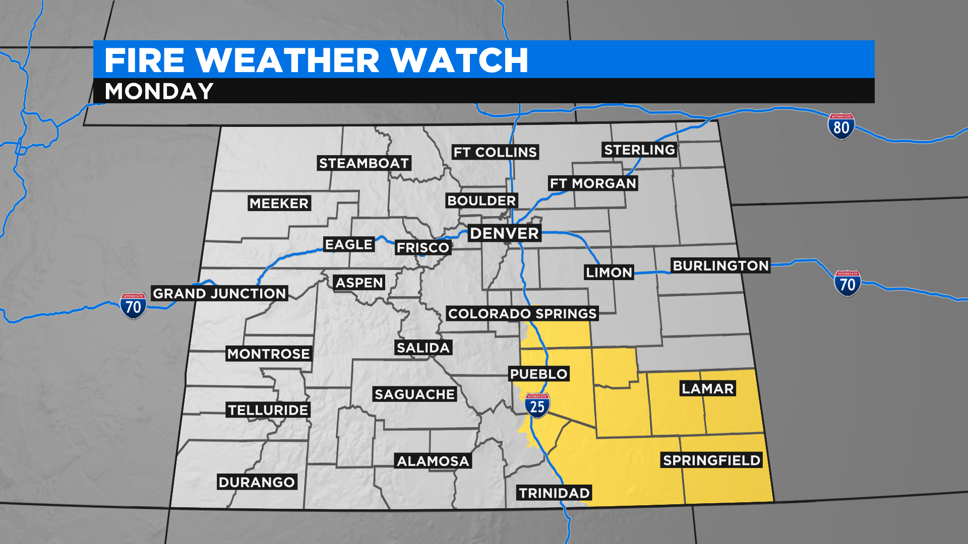
The National Weather Service has issued a Fire Weather Watch for all of southeast Colorado on Monday. This could be upgraded to a Red Flag Warning later today. We could also see the fire weather alerts expand into other areas over the next few days.
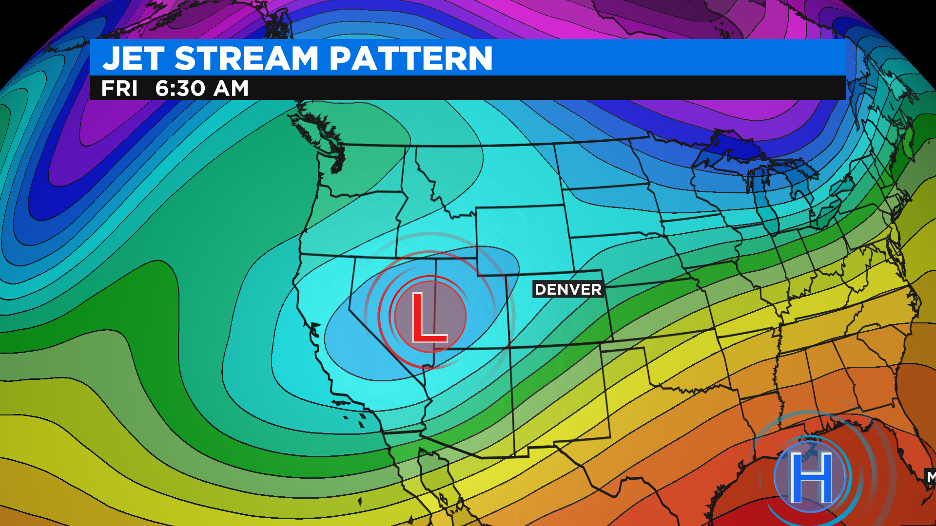
A big storm currently spinning in the Gulf of Alaska will drop into the western United States by Wednesday and Thursday. It will sit and spin for a few days and that will keep Colorado's weather cool and unsettled for as many as 3 to 5 days.
It's just a little too early to talk specifics but as of this posting it looks like a pretty good chance for snow will enter Denver's forecast sometime between late Thursday and early Friday.
Make sure you check back often for updates over the next few days. We are 100% certain it turns much cooler and unsettled starting Wednesday. But the exact timing for chances to see rain and snow (and how much) are still not clear. That will change once this storm moves onto the continent and it gets sampled by weather balloons and surface weather stations along the west coast.