Colorado Weather: Damaging winds to freeze watch
Strong winds batter Front Range with hurricane force. The combination of a strong low pressure area north of Colorado and a powerful jet stream flowing over our state and New Mexico created damaging wind gusts across the region to start the week.
We have a First Alert Weather Day in effect through Tuesday evening for continued strong wind gusts.
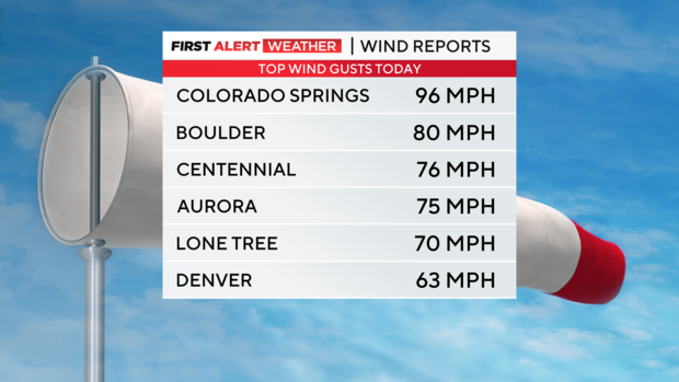
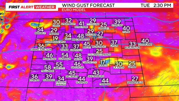
Wind gusts have reached 74 mph-plus in some areas of the Front Range. This is hurricane force.
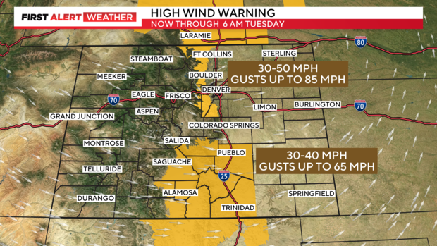
Winds will continue to be strong across the Front Range Foothills through Tuesday morning. There is a High Wind Warning for those areas for some gusts up to 85 mph.
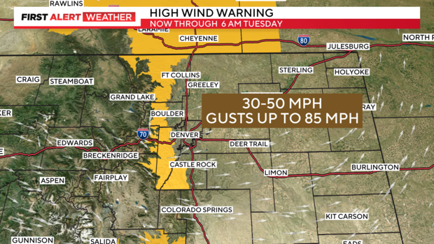
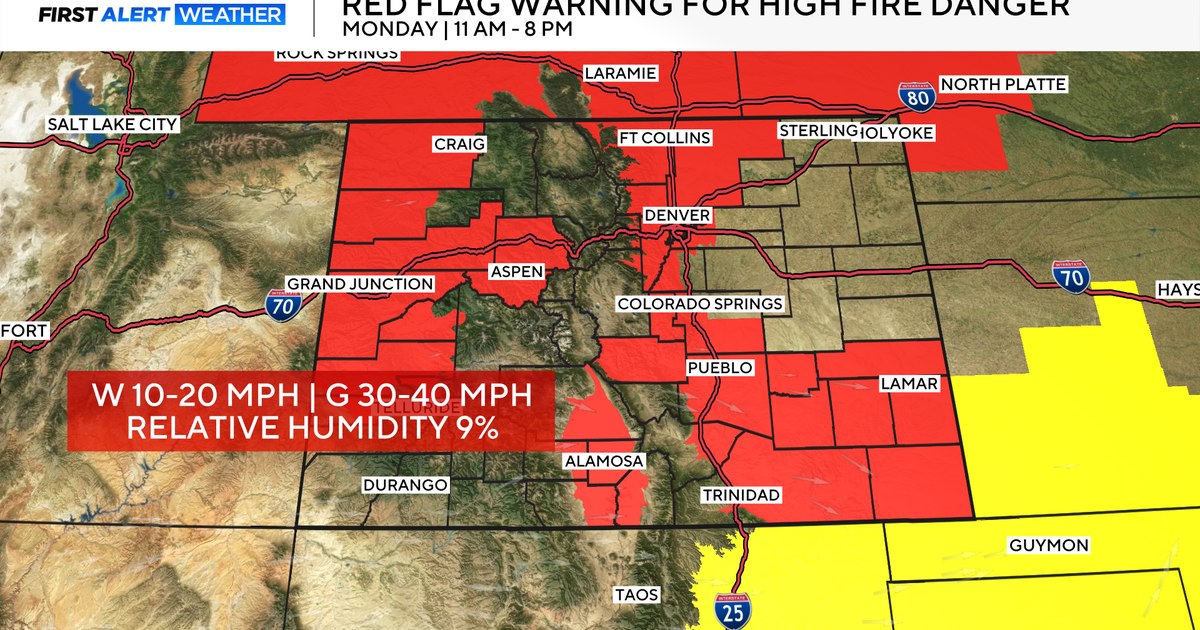
A High Wind Warning is also in place for the Sangre De Cristo mountains and areas of southern Colorado from Pueblo down to Raton Pass.
Conditions will still be windy on Tuesday afternoon, although not as strong as Monday's gusts.
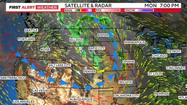
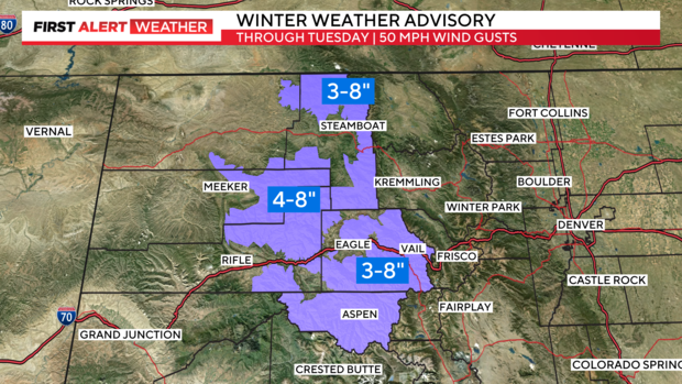
The western mountains have a Winter Weather Advisory in place into Tuesday. Some spots may see 5 to 10 inches of snow with wind gusts up to 50 mph.
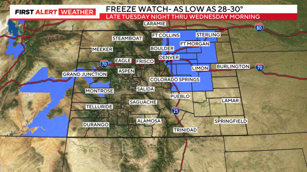
Winds should die down Tuesday night into Wednesday. Tuesday night will be cold with less wind and clearing skies. There is a Freeze Watch in place for Denver and northeastern Colorado. Late Tuesday night into Wednesday morning when temperatures could drop in the 28 to 30-degree zone.
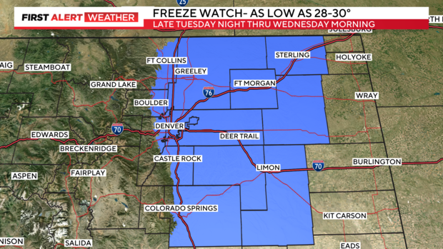
This also includes the Grand Valley out near Grand Junction.
With another batch of moisture coming in for Thursday and Friday with better chances for showers and thunderstorms.