Colorado Weather: Stormy pattern locked in for Tuesday
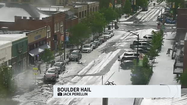
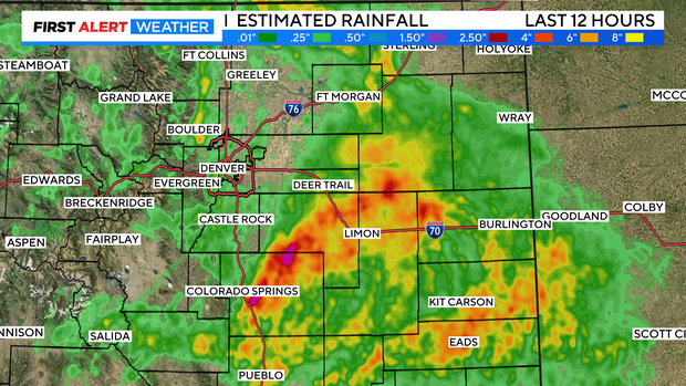
Our daily deluge soaked the the Front Range early on Monday. While Denver officially picked up a quarter inch at Denver International Airport, other areas were flooded and hailed on early in the afternoon.
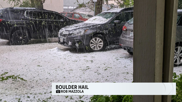
Areas around Boulder had pea to marble size hail pile up to 1 to 3 inches deep.
Along with that some areas picked up over an inch of rain. Flood warnings were in place most of the late afternoon along I-70 from Limon to Burlington as some spots picked up 1 to 4 inches of rain from that area down to Colorado Springs.
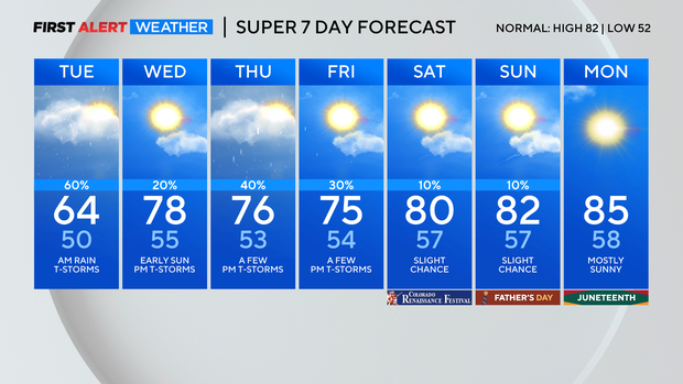
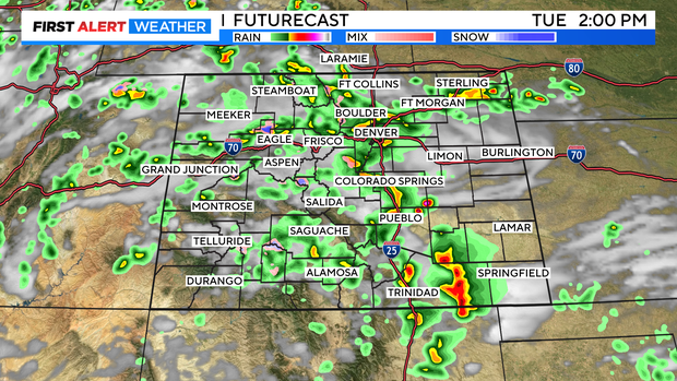
Tuesday will see a repeat of the early showers and thunderstorms. The day should start out cloudy, drizzly and foggy as upslope flow cools our temperature and brings in moisture.
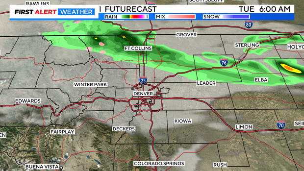
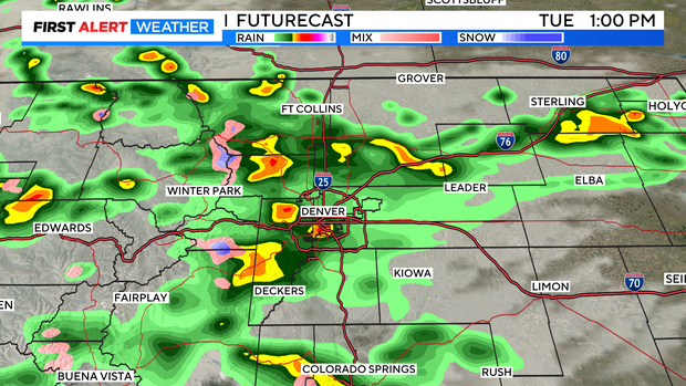
By late morning showers and thunderstorms should strengthen across the Front Range and northeastern plains.
After 4pm skies should start to clear and the evening should be dry over northern Colorado.
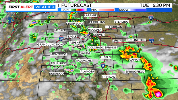
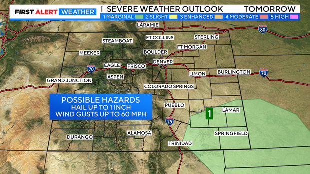
The chances for severe thunderstorms with large hail and damaging winds will be confined to extreme southeastern Colorado. There is a marginal risk for severe storms in that area. Storms around the Denver metro area may have heavy rain but, severe weather will be limited.
Temperatures will remain unseasonably cool across the eastern plains again on Tuesday. with highs in the 60s and 70s. Looking ahead our wet and cool weather pattern should start to finally break down as we get closer to the weekend.