Colorado Weather: Windy, Warm Monday Before Cold Front Blasts In With Cold, Snow
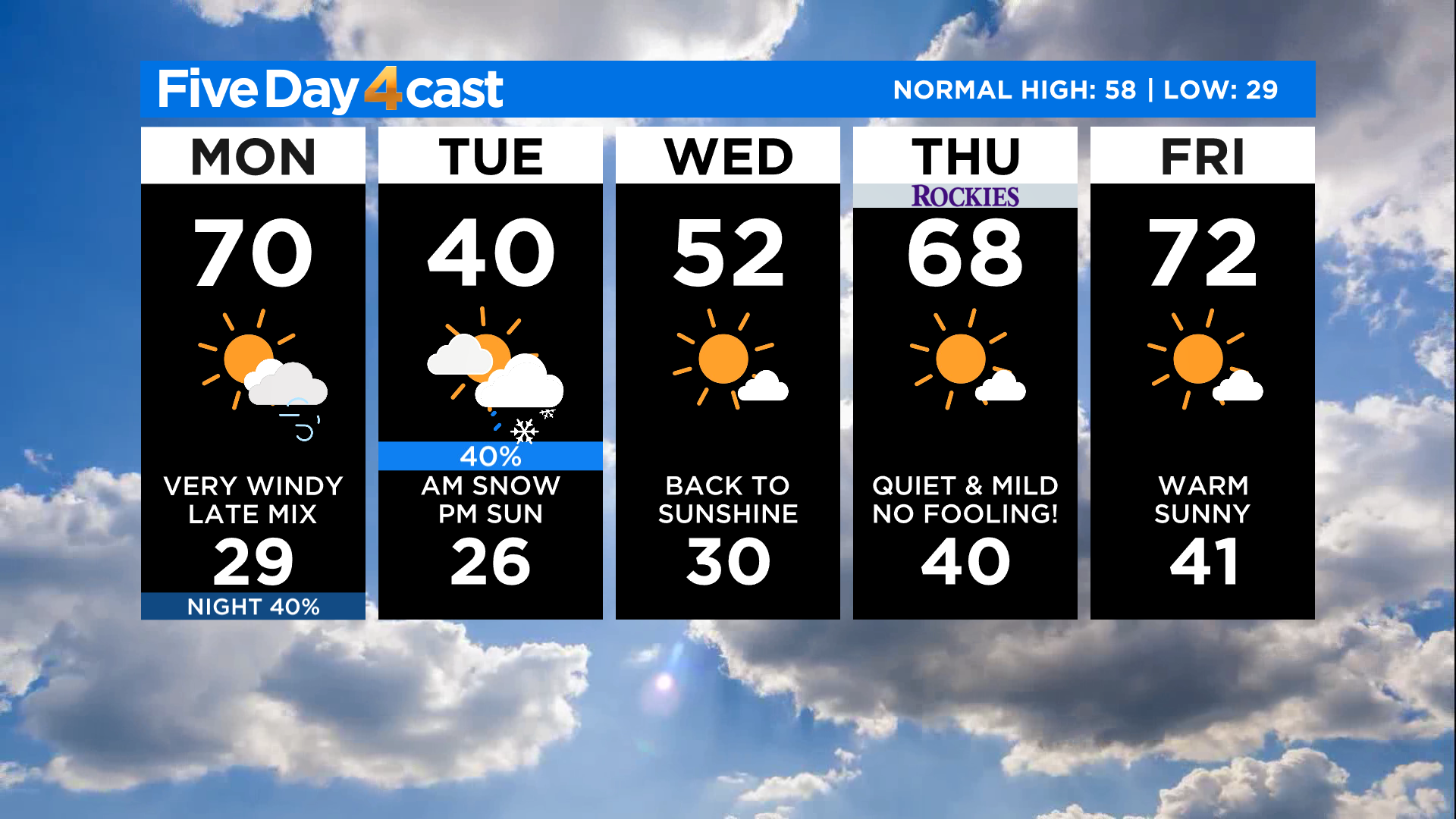
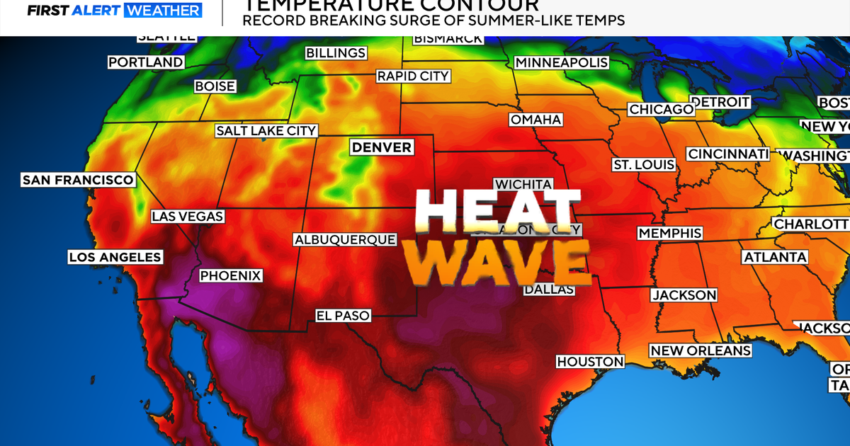
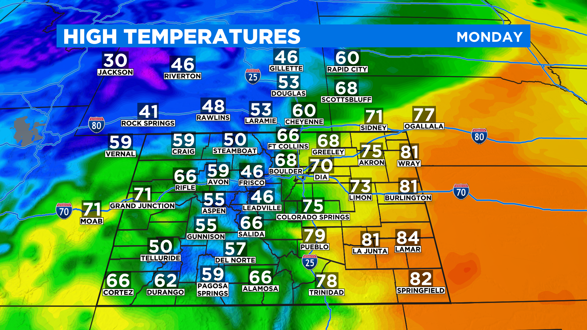
DENVER (CBS4) - The new work week will start off with an abrupt weather change late Monday as a strong cold front moves in from the northwest. But before it gets here we'll have one last warm day just about statewide with highs ranging from the 50s in the northwest to the 80s in the southeast.
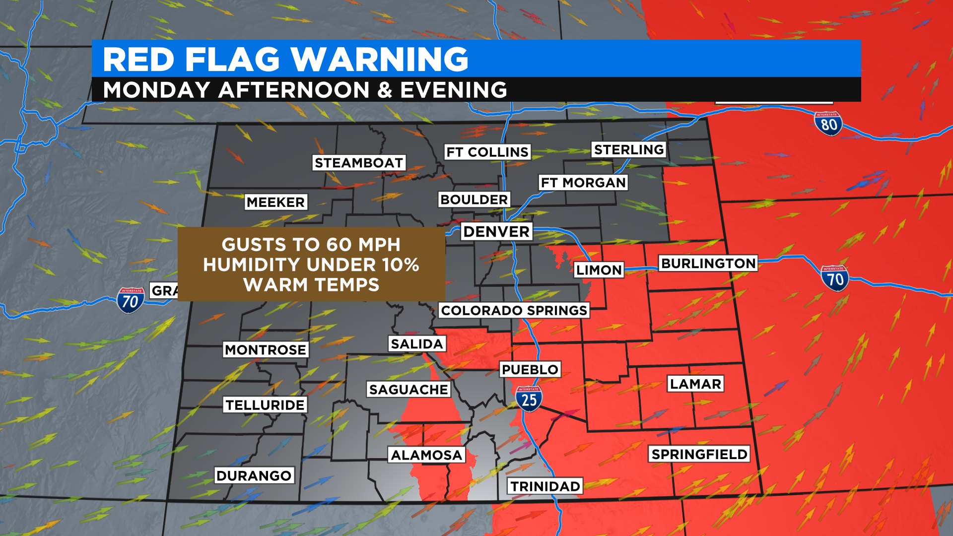
It will be very windy out ahead of this cold front overnight and during the day on Monday. The National Weather Service has issued a handful of high wind alerts around the state. Some of the strongest winds are expected in the foothills west of Denver and on the southeast plains.
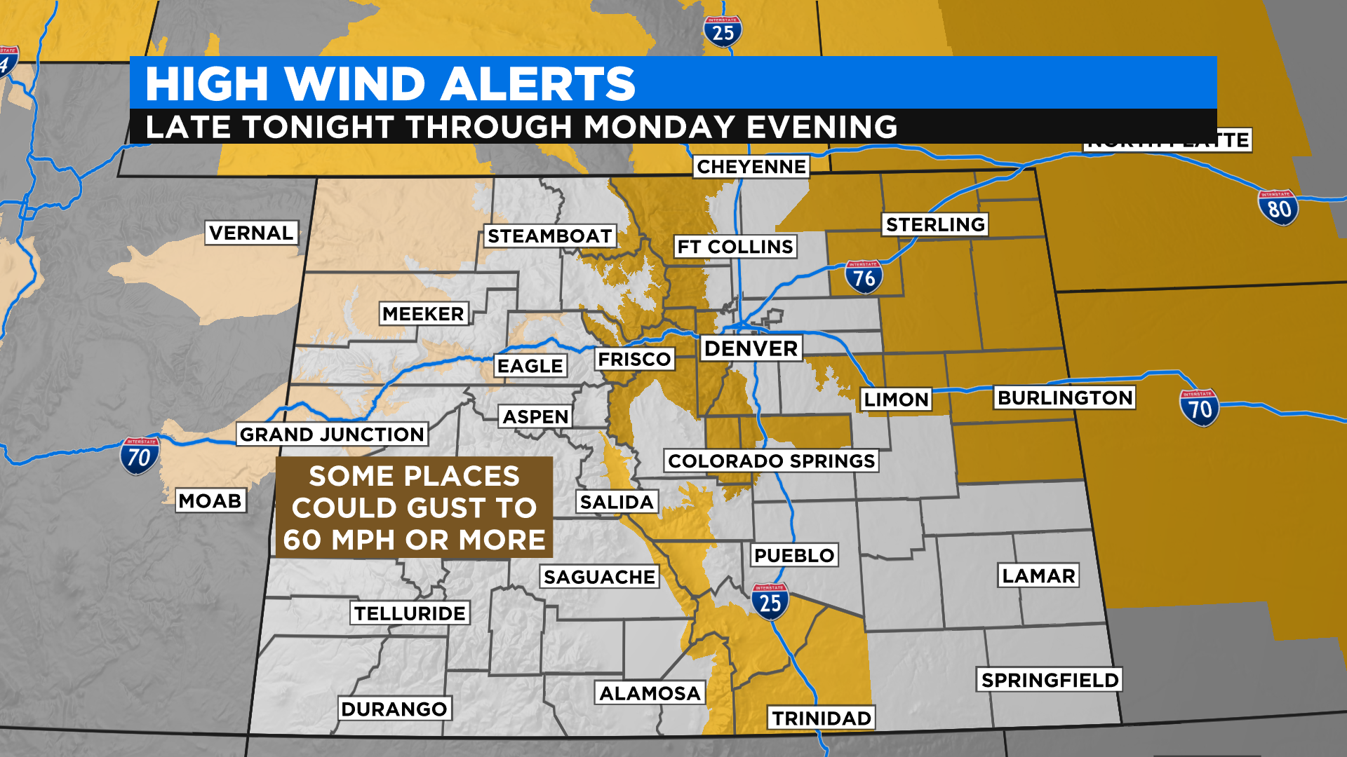
The wind and very warm weather will drive the fire danger to extreme levels Monday afternoon and evening on the southeast plains. The National Weather Service has issued a Red Flag Warning for that part of the state.
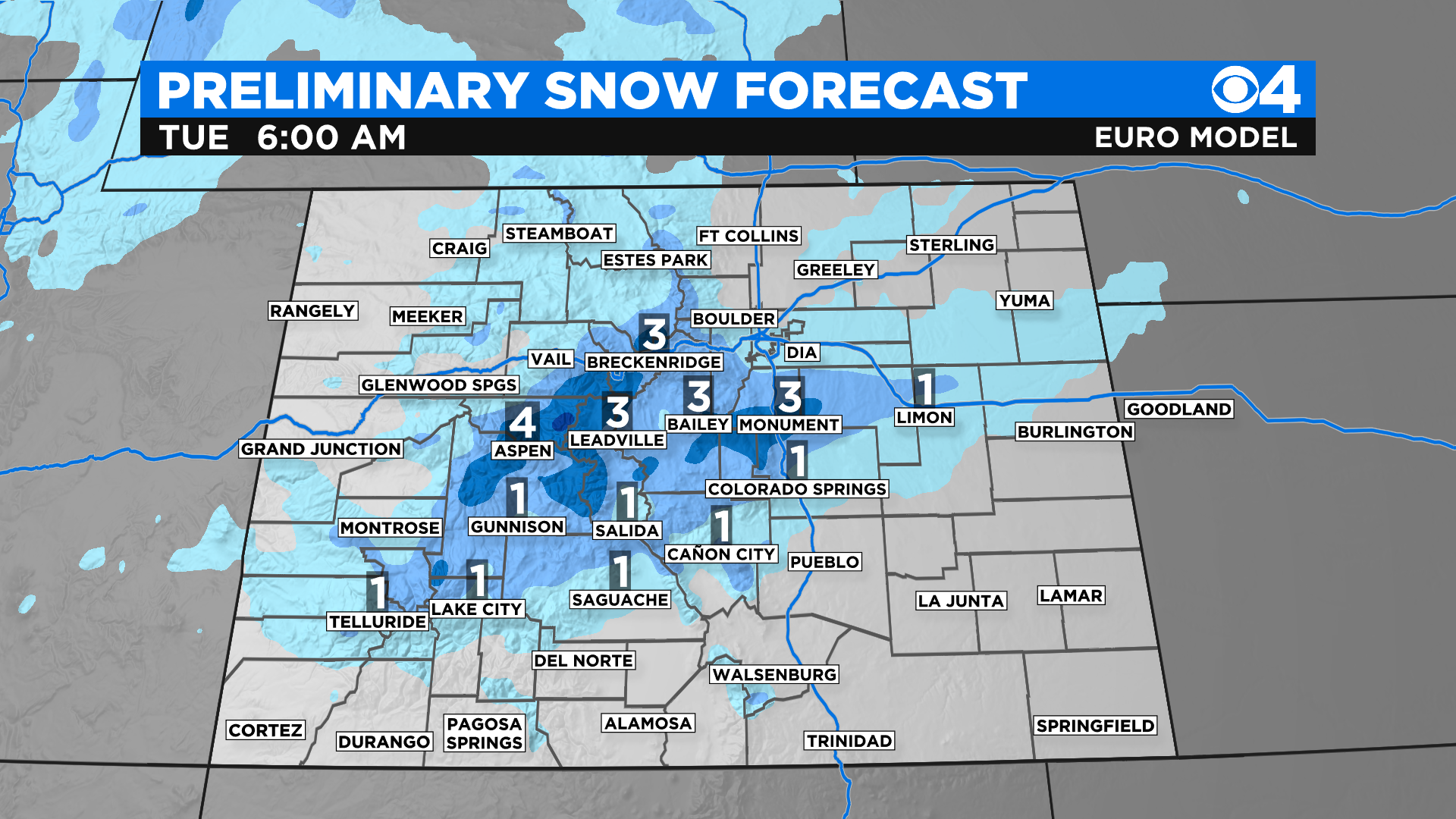
This cold front will kick up some bands of snow as it crosses the state Monday night and early Tuesday but it's simply moving too fast to drop a lot of snow. Some of our mountains could see up to 4 inches.
The lower elevations, including metro Denver, will see very little. At this point we think anywhere from a Trace to 2 inches in a few spots. The timing for this is late Monday night and early Tuesday morning.
This storm will be in and out within just a few hours. We'll see some clearing by Tuesday night. A warming trend will set in starting Wednesday and that will take us all the way through the upcoming weekend.
Right now it is looking gorgeous for the Rockies opening on Thursday. Highs in Denver will be close to 70 degrees.