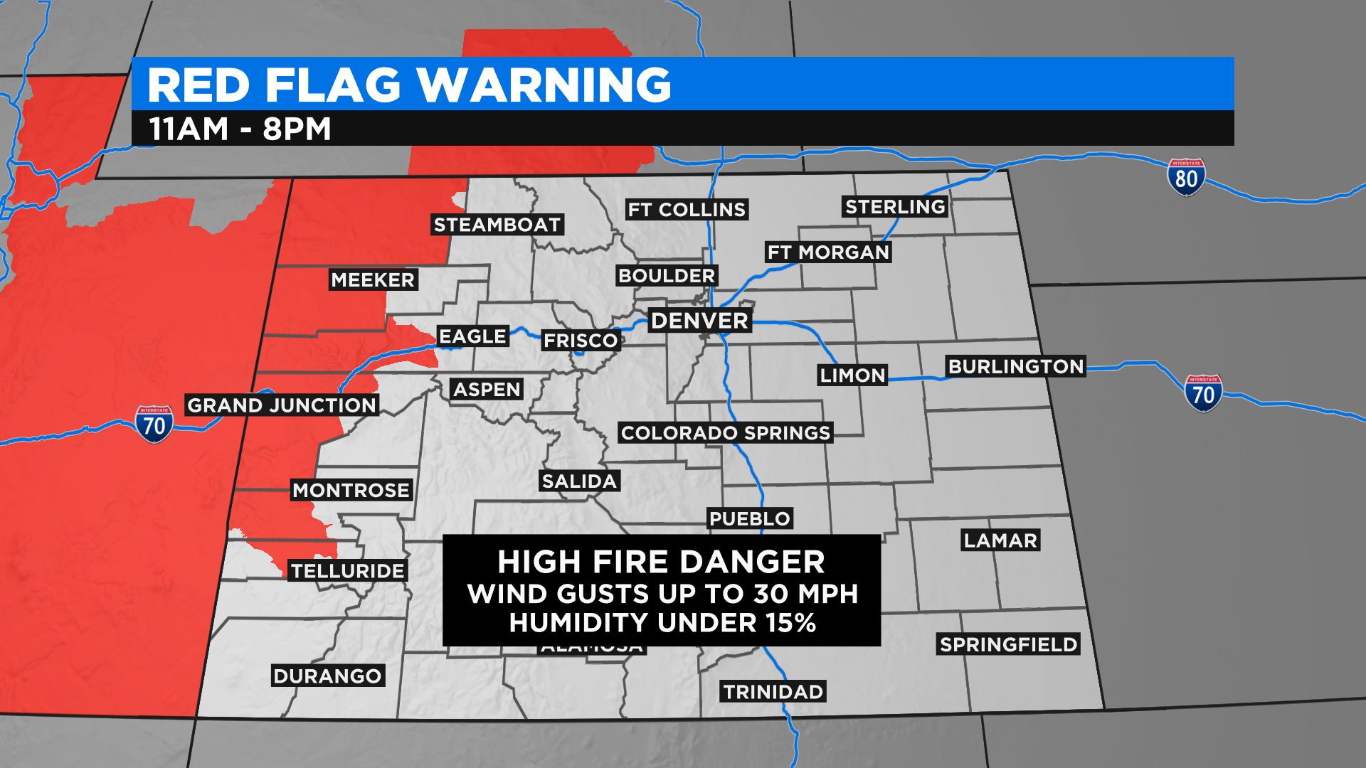
Colorado Weather: Continued Hot West, Few Severe Storms Eastern Plains
DENVER (CBS4) - You've made it to the middle of the week and the weather today will be a lot like it was yesterday. It stays hot and dry on the western side of Colorado with high fire danger.
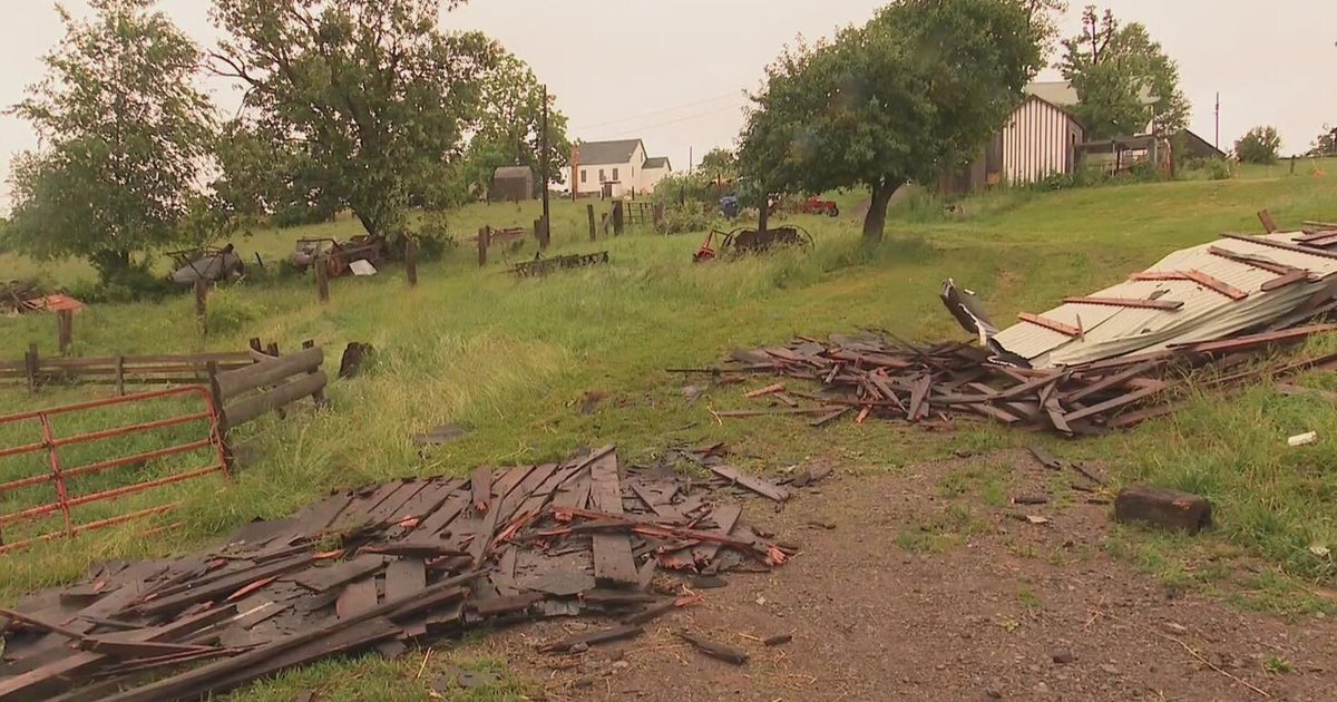
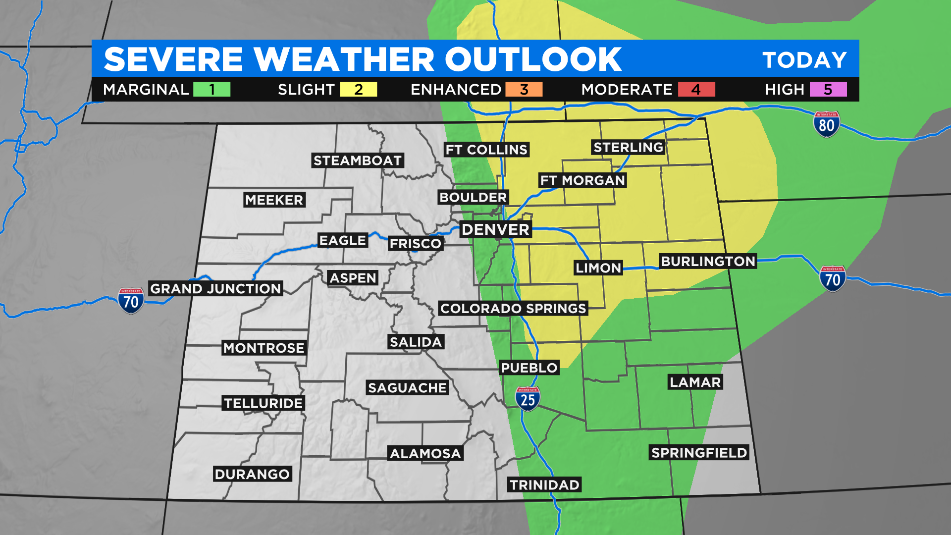
Meanwhile on the eastern plains we have plenty of low-level moisture in the air and that will help to fuel showers and thunderstorms once again this afternoon. Some of those storms could turn severe along and east of Interstate 25 with the highest severe threat on the northeast plains.
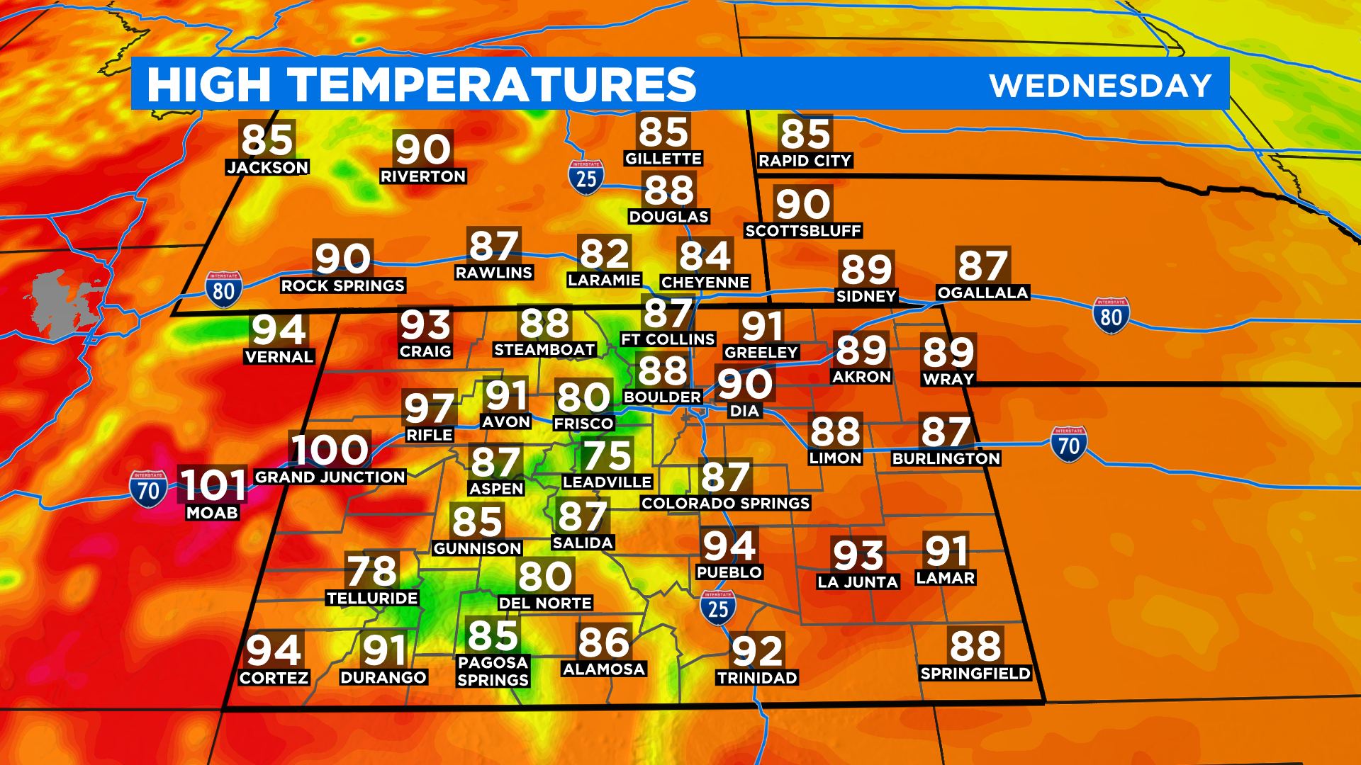
Temperature will be at or above normal today around Colorado with 90s and low 100s on the western slope. Our mountains will be in the 75 to 85 degree range with upper 80s and low 90s on the eastern plains.
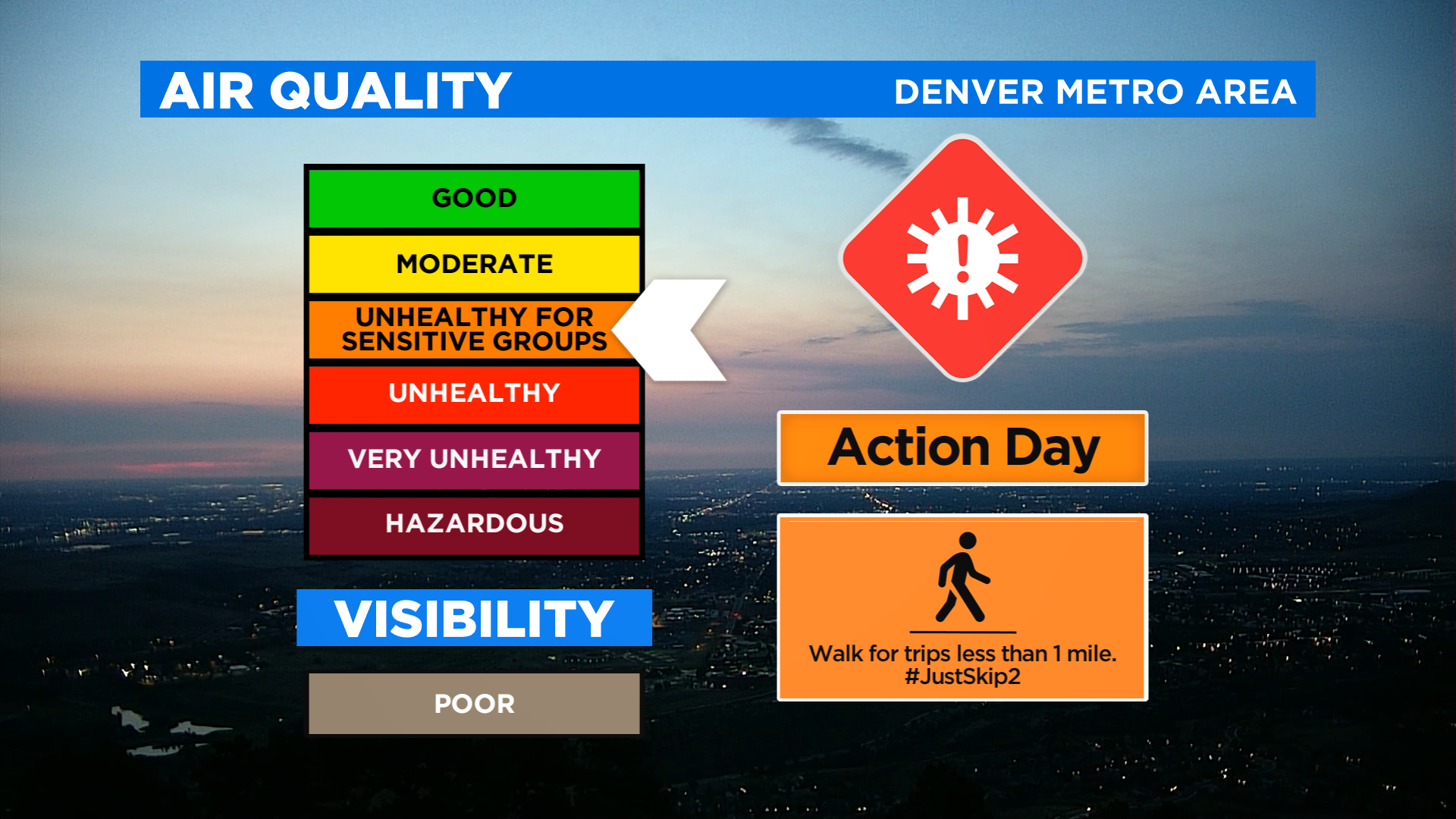
The Front Range is under and ozone alert through at least 4 pm today. The alert includes all of metro Denver, Greeley, Boulder and Fort Collins.
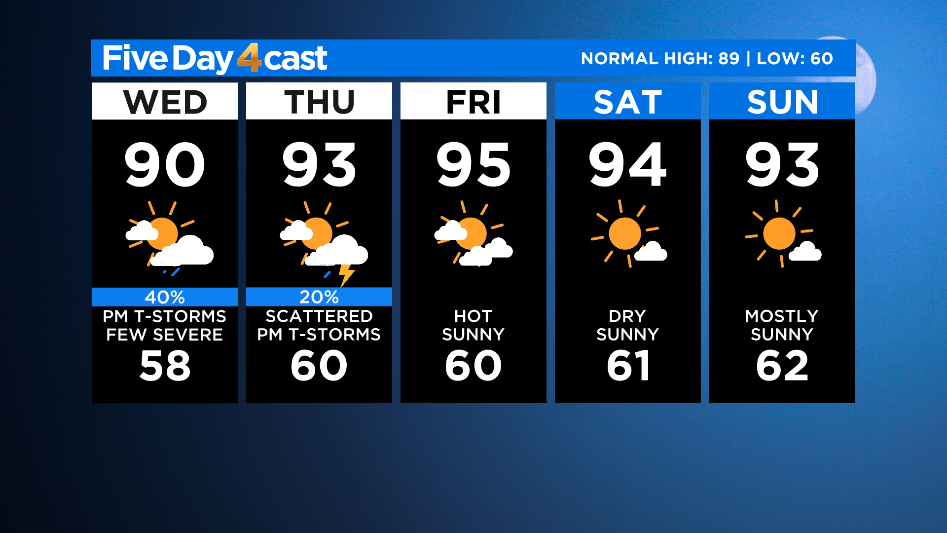
Looking ahead at the next 5 days we will see our thunderstorm chances decrease and the temperatures go up as we move into the weekend.

For the most part it will be hot and dry around Colorado with only a few isolated storms here and there between Friday, Saturday and Sunday.