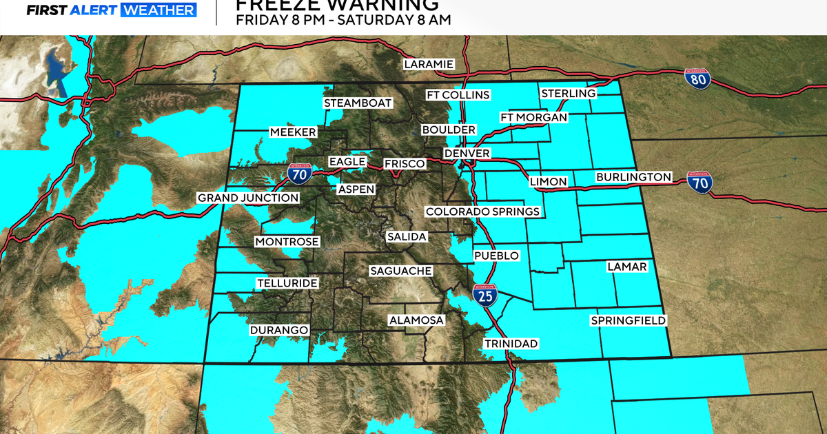
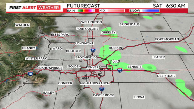
Colorado Flood Watch is cancelled, drier air pushing in
Friday's Flood Watch has been cancelled. Drier air is pushing into the Front Range from the northeast easing the intensity of our evening showers.
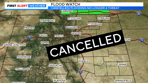
There may still be a few heavy rain showers over Park County but, overall showers will be light to moderate heading into the overnight hours.
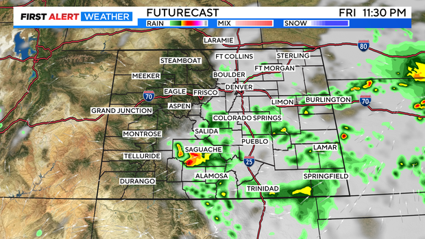
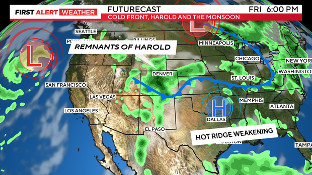
The triple whammy of monsoon and Harold moisture along with a late summer cold front soaked Colorado and the Denver metro area Friday.
By late afternoon, areas in and around the Denver metro area have seen steady, soaking amounts. Anywhere from a tenth of an inch to a little over a half inch of rain. The heavier rain has been in northeastern Colorado from Morgan into Washington counties especially. Some areas have seen 1 to nearly 6 inches of rain from Friday's thunderstorms.
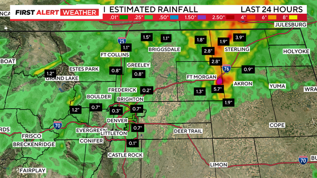
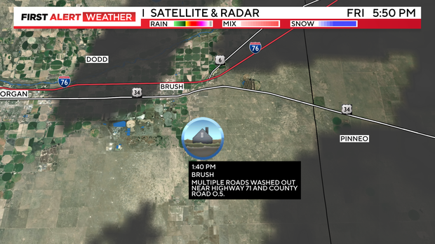
In the Brush area of Morgan County some roads have been washed out because of heavy rainfall.
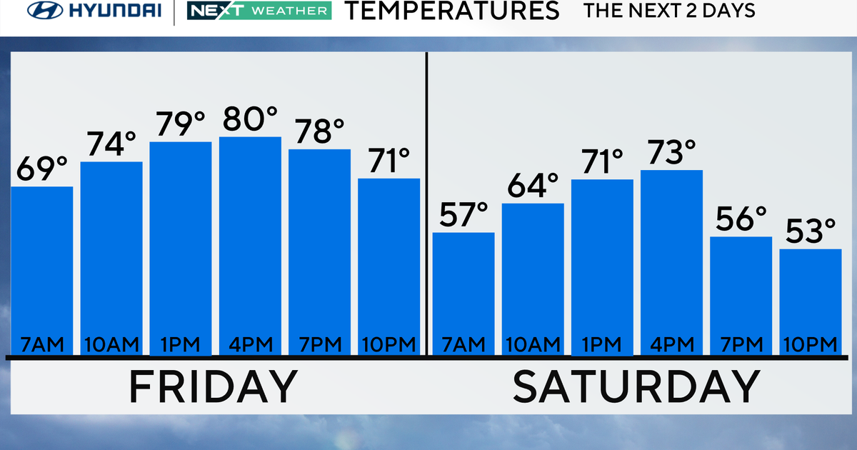
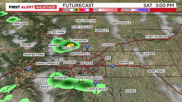
Saturday will be a bit drier than Friday. There will be morning clouds and a few isolated showers early on.
By late morning, sunshine should start to break thru and help to heat up temps and build up a few afternoon and evening thunderstorms.
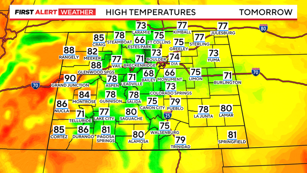
Highs will warm up a bit but, still be very comfortable for the entire weekend. With mostly 70s and low 80s over the mountains and eastern plains. The western Slope will start warming again with 80s to near 90 for afternoon highs.
Sunday will be just a bit warmer with scattered afternoon t-storms.