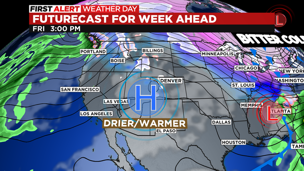
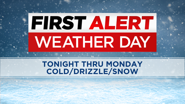
Colorado Weather: Bitter cold stretch locking in thru Monday
The first wave of Arctic cold has taken over eastern Colorado. You can expect light snow, freezing drizzle and fog into Saturday night. A First Alert Weather Day is posted for Saturday, Sunday and Monday for the bitter cold expected.
There are two systems hitting the state this weekend one is a storm moving in from Utah that has been dumping snow in the mountains and will bring in more throughout the weekend. The second is the big Polar Plunge pushing in the Arctic cold temperatures to eastern Colorado. The two together will produce western moisture over-running dense cold air over the plains getting snow showers going into Saturday night.
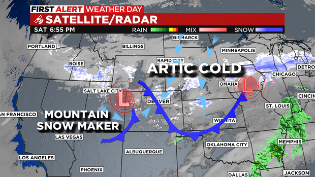
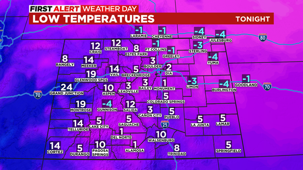
Across Denver and the eastern plains as cold air moves in there may be a few light snow showers, freezing drizzle and fog across the area. That may make some of the roads a bit slick Saturday night into Sunday morning.
Overnight lows starting Saturday will be in the single digits and below zero.
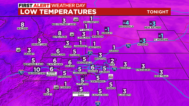
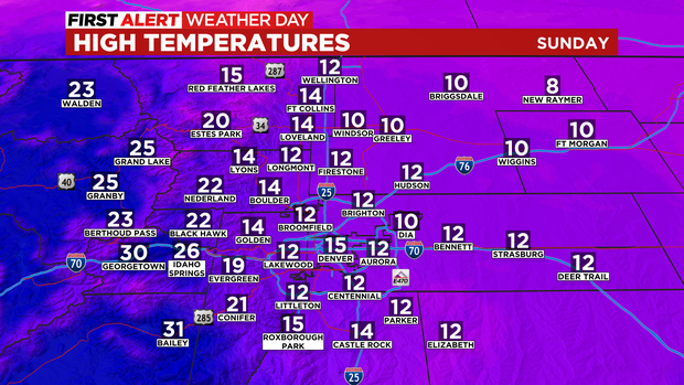
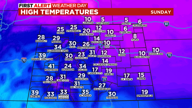
Temperatures will get colder thru the weekend. Sunday's highs will be ranging from 10 to 15 degrees from Fort Collins down thru the Denver metro area and beyond.
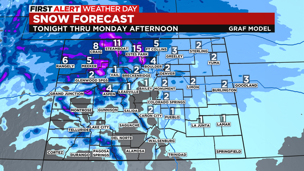
Along with the drop in temps there will be light amounts of snow each day. We are talking about maybe a half inch to an inch each day adding up to a possible 1 to 3 inches by the end of the 3 days of extreme cold. Amounts in and near the foothills on from Boulder and Lyons up thru Fort Collins may see a little more.
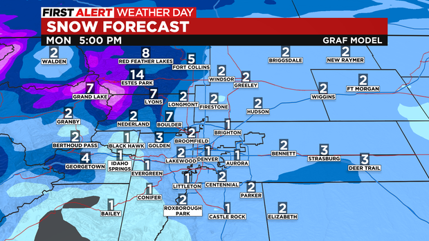
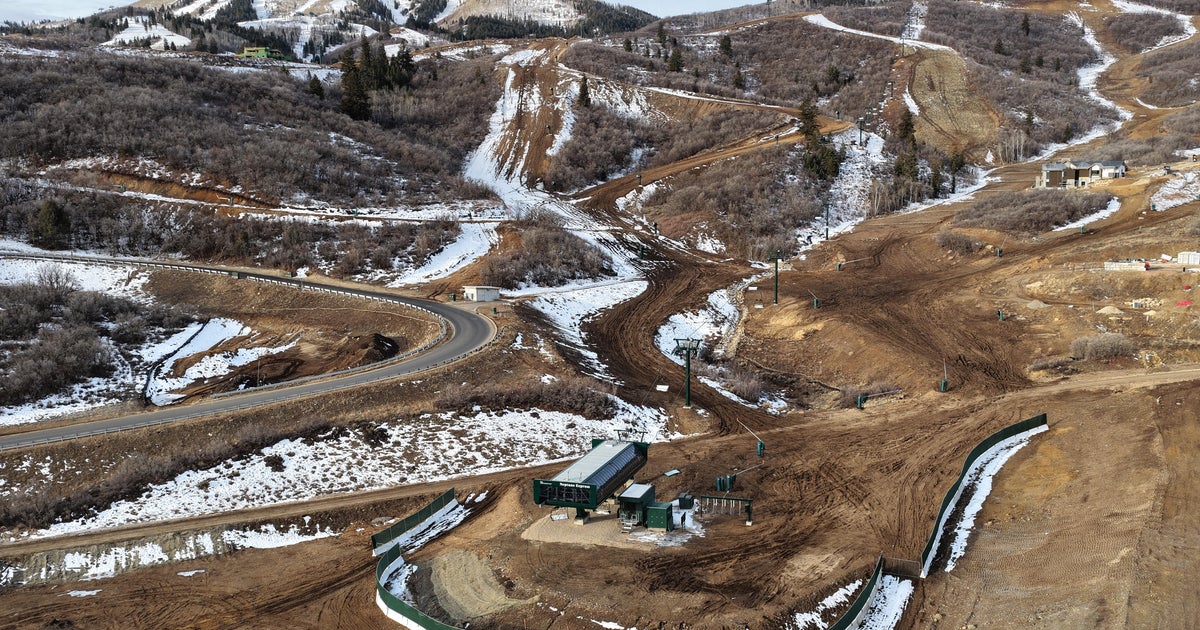
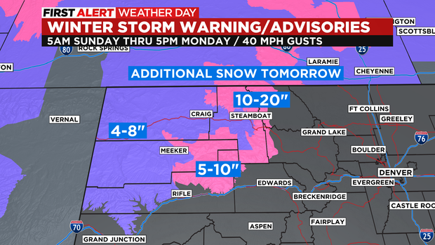
In the mountains, many of the northern mountains will see additional snow on Sunday into Monday in some spots as Winter Storm Warnings and Advisories start again Sunday morning. Some of the mountains around Steamboat may see another 10-20 inches of snow on top of the 1 to 2 feet some spots picked up on Saturday.
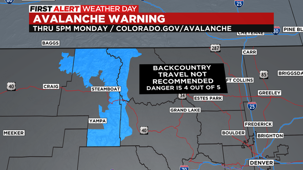
There is also an Avalanche Warning posted for the mountains around the Steamboat Springs and Yampa region for backcountry areas. Where the danger is rated 4 out of 5. Almost as high as it gets.
The rough weather pattern will breakdown by Tuesday with high temperatures getting back into the 30s. With warmer and drier air moving in for the end of next week on into the weekend.