Colorado Weather: Another Snow Storm Set To Dump In Denver
DENVER(CBS)- We have a First Alert Weather Day posted for Wednesday with a blast of winter set to take over Colorado. A deep low pressure trough has formed over the west coast.
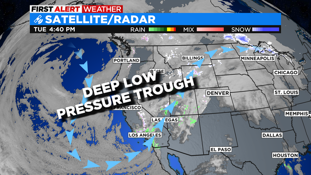
As the trough digs into the southwest a flow of colder air and moisture will slam the Rocky Mountain region.
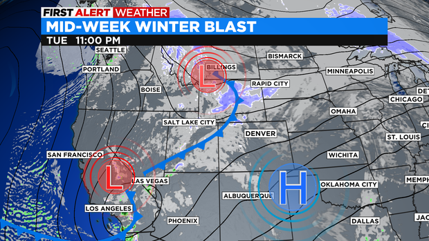
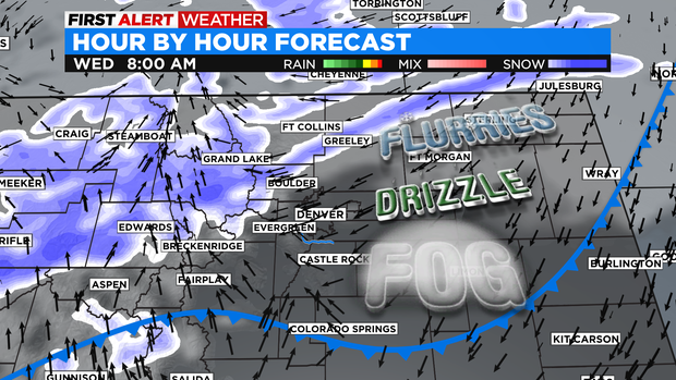
The leading edge of the front will slide thru eastern Colorado overnight Tuesday into Wednesday morning. Moisture will be limited to start but, there may be a few spots will a light flurry, drizzle and fog. That may be enough to create a few slick spots on bridges and overpasses.
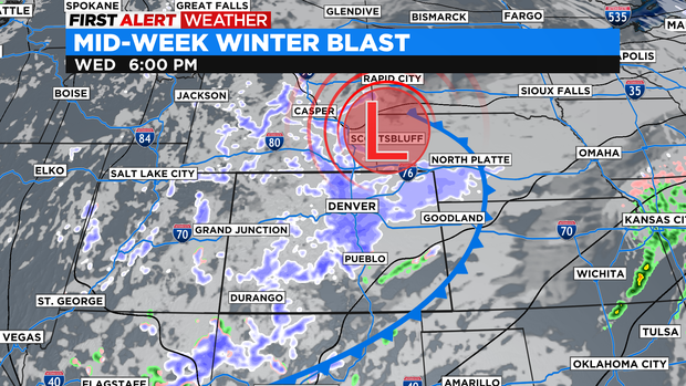
The main energy of the storm arrives in the afternoon with the heavier snow dumping between 5pm and midnight. That said there will be an effect on the afternoon commute making for icy and snow packed roads as the afternoon drive progresses.
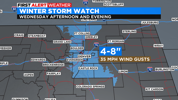
A Winter Storm Watch is posted for Wednesday afternoon and evening for 4 to 8 inches of snow and up to 35 mph wind gusts for the Denver metro area and Front Range Foothills.
Snow should end for Denver and the Front Range after midnight Wednesday and clear out by Thursday morning.