Colorado Weather: A cool day before extended warming trend
Snow will be ending over the Denver metro area as Tuesday night with a chilly Wednesday on the way. With the cold wave moving out we have one more shot for snow flurries over the Denver metro area Wednesday afternoon.
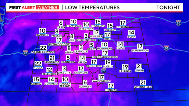
With clearing skies overnight morning low temperatures will be rather cold. With teens over the eastern plains and single digits in the mountains.
Wednesday may actually start out mostly sunny over the northeastern plains with increasing clouds as the day goes on.
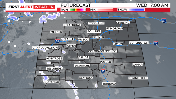
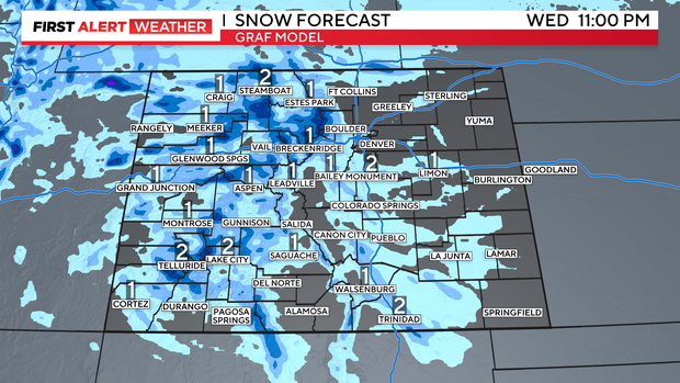
There will be a parting shot of moisture and cold air pushing in for Wednesday afternoon. This may bring in more snow showers for the mountains and a few light snow showers across the eastern plains.

Amounts will be light across most of the area with little to no accumulation for the Denver metro area.
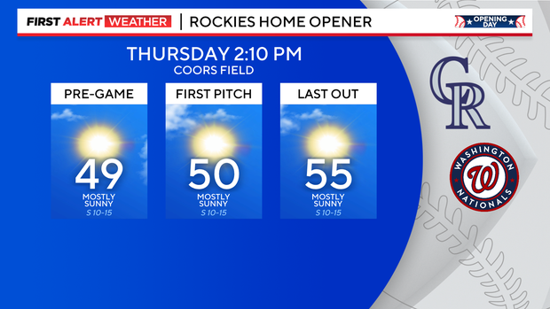
A warming trend will begin on Thursday. Just in time for Opening Day for the Rockies at Coors Field. Temperatures should warm into the middle 50s!
After that a strong ridge of high pressure will begin to move in for Friday into the Easter weekend and beyond.
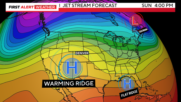
Easter sunrise will be near 41 degrees with clear skies and an afternoon high near 71. Upper 70s will show up for several days next week.