Colorado Snow Totals List Shows Wolf Creek, Crested Butte Ski Areas Tie For Most Snow
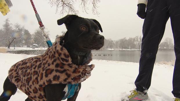
DENVER (CBS4) - After weeks without snow some much needed precipitation fell across Colorado with parts of the high country measuring the storm in feet over the course of 48 hours. Much lighter amounts fell in Denver, across the foothills and the northern mountains.
In Denver it was the first measurable snow of the season, falling about 7 weeks behind schedule. The city missed tying an all-time stretch without snow by just two days.
RELATED: Snow Drought Ends: It Was 7 Weeks Late, But Denver Finally Recorded A Measurable Snow
The following amounts are from CBS4 Weather Watchers, totals reported to the National Weather Service and information from area ski resorts. In many cases the snow won't make much of a dent in the drought, but we are hopeful that more storms will materialize down the road to help us out.
29.0" - Wolf Creek (48 hour total as of 7:15 a.m. Friday)
29.0" - Crested Butte (48 hour total as of 5:52 a.m. Friday)
27.0" - Purgatory (48 hour total as of 5:23 a.m. Friday)
24.0" - Grand Mesa Lodge
22.0" - Powderhorn (48 hour total as of 5:53 a.m. Friday)
19.5" - NW of Gunnison
19.0" - Aspen Mountain (48 hour total as of 6:17 a.m. Friday)
18.4" - 4 miles SE of Mount Zirkel
17.9" - 1 mile NNE of Crested Butte
17.2" - 9 miles SSE of Gould
17.0" - Snowmass (48 hour total as of 6:17 a.m. Friday)
17.0" - Telluride (48 hour total as of 5:25 a.m. Friday)
16.6" - Silverton
15.0" - 8 miles NW of Glendevey
13.0" - Vail (48 hour total as of 5:46 a.m. Friday)
12.7" - 9 miles E of Glendevey
12.0" - 5 miles E of Stoner
12.0" - 7 miles NW of Pagosa Springs
11.5" - 9 miles SE of Cameron Pass
11.0" - Copper Mountain (48 hour total as of 5:34 a.m. Friday)
11.0" - Steamboat (48 hour total as of 5:14 a.m. Friday)
11.0" - 5 miles S of Vallecito
10.0" - Breckenridge (48 hour total as of 5:38 a.m. Friday)
10.0" - 3 miles N of Skyway
10.0" - 7 miles ESE of Mancos
9.2" - 3 miles NNE of Audubon
9.2" - 8 miles SSE of Rand
8.1" - 4 miles S of Longs Peak
7.5" - 2 miles N of Heeney
7.2" - 4 miles ENE of Dolores
6.9" - 8 miles SSE of Cameron Pass
6.9" - 6 miles NW of Silverthorne
6.9" - 7 miles NW of Red Feather Lakes
6.9" - 5 miles W of Berthoud Falls
6.0" - Winter Park (48 hour total as of 8:08 a.m. Friday)
6.0" - 1 mile NE of Avon
6.0" - 10 miles WNW of Ridgway
5.0" - Loveland Ski Area (48 hour total as of 4:44 a.m. Friday)
5.0" - Keystone (48 hour total as of 5:57 a.m. Friday)
4.6" - 5 miles WSW of Grand Lake
4.6" - 3 miles SW of Meeker Park
4.2" - 2 miles WNW of Estes Park
4.0" - Williams Fork Reservoir
4.0" - Ouray
3.4" - 1 mile WNW of Loveland Pass
3.4" - 11 miles S of Rabbit Ears Pass
3.4" - 1 mile SSE of Loveland Pass
3.2" - 4 miles SE of Evergreen
3.0" - 1 mile NNE of Glen Haven
3.0" - 2 miles ESE of Kinikinik
3.0" - 2 miles SSE of Allenspark
3.0" - Arapahoe Basin
3.0" - Silverthorne
2.8" - 3 miles NNW of Parshall
2.5" - 2 miles SW of Lakewood
2.5" - Gunnison
2.3" - 1 mile ENE of Brookvale
2.3" - Congress Park (Denver)
2.3" - Hoosier Pass
2.3" - 2 miles E of Denver
2.1" - 3 miles SW of Ward
2.1" - 2 miles SE of Morrison
2.0" - Dillon
2.0" - Marshdale
2.0" - Glenwood Springs
2.0" - CBS4 Studios
2.0" - Eldora
2.0" - 1 mile SW of Kittredge
2.0" - SW of Steamboat Springs
2.0" - 5 miles W of Westcliffe
1.5" - 3 miles N of Drake
1.5" - 5 miles S of Manilla Village
1.5" - Creede
1.4" - 2 miles S of Floyd Hill
1.3" - 1 mile SE of Littleton
1.3" - SW Lakewood
1.2" - SE Aurora
1.0" - 2 miles ESE of Commerce City
1.0" - East of Conifer
1.0" - 4 miles NNW of Aurora
1.0" - 2 miles SW of Wheat Ridge
1.0" - 3 miles NNE of Ken Caryl
1.0" - Antero Reservoir
1.0" - Bailey
1.0" - Battlement Mesa
1.0" - 5 miles NE of Ponderosa Park
0.8" - 3 miles WNW of Fairplay
0.8" - 3 miles NNE of Englewood
0.8" - 1 mile E of Arvada
0.7" - 2 miles SSW of Westminster
0.6" - 7 miles E of Virginia Dale
0.5" - 2 miles SSE of Thornton
0.4" - 2 miles W of Boulder
0.3" - 2 miles E of Broomfield
0.3" - Denver International Airport
0.2" - 2 miles E of Parker
0.2" - 1 mile SSW of Georgetown
0.1" - 1 mile SE of Todd Creek
0.1" - Nederland
0.1" - 1 mile W of Brighton
0.1" - 4 miles SW of Carter Lake
0.1" - Coal Creek Canyon
Trace - NW of Brush