Colorado's record heat takes a brief break, but another surge is right behind it

After days of record-breaking heat across Colorado, a cooldown has finally arrived, but it won't last long.
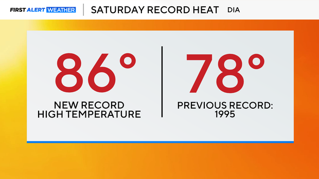
Saturday marked the peak of this early-season heat wave, with Denver International Airport climbing to 86 degrees, setting a record for the warmest temperature ever recorded in March. While the airport fell just short of 90 degrees, many communities across the plains surged into the low 90s — an extraordinary feat for March.
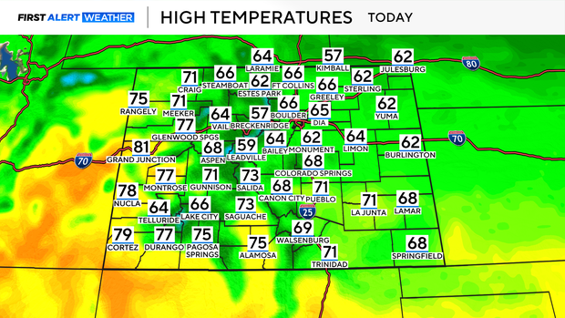
A cold front sweeping through the state is bringing a temporary reset. By Sunday afternoon, temperatures will settle back into the mid-60s, much closer to seasonal norms. The front is also ushering in a bit more moisture, with a slight chance for light rain or snow showers along the Front Range and in the mountains. Any precipitation will be minimal, but it will help ease critical fire weather conditions, at least briefly.
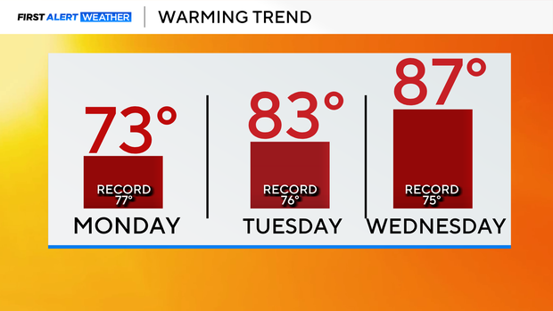
By Monday, temperatures rebound into the 70s as warmer air begins building back into the region. Then by Tuesday and Wednesday, another surge of unseasonable heat is expected — and it could rival or even exceed the records set this past week. Dry air, warming temperatures, and the potential for gusty winds will bring elevated to critical fire weather conditions back to the plains Tuesday and Wednesday. After a brief pause on Sunday, the fire danger is expected to ramp up quickly again.
A cold front is expected to move through by the end of the week, dropping temperatures into the 60s.