Colorado rain totals: more rain and mountain snow expected

Wednesday is a First Alert Weather Day as a strong fall storm brings a blast of much colder air, widespread rain across the Denver metro area, and heavy snow to the mountains.
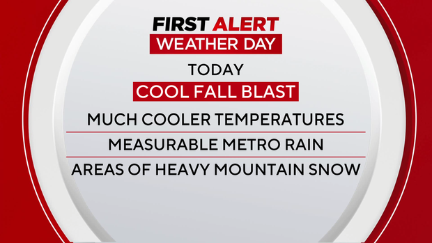
As of Wednesday morning, many communities across Colorado have picked up measurable precipitation, with more to come.
Latest Rain Reports Across Colorado:
- Durango: 2.04 inches
- Silverton: 1.71 inches
- Golden: 1.37 inches
- Boulder: 1.25 inches
- Arvada: 1.14 inches
- Pagosa Springs: 1.01 inches
- Evergreen: 0.99 inches
- Morrison: 0.88 inches
- Superior: 0.80 inches
- Littleton: 0.77 inches
- Denver: 0.38 inches
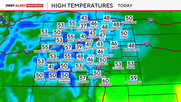
Rain and mountain snow will increase in coverage Wednesday afternoon and continue into Wednesday night. Temperatures will remain chilly, with highs mainly in the 40s across much of the Denver metro area.
Snow levels are expected to drop to around 7,000 feet by Thursday morning. The heaviest snow is forecast above 9,000 to 10,000 feet, where several inches of accumulation are possible.
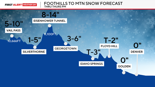
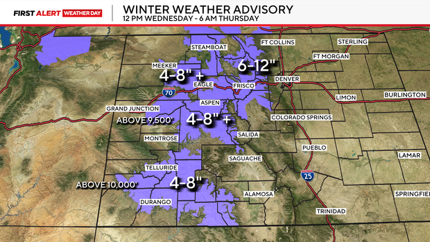
Higher mountain elevations could receive 4 to 12 inches of snow, while mountain valleys and higher foothills may see lighter accumulations, including at least a dusting in some areas.
The combination of accumulating snow and potentially slick roads could affect travel in the mountains from Wednesday afternoon through Thursday morning. Drivers heading over mountain passes should be prepared for changing road conditions. The first Winter Weather Advisory of the season is posted for the mountains starting Wednesday afternoon through Thursday morning.
Rain could also linger along the Interstate 25 corridor and across the eastern plains Thursday morning as cooler air moves into the region. Precipitation is expected to gradually taper off Thursday afternoon as the storm system moves east and weakens.
Behind the storm, colder overnight temperatures could bring the first freeze of the season to much of Colorado's eastern plains. Temperatures are expected to drop to freezing or below late Thursday night into early Friday morning across much of the plains.
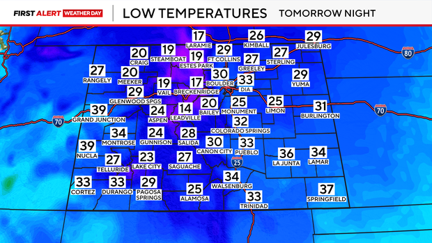
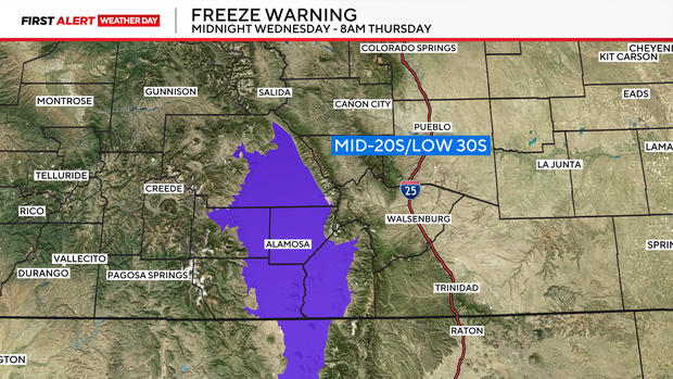
Those with sensitive plants, outdoor vegetation, or exposed plumbing should prepare for the possibility of freezing temperatures. A Freeze Warning is in place from midnight tonight through Thursday morning for the San Luis Valley, where temperatures could drop into the mid-20s to lower 30s.
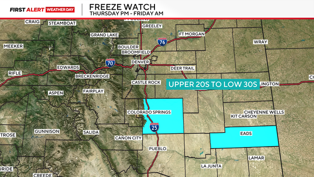
A Freeze Watch is in place Thursday night through Friday morning for El Paso and Kiowa counties, with overnight lows dipping into the upper 20s to lower 30s.
The colder weather will be short-lived, however, as drier conditions and a warming trend return. By Friday, skies should begin clearing and temperatures will gradually moderate. A mostly dry forecast is expected to continue through the weekend, with temperatures climbing back above seasonal averages. Above-normal temperatures are also expected to continue into early next week.


