Colorado Blizzard Recap: Snow Totals, Wind Gusts And Pressure Readings
DENVER (CBS4) - The great bomb cyclone of 2019 will go down in history as one of the strongest mid-latitude cyclones ever recorded on land. It's very rare to have a storm gain so much strength, so rapidly, in the middle of a continent. Typically bomb cyclones occur over the ocean, such as when Nor'easters form off the coast of North Carolina.
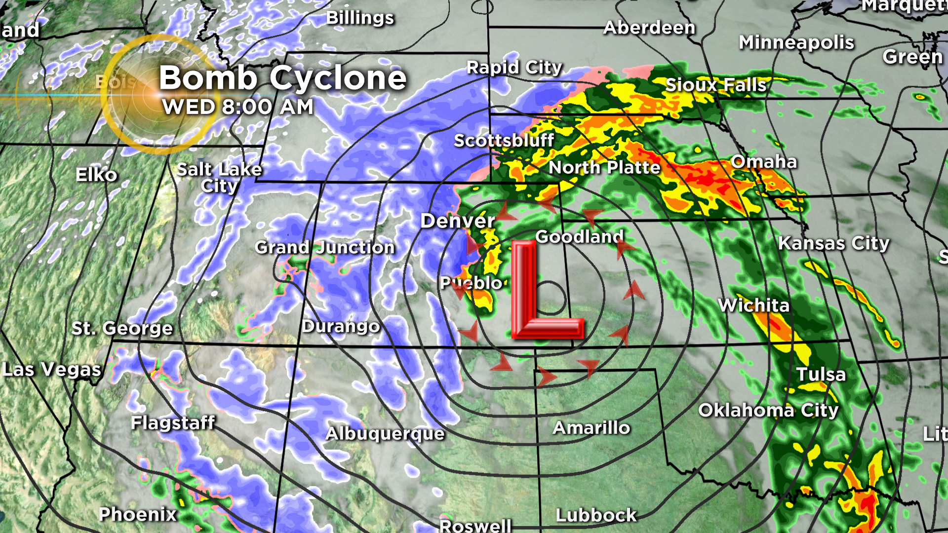
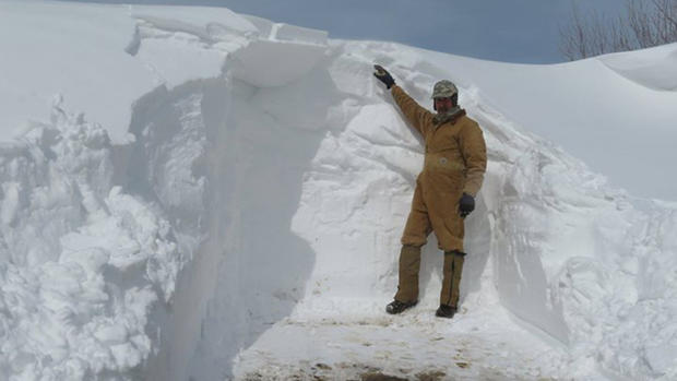
The storm set numerous records in Colorado for either daily rainfall, daily precipitation, daily snow, wind gusts or low air pressure. The following is a list of reports received by the National Weather Service. Some of the snowfall totals are from CBS4 Weather Watchers.
BAROMETRIC PRESSURE
During the late morning hours on Wednesday, March 13, many places in eastern Colorado and western Kansas recorded barometric pressures that are equivalent to a Category 2 hurricane. Some were the lowest ever observed.
Lamar, Colorado - 970.4 mb (potentially a new state record for Colorado)
La Junta, Colorado - 971.2 mb
Stanton, Kansas - 971.87 mb
Hamilton, Kansas - 971.93 mb
Lane, Kansas - 972.42 mb
Lakin, Kansas - 972.45 mb
Leoti, Kansas - 972.77 mb
Grant, Kansas - 973.03 mb
Tribune, Kansas - 973.31
Pueblo, Colorado - 973.9 mb (new record)
Dodge City, Kansas - 974.6 (lowest since 1900)
Goodland, Kansas - 975.2 mb
Colorado Springs, Colorado - 976.1 mb
Denver, Colorado - 979.01 mb (lowest ever measured at DIA)
Alamosa, Colorado - 983.7 mb (new record)
PEAK WIND GUSTS (60 MPH OR GREATER)
96 MPH - Colorado Springs
91 MPH - 6 miles S of Stonewall
89 MPH - La Junta Airport
85 MPH - 6 miles SW of Truckton
82 MPH - Lamar Airport
81 MPH - 2 miles N of Black Forest
81 MPH - Limon
78 MPH - Pueblo Airport
77 MPH - 5 miles S of Manilla Village
76 MPH - 6 miles WSW of Carr
76 MPH - Hugo
74 MPH - 8 miles S of Springfield
73 MPH - 4 miles E of Thatcher
73 MPH - 1 mile ENE of Brighton
72 MPH - 3 miles SE of Westcreek
71 MPH - Akron Airport
71 MPH - 18 miles SW of Forder
71 MPH - 6 miles ESE of Weston
70 MPH - 2 miles NW of Strasburg
69 MPH - 12 miles WSW of Forder
69 MPH - 1 mile ENE of Aguilar
69 MPH - 4 miles SW of Campo
68 MPH - 8 miles S of Holyoke
68 MPH - 5 miles S of the Air Force Academy
67 MPH - 1 mile SE of Julesburg
65 MPH - 2 miles W of Kelim
65 MPH - 1 mile SE of the Rampart Reservoir
64 MPH - 3 miles N of Loveland
63 MPH - 4 miles WNW of Woodlin School
63 MPH - Nunn
63 MPH - 17 miles NW of Two Buttes
63 MPH - 1 mile NNW of McClave
62 MPH - Holyoke Airport
62 MPH - Trinidad Airport
62 MPH - 2 miles W of Keenesburg
61 MPH - Lone Tree
61 MPH - Saguache
61 MPH - 4 miles E of Buckeye
61 MPH - 4 miles N of Walsenburg
61 MPH - 7 miles NE of Springfield
60 MPH - 3 miles E of Denver
60 MPH - 3 miles NE of Englewood
60 MPH - 9 miles W of The Saunders
60 MPH - 7 miles W of Las Animas
60 MPH - 4 miles NNE of Lamar
SNOW TOTALS
52" - Wolf Creek Pass
25.5" - 2 miles SSE of Blue Valley
23" - Ouray (CBS4 Weather Watcher)
22" - Pinecliffe (CBS4 Weather Watcher)
21.1" - 3 miles NE of Nederland
20.9" - 1 mile NNE of Shaffers Crossing
18.4" - Nederland
17.6" - 2 miles NE of Rollinsville
17" - 5 miles NNW of Mishowaka
16.3" - 2 miles SSE of Kittredge
16.2" - 3 miles W of Aspen Park
16" - 2 miles ENE of Monument
16" - East Franktown (CBS4 Weather Watcher, drifts to 4 feet)
15" - 1 mile W of Woodland Park
15" - N. of Black Hawk (CBS4 Weather Watcher)
15" - SE Genesee (CBS4 Weather Watcher)
14.5" - Estes Park (CBS4 Weather Watcher)
14" - 1 mile SSE of Agate
13.7" - 2 miles SSW of Brookvale
13.5" - 3 miles NW of Black Forest
13.4" - 2 miles SSW of Elkdale
13" - Coal Creek Canyon (CBS4 Weather Watcher)
12.8" - 2 miles SW of Golden
12.5" - Dillon
12" - Dillon (CBS4 Weather Watcher)
12.3" - Evergreen (CBS4 Weather Watcher)
12" - 3 miles SSE of Silver Plume
12" - Monarch Pass
11.9" - 1 mile NE of Brookvale
11.3" - 7 miles NW of San Isabel (1.40" water equivalent)
11" - East of Conifer (CBS4 Weather Watcher, drifts to 4 feet or more)
10.6" - 1 mile W of Rosita
10.4" - 3 miles N of Foxfield
10.4" - 7 miles W of Rustic
10" - 3 miles NNE of Parker
9.5" - 3 miles E of Franktown
9.5" - 7 miles E of Virginia Dale
9" - 2 miles NNE of Elizabeth
9" - NW of Bailey (CBS4 Weather Watcher, 0.75" water)
9" - 1 mile ENE of 11-Mile Canyon Reservoir
9" - 1 mile NNW of Cheesman Reservoir
9" - 5 miles SSE of the Air Force Academy (drifting to 3.5 feet)
9" - Parker (CBS4 Weather Watcher, drifts at least 2-3 feet)
8.5" - 3 miles SW of Ponderosa Park
8.5" - 3 miles SSW of Highlands Ranch
8.5" - 3 miles NNW of Horsetooth Mountain
8.4" - 3 miles ESE Buckhorn Mountain
8.3" - 2 miles WNW of Estes Park
8" - 2 miles SW of Chatfield Reservoir
8" - 2 miles SW of Cherry Hills Village
8" - Walden (CBS4 Weather Watcher)
7" - Frederick (CBS4 Weather Watcher, significant drifting to 3 feet)
7.9" - 1 mile S of Highland Park
7.5" - S. Parker (CBS4 Weather Watcher, drifts to 4 feet)
7.4" - Georgetown
7.1" - Denver International Airport
7" - Severance (CBS4 Weather Watcher)
7" - Silver Plume (CBS4 Weather Watcher)
7" - 2 miles WSW of Byers
7" - 10 miles NW of Kremmling
6.8" - 4 miles W of Pinewood Springs
6.8" - Sedalia (CBS4 Weather Watcher)
6.4" - 3 miles N of Cherry Creek Reservoir
6.2" - NW Arvada (CBS4 Weather Watcher)
6" - 5 miles SE of Commerce City
6" - 2 miles ESE of Denver
6" - 6 miles NNW of Silverthorne
6" - 1 mile NNW of Lake George
5.6" - Frisco
5.5" - SW Denver (CBS4 Weather Watcher)
5.5" - West Arvada (CBS4 Weather Watcher)
5.5" - Brush (CBS4 Weather Watcher, 0.51" water)
5.2" - Broomfield (CBS4 Weather Watcher)
5" - 1 mile E of Gary
5" - 1 mile WNW of Hugo
5" - 1 mile S of Crook
5" - 1 mile SE of Englewood
5" - 5 miles W of Westcliffe
4.5" - 1 mile ENE of Longmont
4.3" - 1 mile WNW of Bellvue
4" - 3 miles WSW of Fort Collins
4" - SW Lone Tree (CBS4 Weather Watcher, drifts to 1 foot or more)
4" - 3 miles ESE of Lakewood
4" - Superior (CBS4 Weather Watcher)
4" - 3 miles E of Loveland
4" - Littleton's Columbine West area (CBS4 Weather Watcher)
3.7" - NW Westminster (CBS4 Weather Watcher)
3" - 2 miles WNW of Peterson Air Force Base
3" - Fort Collins (CBS4 Weather Watcher)
3" - S. Lakewood (CBS4 Weather Watcher)
2.8" - Lakewood (CBS4 Weather Watcher)
2.5" - 2 miles WNW of Colorado Springs (estimated due to wind, 0.95" of rain before change to snow)
2" - Wray (CBS4 Weather Watcher, 1.25" total moisture, mostly rain)
2" - Fort Collins (CBS4 Weather Watcher, 0.47" of rain)
HEAVY RAIN REPORTS
1.23" - 1 mile WSE of Rosita
1.04" - 2 miles WNW of Colorado Springs
0.87" - 3 miles S of Pueblo
DAMAGE REPORTS
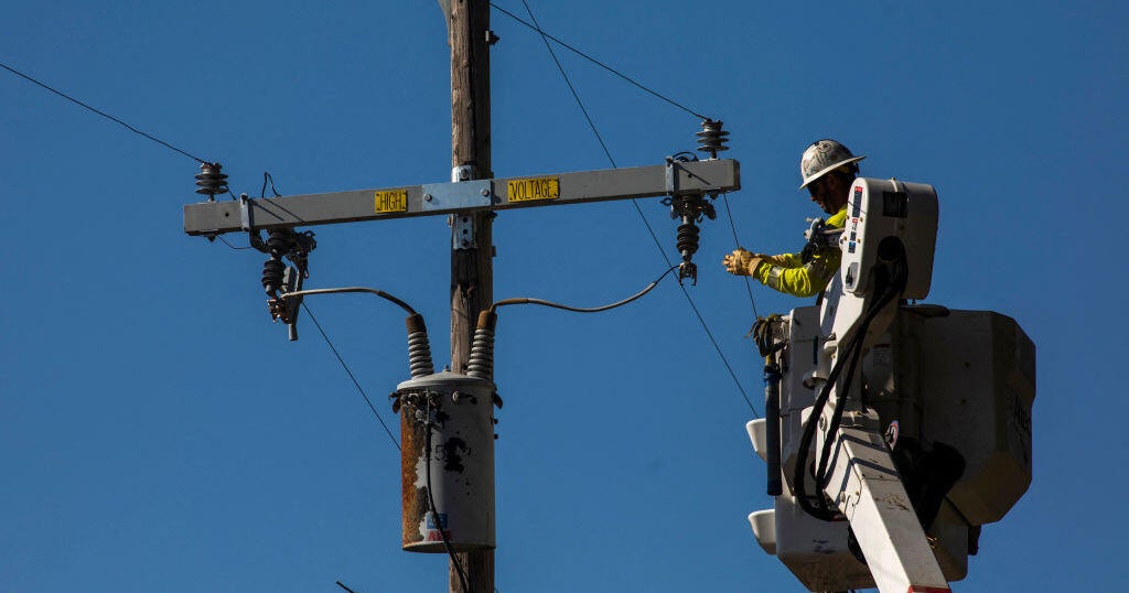
RELATED: Power Restored To All Xcel Customers Following March Blizzard