Strong winds in Colorado due to driving jet stream and approaching cold front will result in high fire danger
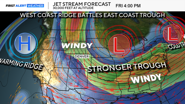
Another prolonged wind event is in the works for both Thursday and Friday. The combination of a driving jet stream and approaching cold front will set the stage for two days of high fire danger across northeastern Colorado before the weekend arrives.
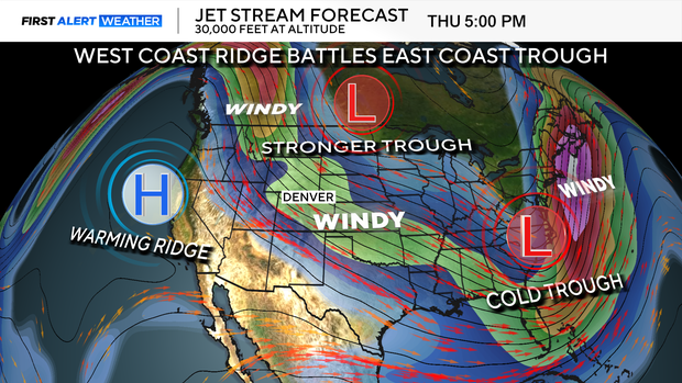
We have launched a First Alert Weather Day for both Thursday and Friday in anticipation of strong winds and very low humidity levels. Denver is not included in the threatened area but, areas to the north and east are definitely looking at the potential for elevated to critical fire danger.
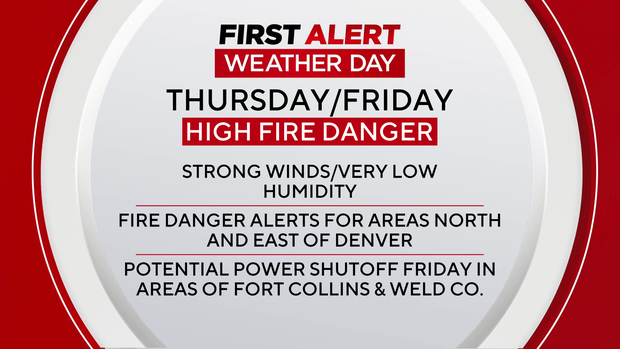
Friday will have the strongest wind as the jet stream and cold front team up. As a result, there is the potential for a power shutoff in areas in and near Fort Collins and parts of Weld County on Friday.
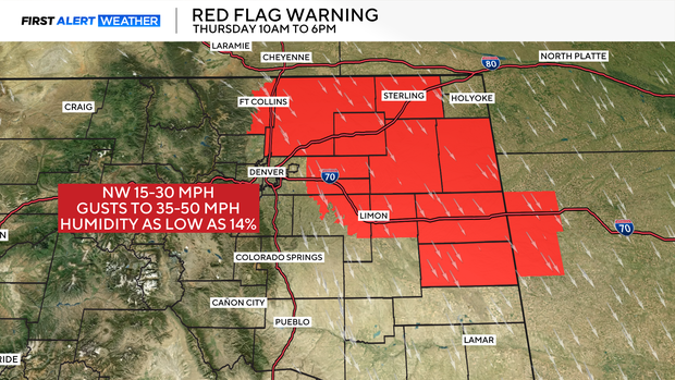
Thursday begins with a red flag warning running from 10 a.m. to 6 p.m. Sustained winds of 15 to 30 mph along with gusts 30 to 50 mph are possible. Relative humidity levels may drop as low as 14%. An average relative humidity in the month of January on a dry day would be somewhere 30 to 40 %.
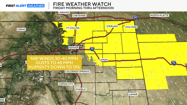
Friday will see an increase in wind strength with gusts as high as 65 mph from the northern Front Range foothills across the northeastern plains from 10 a.m. to 6 p.m. on Friday. There is a fire weather watch posted for Friday with humidity levels as low as 13%.
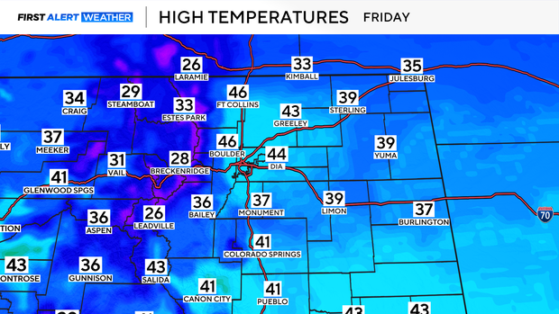
Friday will also be much cooler behind the approaching cold front.
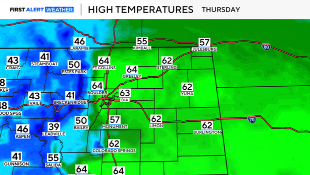
While highs will be in the 60s in the area on Thursday, they will only make it into the 40s on Friday.