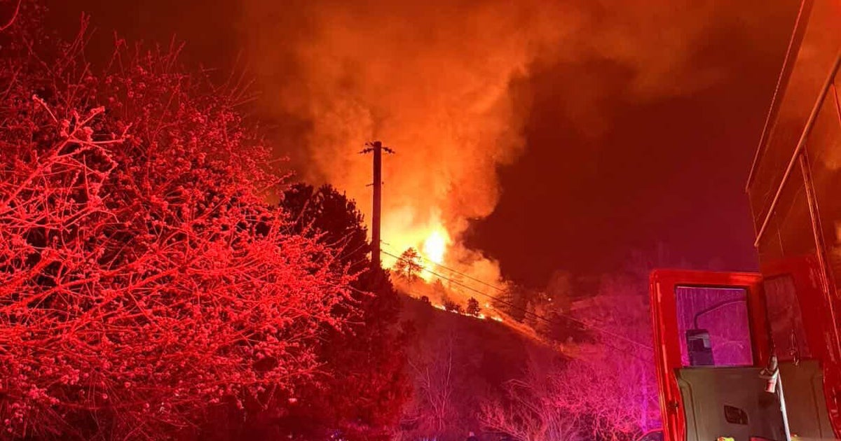
Colorado facing fire danger, heavy snow, strong winds and avalanche danger on Wednesday
Colorado has another day of fire and ice threats from the mountains into the plains. Wednesday is a First Alert Weather Day as the triple threat of unseasonably warm temperatures, strong downslope winds and extremely low humidity levels appear once again across the region.
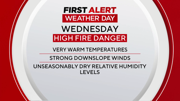
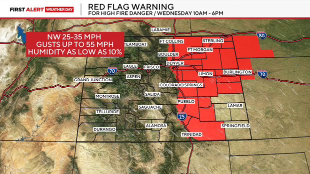
A red flag warning is in effect for the second day in a row for areas below 6,000 feet from the Front Range foothills into the Eastern Plains. This includes the Denver metro area running from 10 a.m. through 6 p.m. Wind gusts may reach 55 mph, high temperatures will be in the 60s to low 70s and relative humidity levels will be as low as 10%.
At the same time, there's copious amounts of moisture flowing into the northern and central mountains of the state through Wednesday night. There are winter storm warnings and winter weather advisories in place. Some of our northern mountains may see a foot or more with wind gusts up to 65+ mph.
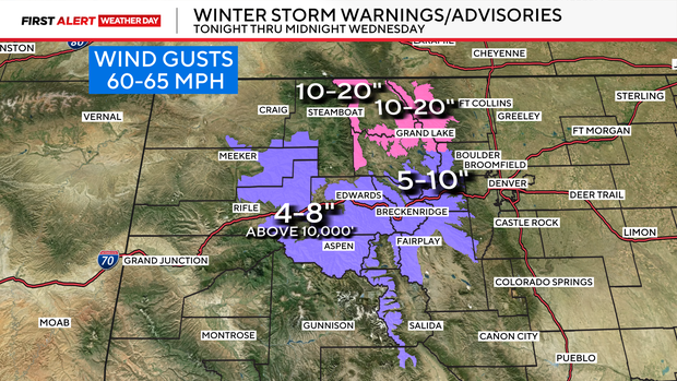
With the heavy, wind driven snow across northern Colorado there will be very weak slabs of snow forming during the snow event. This will boost the avalanche danger in backcountry areas up to a 4 out of 5 danger level.
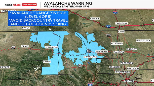
The warning is in effect Wednesday from 5 a.m. through 11 p.m.