Cold front snaps Colorado's warm stretch as snow moves back into the state
It was a Christmas unlike any other in Colorado, as temperatures climbed into the 70s in Denver!
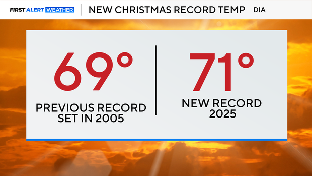
The official high on Christmas Day 2025 was 71 degrees, breaking the previous record of 69.
While temps were climbing in the lower elevations, the high country saw rain in some areas on Christmas. Yes, rain.
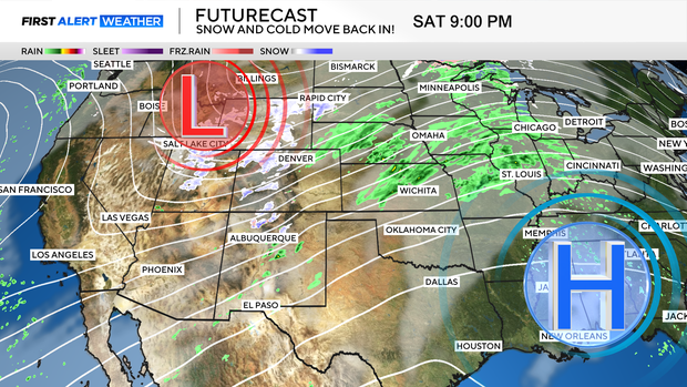
But good news is on the way as Pacific moisture moves into Colorado, and a cold front snaps our warm stretch by the weekend.
Snow is going to hit the high country first on Saturday, gradually spreading across the mountains, before dropping down into the plains late Saturday night.
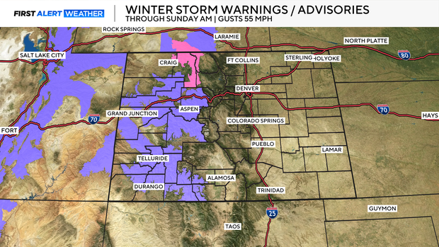
Winter Weather Advisories and Winter Storm Warnings go into effect tonight in the high country through Sunday morning.
Some mountain areas could see as much as 12" of snow, with Rabbit Ears Pass, the Elkhead and Park Ranges potentially receiving as much as 18" of snow. Those areas may also see winds gust as high as 55 mph.

The snow will move down into the lower elevations late Saturday night, developing behind a cold front that hits the plains.
Upslope flow behind the front will help bring snow to the Denver area with 1-4" possible. More snow is expected in the foothills and the Palmer Divide.

The cold front is also snapping our warm stretch and taking temperatures down into the 20s.
With the cold and snow, road conditions could be slick in the Denver area Sunday morning.