Brief cooldown in Colorado before spring-like weather makes a comeback
With a strong ridge of high pressure over the region Colorado has been experiencing a stint of spring-like temperatures, but with a cold front passing through the state, temperatures are dropping to more seasonal degrees.

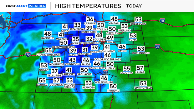
While cooler, highs will still be comfortable for Wednesday, climbing into the upper 40s to low 50s across the Front Range and plains. Winds will also be much calmer on Wednesday afternoon.
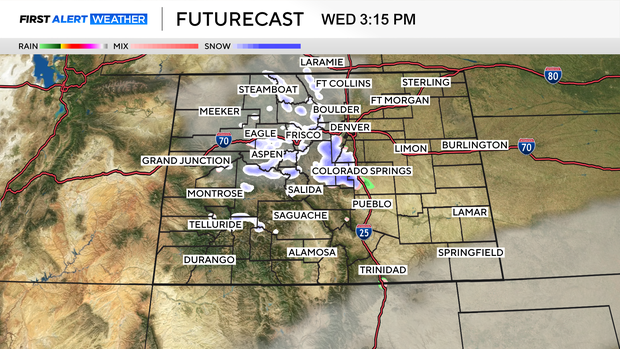
Some mountain areas may see a little light snow throughout the day on Wednesday, but accumulations would be very low. Most places could pick up around 2" of new snow.
By Thursday another ridge of high pressure builds back up, bringing back that warm weather. This time without the strong and gusty wind. Highs will climb back into the 60s for the rest of the week, and into the weekend.
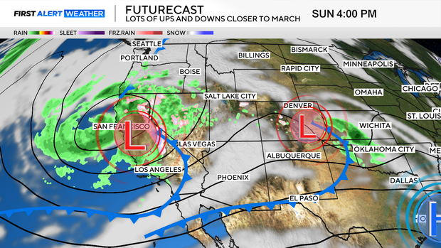
Saturday is March 1, which marks the first day of what is historically Colorado's snowiest month of the year. On average, March brings around 11.5" of snow to DIA. While Saturday and Sunday will be warm and mild, a pattern shift arrives on Monday. That will bring some unsettled weather to the area Monday night, with rain chances possible. By Tuesday we will see cooler temperatures and a chance of some measurable snow across the state.