Fire crews in Colorado use digital map simulator to prepare for wildfire season ahead

Inside the training room of an Arvada fire house, crews hurdle together, watching, reacting, and planning their response ahead of Colorado's upcoming wildfire season.
"If it's dark rattlesnakes, tripping hazards, getting equipment up there; all things you have to consider," Arvada Fire Lt. Dariusz Piwko said.
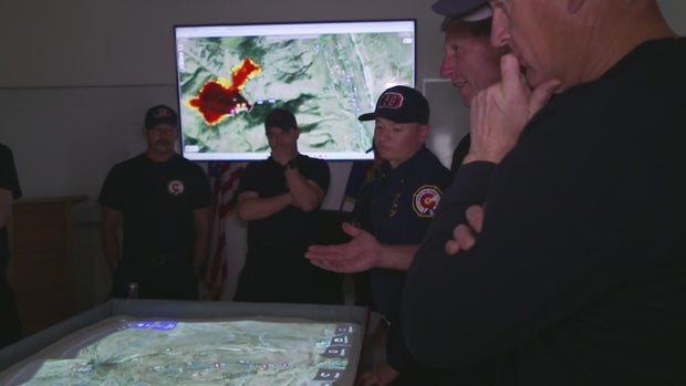
A map on the table shows a wildfire spreading across the area.
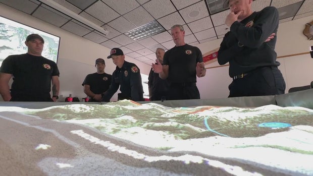
The map is a simulator that they can control.
Piwko says that includes everything from where and when it ignites to wind speed and direction.
"Here, the sim table can actually overlay Google Earth imagery, so it shows you the trees, the roads, the water sources," he said.
The table itself is still a sandbox, much like they've always used for training, but without the toy cars they previously relied on.
"This is the next level," Piwko said."People had to imagine what a fire was doing instead of visually seeing it."
For Piwko, the technology means crews will be better prepared, but it doesn't eliminate the need for real change.
"We have these greenway trails. They can also provide an additional layer of security and safety in the event of a fire," fire prevention specialist Chris Warren said.
Warren says that with a growing wildland-urban interface, they're building fire breaks and use animal grazing to help mitigate risk, but he says the community can add to that work.
"If a fire starts over here and comes ripping toward this, we have some sort of defensible space to break down that fire intensity and get the fire closer to something that's more manageable," Warren said.
Bringing the two together could make all the difference should that simulation become reality.
The equipment belongs to the Jefferson County Sheriff's Office, which was able to purchase the sim table that costs roughly $100,000, thanks to a grant from the Department of Justice.
Multiple agencies will have access to the equipment.