Another sunny, warm afternoon but big changes hit Colorado by Friday
It will be another sunny and warm afternoon, but big changes will hit Colorado by Friday.
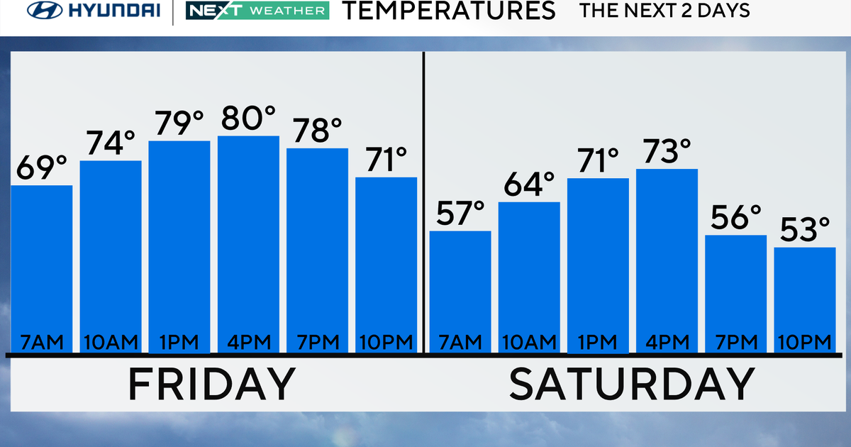
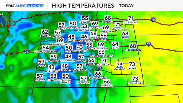
If you liked the weather on Tuesday, there is a good chance you'll enjoy Wednesday's forecast. Sunshine will help bring temperatures back into the upper 60s across most of the Denver metro area. Across the state, high temperatures will be roughly 15 to 20 degrees warmer than normal.
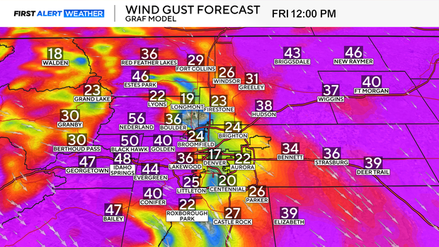
Thursday will come with more warmth, but as a strong storm moves in from the West, parts of the state will experience some stronger winds. Parts of Southeastern Colorado and the plains will be under Red Flag Warnings and Fire Weather Watches going into the day on Thursday. Relative humidity levels could drop as low as 10%, while winds gust up to 55 mph.
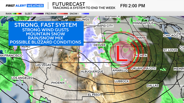
Then, attention turns to the strong, fast-moving storm forecast to hit the state by Friday. This storm will bring widespread precipitation and strong gusty winds to the state, with heavier snow expected in the mountains.
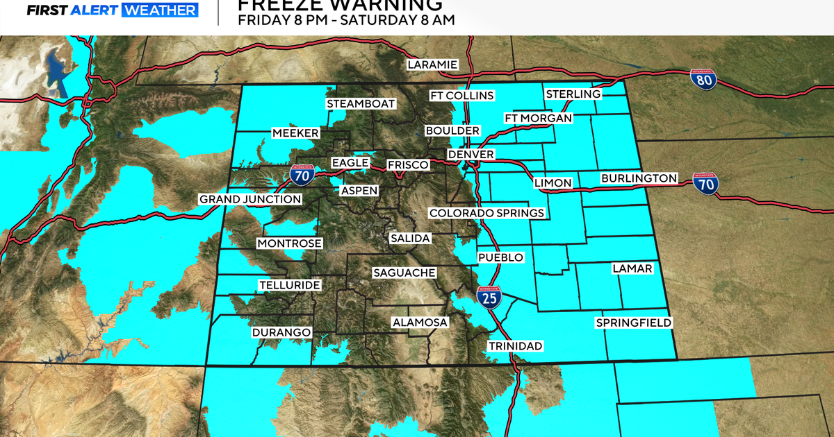
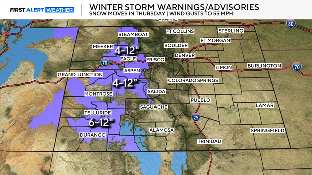
Winter Weather Advisories have been issued for the mountains and will go into effect on Thursday evening, remaining in place through Friday. Roughly 4-12" of snow could fall across our Colorado mountains, with winds in the high country expected to gust as high as 55 mph.
For the lower elevations, precipitation will likely hold off until Friday morning, falling for most as a rain/snow mix. However, places like the Palmer Divide and Foothills could see more snow mix in. While it looks clear the system will bring strong, gusty wind, questions remain about the timing of the transition from rain to snow. If this storm comes together more quickly over Colorado, there is the potential for more snow into Northeastern Colorado. That snow, combined with strong winds, could lead to blizzard conditions.
The First Alert Weather Team has called Friday a Potential First Alert Weather Day.
The storm quickly tracks out of the area, leading to gradual clearing throughout the weekend, with temperatures climbing back into the 50s and 60s.