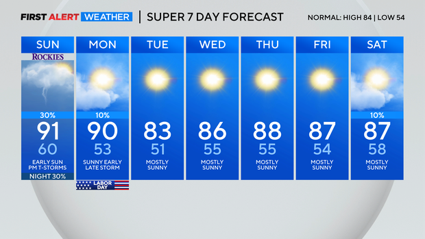
A few Colorado t-storms in the mix for Labor Day weekend
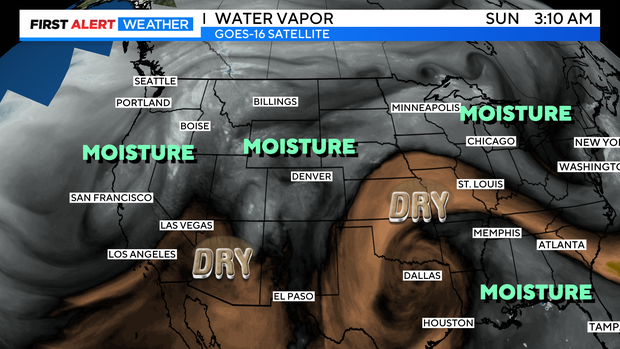
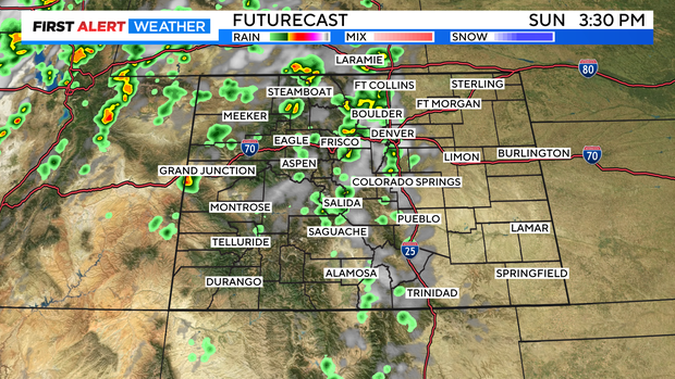
Happy Labor Day weekend! Overall we have a pleasant stretch for our long holiday weekend. There is a little monsoon moisture pulling east from Utah into our home state. This will bring in a few thunderstorms for Sunday and Labor Day.
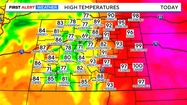
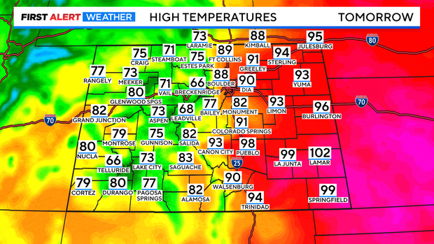
Looking at temperatures first across Colorado the heat will be on over the eastern plains with highs in the 90s. Some parts of the southeast may be pushing 100! There are more clouds and more showers and storms in the mountains and western slope this will slow the warming in those areas. With mostly 70s in the high country and 80s out west.
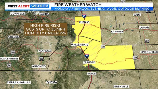
Areas of southern Colorado from Pueblo down into Las Animas County there is a Fire Weather Watch in place for Monday afternoon and early evening.
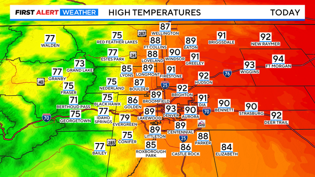
Temperatures closer to the Denver metro area will be in the upper 80s to low 90s along the I-25 corridor with 70s and 80s in the foothills and mountains of the Front Range.
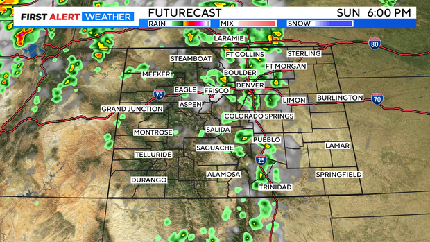
There is a good chance for scattered showers and t-storms from the mountains into western areas of the state as the day goes on. The Front Range and eastern plains have a chance for afternoon storms between 3pm and 8pm on Sunday.
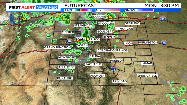
Labor day will be a little less hot in the east with more comfortable highs in the mountains and west.
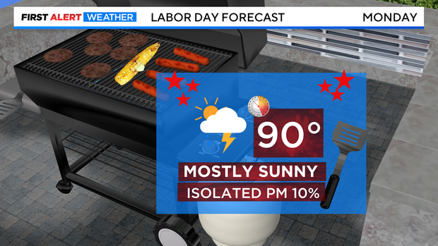
Denver's Labor Day outlook is calling for a high near 90 with just a slight chance for a late day storm.
The first work week of September will see relief from the heat with all 80s going right into next weekend.