Warm And Breezy Start For Thursday; Storms Roll Through At Night
Enjoy the warm sunny weather while it lasts. Showers and storms will be moving into the Chicago area Thursday night, and the summer-like temperatures will be gone by the weekend.
Watch CBS News
Enjoy the warm sunny weather while it lasts. Showers and storms will be moving into the Chicago area Thursday night, and the summer-like temperatures will be gone by the weekend.

A warming trend continued for the Chicago area on Tuesday, as temperatures were expected to feel more like August or July, before more autumn-like weather returns this weekend.

Though the storms were not expected to be severe, the National Weather Service said they will bring occasional heavy downpours and lightning strikes, as well as gusty winds.

As a band of thunderstorms brought torrential rains to parts of the Chicago area early Tuesday afternoon, the National Weather Service cautioned about the potential for flooding along local streams, and on streets in urban areas.

According to the National Weather Service, the first seven days of September were the fourth warmest on record for Chicago, and it was the warmest first week of September in 55 years.

Hot and steamy conditions that have been the norm all week in Chicago should continue through Labor Day, with highs in the upper 80s or low 90s each of the next four days.

Meteorological fall might start Tuesday, but summer weather isn't gone just yet, as it will be hot and muggy in the Chicago area for the next seven days, with several days reaching or flirting with 90 degrees or higher.

The dense fog advisory for Cook, DeKalb, DuPage, Grundy, Kane, Kankakee, Kendall, Lake, McHenry, Will, Boone, Lee, Ogle, and Winnebago counties lasts until 9 a.m. Monday, according to the National Weather Service.
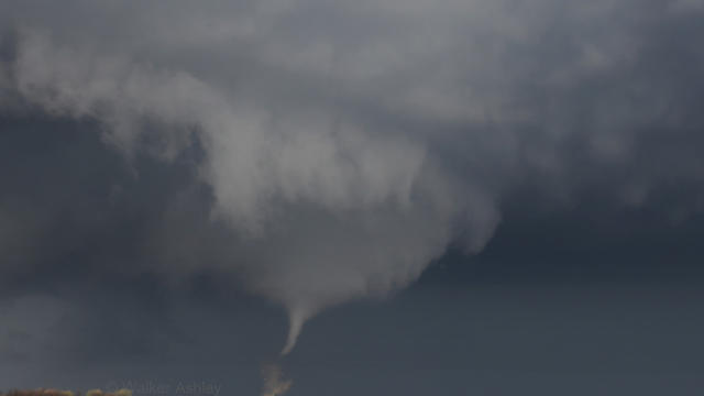
The Chicago area has set a record for the most tornadoes in a single year, according to National Weather Service data.

Most of this will be a bit on the cool side for August, with temperatures feeling more like fall.

The National Weather Service has confirmed that two weak tornadoes touched down in the western suburbs during Tuesday's storms.

Summer storms ripped through the Chicago area Tuesday night, leaving downed trees, standing water, and lots of cleanup to do. While the damage was not significant, thousands lost power when power lines were knocked down.


Many streets and viaducts across the Chicago area flooded overnight, as heavy rain swept across the northern Illinois. The storms dumped 2 to 4 inches of rain across the Chicago area by Tuesday morning, according to the National Weather Service.

Another steamy day in Chicago likely will also see scattered showers and thunderstorms by the afternoon on Monday, and more storms could hit the area Tuesday and Wednesday.

According to the National Weather Service, isolated showers and storms will be moving southeast throughout the afternoon.

While there will be a slight chance of showers Friday evening, and a small risk of thunderstorms on Sunday, most of this weekend should have ideal summer conditions.

The official temperature in Chicago hit 82 degrees shortly before 1 p.m. Thursday at O'Hare. According to the National Weather Service, the city's streak of temperatures reaching 80 degrees or more has reached three weeks.. That trend is likely to continue at least through the middle of next week.

The National Weather service says the tornado developed too quickly to give people in its path advance warning.
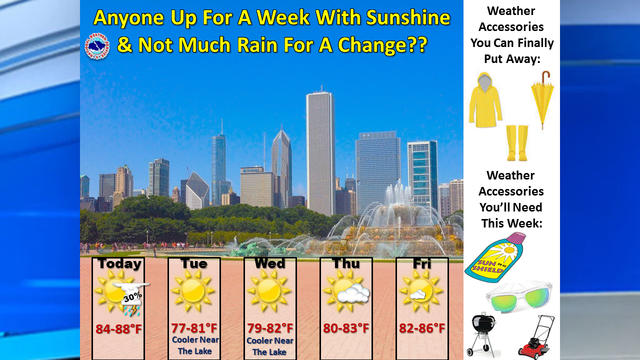
Though the Chicago area could get some showers or storms in the evening on Monday, the rest of the week should be ideal summer weather, with warm and dry conditions, without being unbearably hot.

Warning of an "oppressive" combination of heat and humidity over the next two days, the National Weather Service has issued a heat advisory for the Chicago area for much of Saturday.

If you've been longing for the dog days of summer, you'll get your wish this weekend, as conditions will be hot and muggy through Sunday, as temperatures will soar much higher than we've seen in weeks.
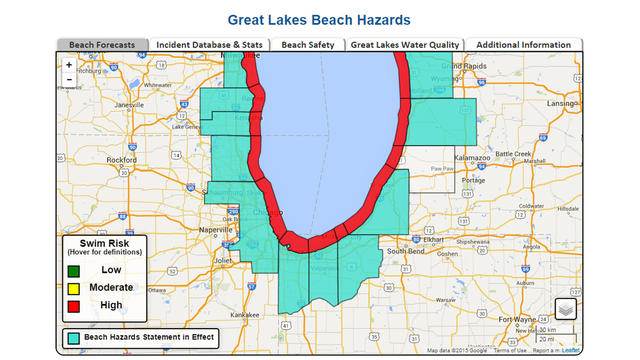
Chicago might finally be getting ideal beach weather, but forecasters were warning people to stay out of Lake Michigan from Tuesday afternoon to Wednesday morning, due to high waves expected along the lakefront.

A fast-moving line of storms that brought heavy rain and high winds to the Chicago area Monday morning was likely just the first taste of severe weather for northern Illinois and northwestern Indiana.