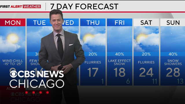
Cold Weather Advisory tonight with dangerously cold wind chills for Chicago
A cold front overnight will kick up strong winds that blow this loose, powdery snow around and also drop Monday morning wind chill temperatures between -15 and -25 degrees.
Watch CBS News
A cold front overnight will kick up strong winds that blow this loose, powdery snow around and also drop Monday morning wind chill temperatures between -15 and -25 degrees.
A cold front overnight will kick up strong winds that blow this loose, powdery snow around and also drop Monday morning wind chill temperatures between -15 and -25 degrees.
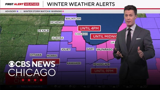
Meteorologist David Yeomans has a First Alert Weather update for Sunday, Jan. 25, 2026.
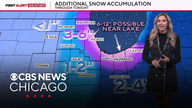
Meteorologist Kylee Miller has a First Alert Weather update for Sunday, Jan. 25, 2026.
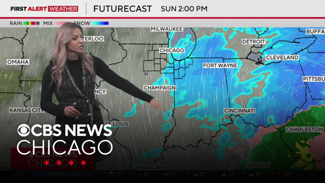
Meteorologist Kylee Miller has your 6 a.m. First Alert Weather forecast for Sunday, Jan. 25, 2026.
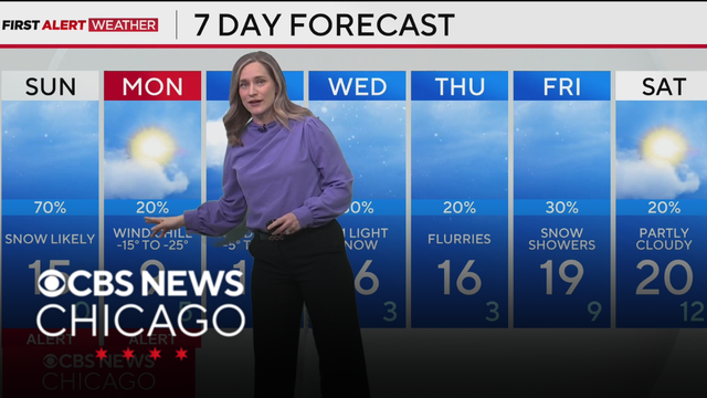
Snow tapers off Sunday afternoon, with some lake effect lingering into the evening.
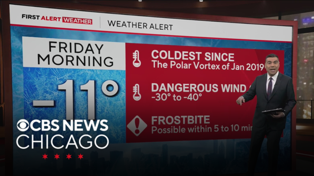
A cold front rushes in late on Thursday that opens in the door for dangerously cold temperatures.
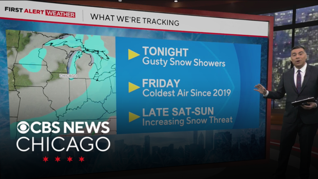
Temperatures tonight remain in the teens, and Thursday will be an in-between day where we have temperatures in the 20s for the afternoon, mostly cloudy skies, then as a cold front rushes in late on Thursday, that opens the door for dangerously cold temperatures.
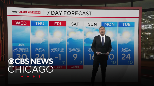
Periods of snow can be expected overnight through Wednesday morning, following the afternoon with more blowing and gusty snow showers.
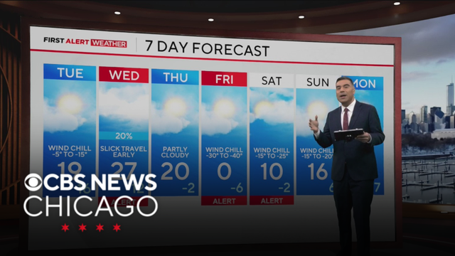
Bundle up with the heavy jackets early tomorrow morning. By the afternoon highs will hover in the teens but will still feel like the single digits during the afternoon with partly cloudy skies.
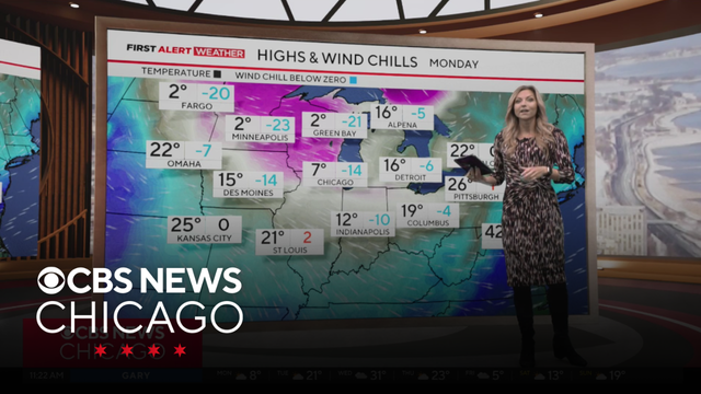
Meteorologist Kylee Miller has your 11 a.m. First Alert Weather forecast for Monday, Jan. 19, 2026.
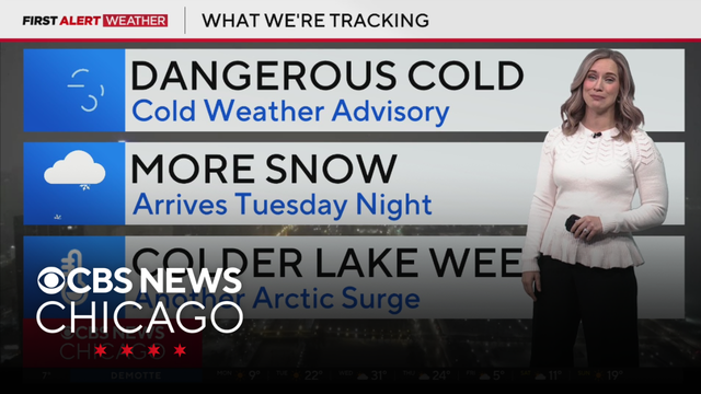
Meteorologist Laura Bannon has your 5 a.m. First Alert Weather forecast for Monday, Jan. 19, 2026.
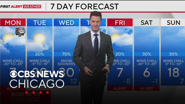
Wind chills for much of the morning on Monday will be dangerous to spend time outdoors between -20 and -25 degrees.
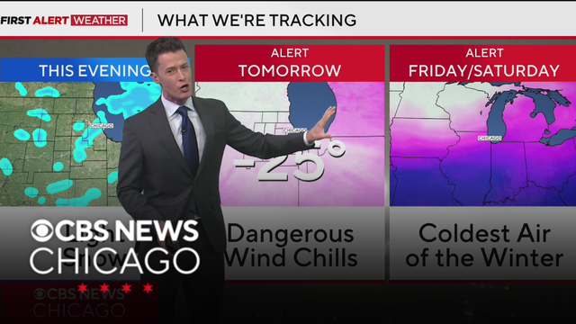
The wind chill is expected to be between -20 and -25 degrees. Meteorologist David Yeomans has the latest.
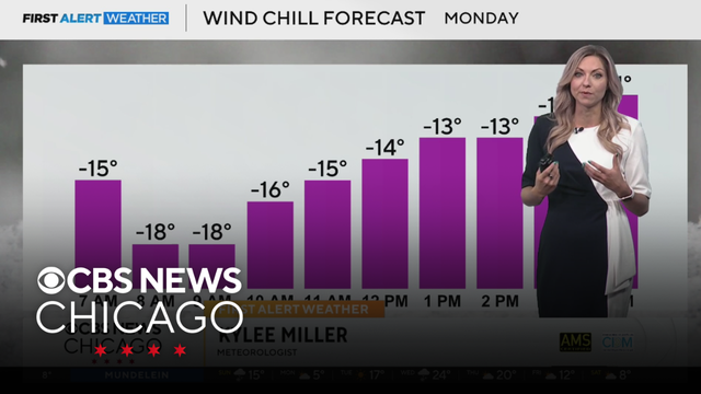
Meteorologist Kylee Miller has your 7 a.m. First Alert Weather forecast for Sunday, Jan. 18, 2026.
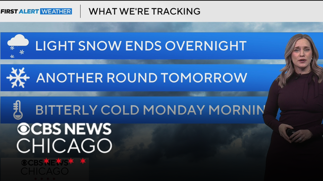
Additional snow is possible Sunday afternoon into early evening, followed by a blast of arctic air Sunday night into Monday with dangerous wind chills.
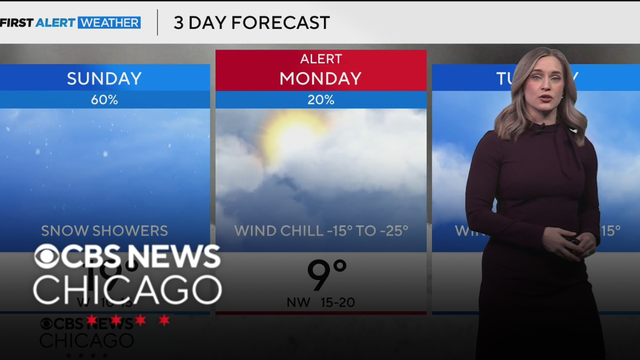
By Monday, wind chills are expected to be as low as 15 to 25 degrees below zero. Meteorologist Laura Bannon is tracking colder weather.
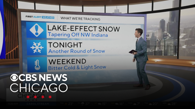
Meteorologist David Yeomans has your 11 a.m. First Alert Weather forecast for Thursday, Jan. 15, 2026.
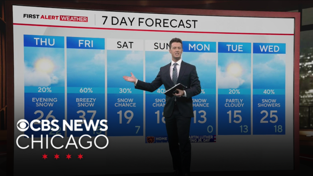
Temperatures will also be cold from here on out. Flash freezing a concern through early Thursday.
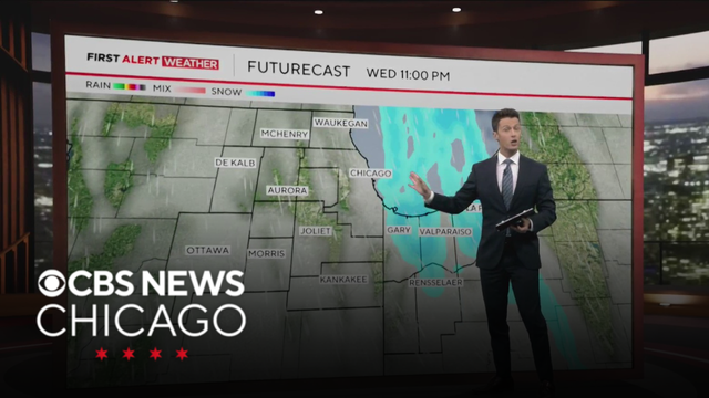
Snowfall accumulations could range from 3 to 6 inches in Porter County and La Porte county could see up to 8 inches of snowfall.
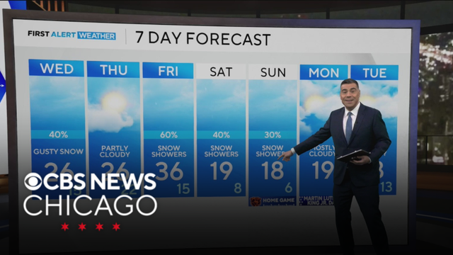
A strong cold front will bring scattered snow to the area Wednesday morning through the afternoon, then expect flurries in Illinois, but accumulating lake-effect snow in NW Indiana. 1" to 4" snow totals are looking likely in Porter County to La Porte County, with totals as high as 8" in localized snow bands.
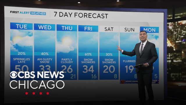
Clouds will rule the area along with a few sprinkles from time to time on Tuesday.
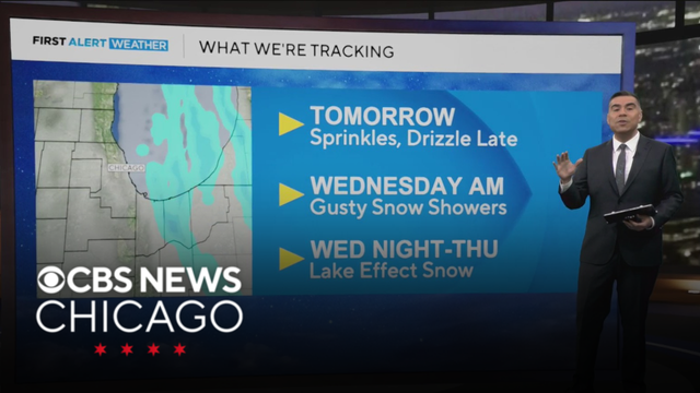
Temps will be in the upper 20s for Monday night, followed by another round of 40s for Tuesday.
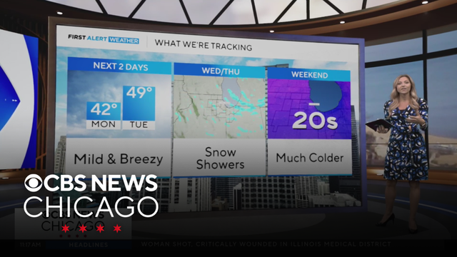
Meteorologist Kylee Miller has your 11 a.m. First Alert Weather forecast for Monday, Jan. 12, 2026.
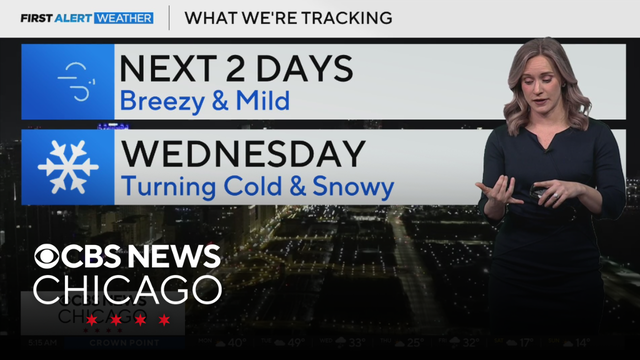
Meteorologist Laura Bannon has your 5 a.m. First Alert Weather forecast for Monday, Jan. 12, 2026.