Another winter storm, return of polar vortex prompts weather alert for Chicago area

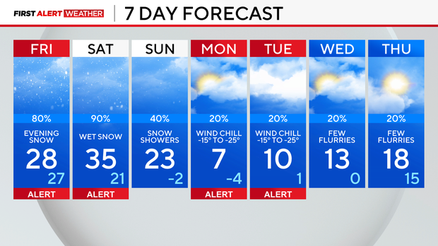
CHICAGO (CBS) — A Weather Alert will be in effect for Friday and Saturday as another winter storm moves in, impacting Valentine's Day evening plans.
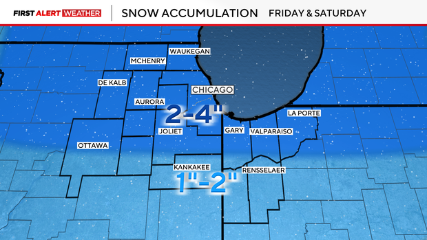
Clouds increase Friday morning, but dry weather is expected through the afternoon. Periods of heavy snow move in during your evening plans. The first round of snow late Friday is expected to bring 1-2 inches of accumulation to most areas.
Saturday, temperatures warm to near or just above freezing as periods of wet snow return. Another 1-2 inches of snow is possible, especially late in the day.
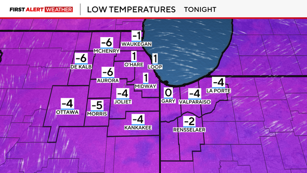
We are tracking the return of the polar vortex next week as a wavy jet stream brings a blast of Arctic air to the Great Lakes. Air temperatures are expected to fall below zero on Monday and Tuesday mornings, with dangerously cold wind chills reaching -15 to -25 degrees.
Forecast at a glance
TONIGHT: Mostly clear. Frigid, with a low of 1.
FRIDAY: Increasing clouds. Evening snow, with a high of 28.
SATURDAY: Cloudy with periods of wet snow, with a high of 35.