Chicago area under Flood Watch as second round of storms nears, but tornado risk has dropped

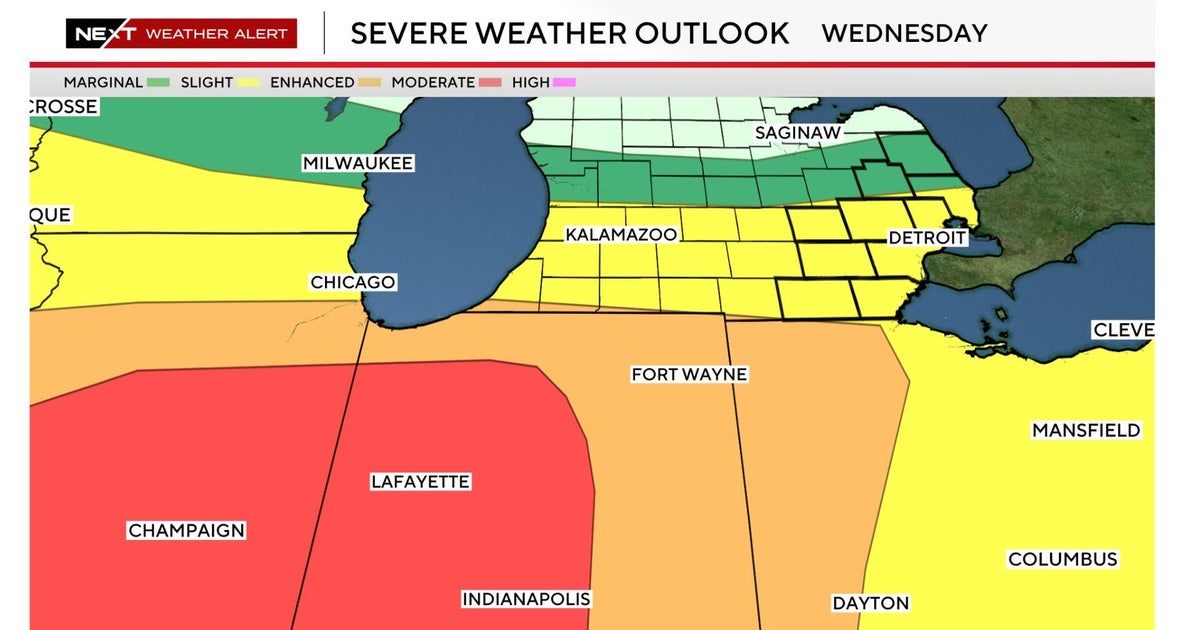
There are more thunderstorms and rain in the forecast Wednesday, but a cold front has pushed the risk of strong tornadoes south. The entire Chicago area is under a Flood Watch.
Two rounds of storms began in the mid-morning; a second round is expected to arrive in the mid-afternoon. Ground stops that had been in place at both O'Hare and Midway airports for part of Wednesday afternoon have been lifted.
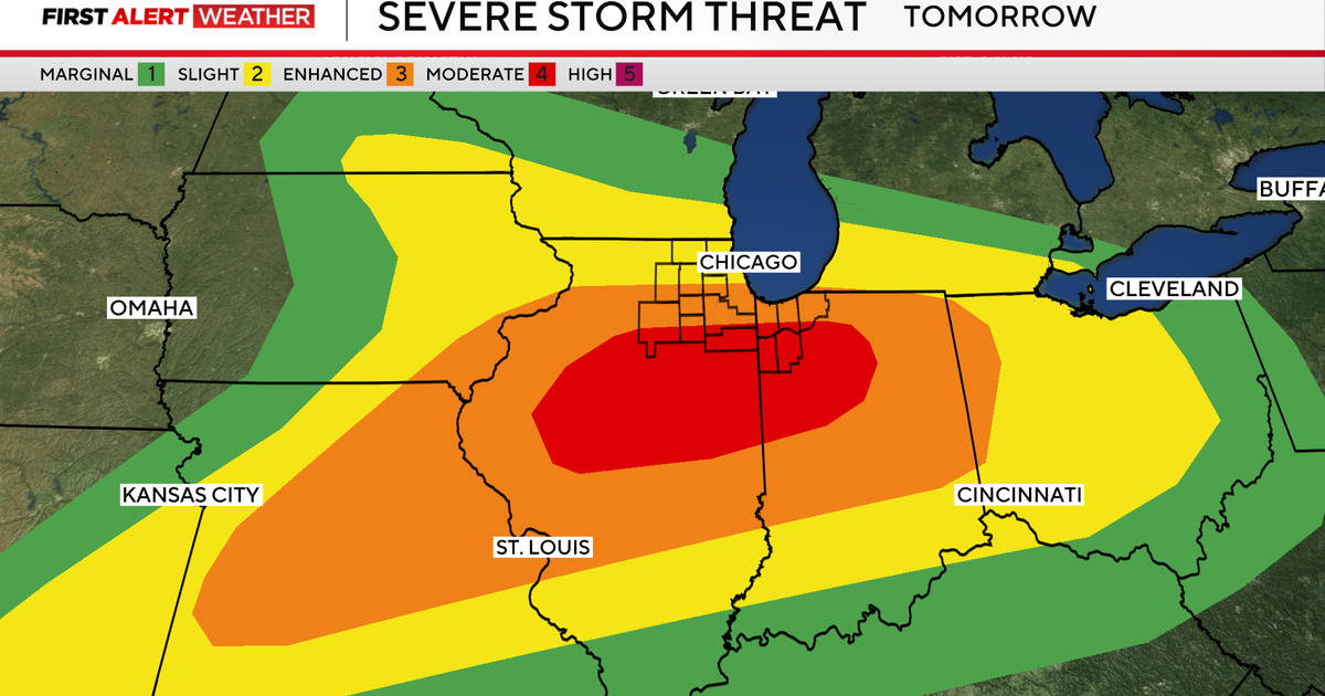
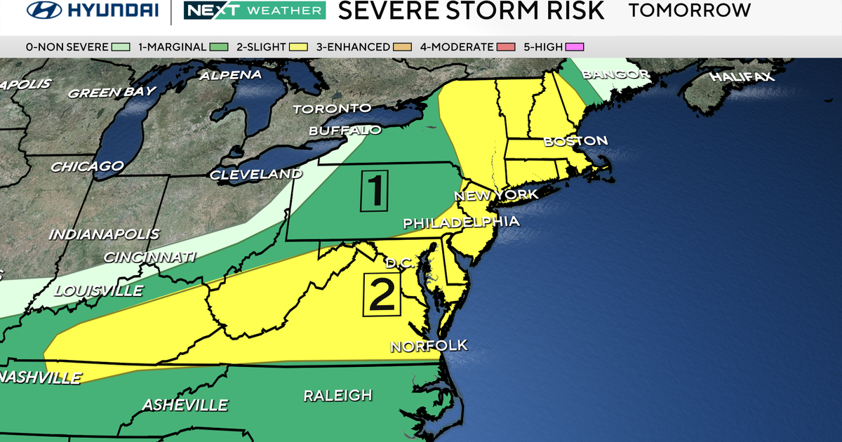
Earlier models showed the potential for another tornado outbreak in the Chicago area less than a week after 13 tornado touchdowns were confirmed in the south and southwest suburbs and Northwest Indiana, but a cold front has lessened the threat and pushed it further south. The highest risk for severe storms and tornadoes is south of I-80 and especially south of the Kankakee River.
The Chicago area is now at a 2 out of 5 enhanced risk for severe weather.
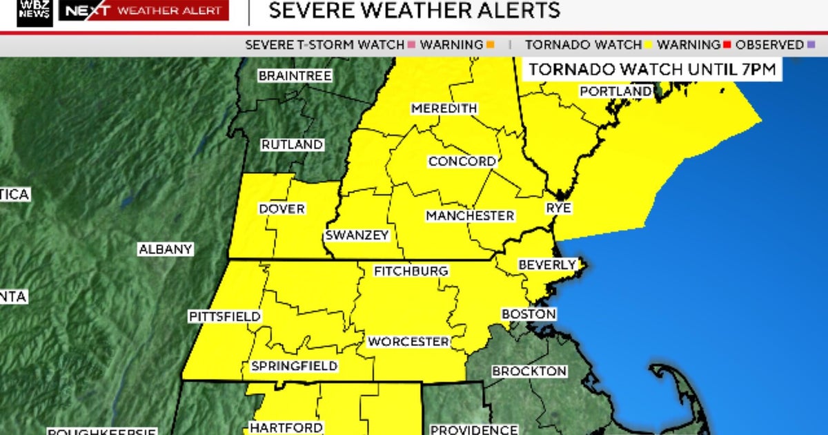
A Tornado Warning was issued for Lake County, Illinois, until 10 p.m.
A Severe Thunderstorm Warning is in effect for McHenry County until 9:30 p.m.
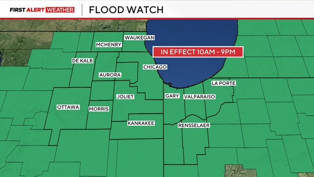
A Flood Watch is in effect for Cook, DeKalb, DuPage, Will, Grundy, Kane, Kankakee, Kendall, LaSalle, Lake, McHenry, Ogle, and Winnebago counties in Illinois and Benton, Jasper, Lake, Newton and Porter counties until 9 p.m.
The first round of storms began in mid- to late-morning in the Chicago area, with steady a hard rain falling into the early afternoon. As of 4:30 p.m. the rain had dried up, but a second round of storms is lumbering in from the west with more heavy rain in areas to the north. The further south you go, the more likely you are to encounter severe storms with damaging winds, large hail and the potential for tornadoes.
Most of the steady rain should move out of the area by late afternoon, with some showers lingering into the evening. Conditions will improve heading into the night around Chicago, with quiet and sunny days ahead.
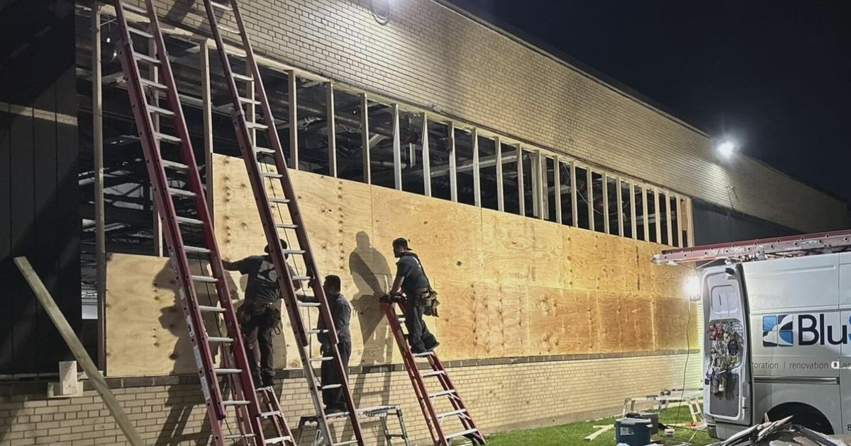
Thousands still without power after tornadoes last week
Days after a severe weather outbreak, thousands of NIPSCO customers are still without power and are bracing for the next rounds of severe weather.
Storms on June 11 brought at least 13 tornadoes to Northern Illinois and Northwest Indiana. Tornadoes downed power lines and destroyed houses.
Last week, over 86,000 customers were impacted by outages in Indiana. NIPSCO said crews have since restored power to around 95% of impacted customers.
As of Thursday morning, over 1,400 customers are still without power across northern Indiana. Merrillville was among the hardest hit areas still waiting for power restoration.