Clouds return Tuesday morning, severe weather risk Wednesday in Chicago


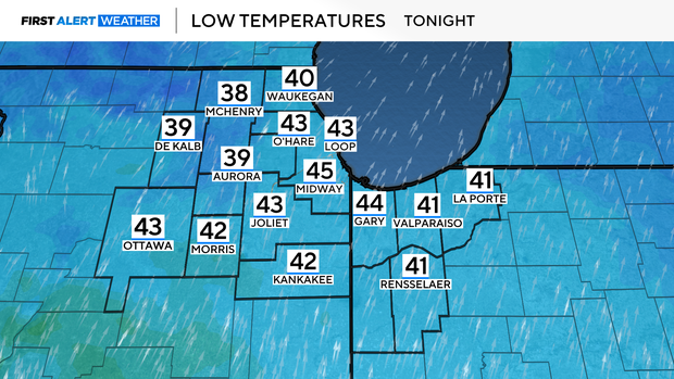
Skies will be mostly clear Monday night, with lows in the low 40s.
Clouds return by Tuesday morning.
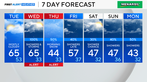
Tuesday will be mostly cloudy, breezy and warmer. Highs will be in the mid-60s in Chicago, but some spots south and southwest of the city will approach 70 degrees.
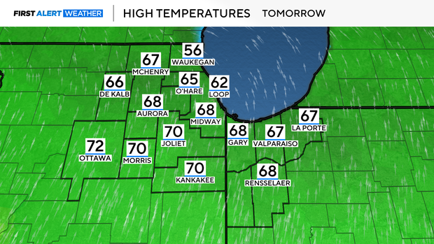
A wind off of Lake Michigan will keep the North Shore in the 50s.
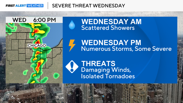
A severe weather threat returns for Wednesday afternoon and evening. Storms producing damaging winds will be the primary threat, but an isolated tornado can't be ruled out.
The best chance for storms on Wednesday will be between 3 p.m. and 9 p.m.
On the backside of this storm system, cold air will push into the area, allowing for snow showers Wednesday night into early Thursday.
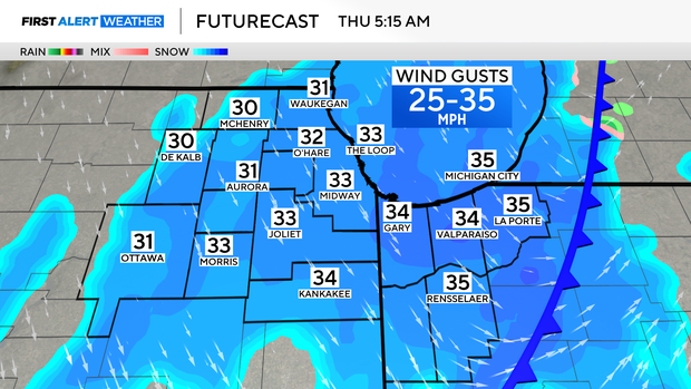
Light accumulations of snow may make for a slick morning commute on Thursday.
Spring begins with the vernal equinox on Thursday at 4:01 a.m.
Highs rebound back to the 50s by Friday, with chances of rain returning by late Friday.
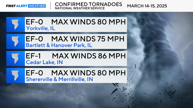
Meanwhile for the storms this past Friday night into Saturday morning, the National Weather Service has concluded the storm surveys. There were four confirmed tornadoes in the CBS Chicago viewing area.
One EF-0 tornado touched down in Yorkville, another in Bartlett and Hanover Park, and a third in Schererville and Merrillville, Indiana. An EF-1 tornado touched down in Cedar Lake, Indiana.
Forecast at a glance
Monday night: Mostly clear and breezy. Low 44.
Tuesday: Partly cloudy. Mild. High 65.
Wednesday: Building storm threat. High 63.