Chicago Weather Alert: Chillier temperatures coming

CHICAGO (CBS) -- Fog was set to lift late Tuesday night, and severe weather had moved on -- but chillier temperatures are coming in the morning.
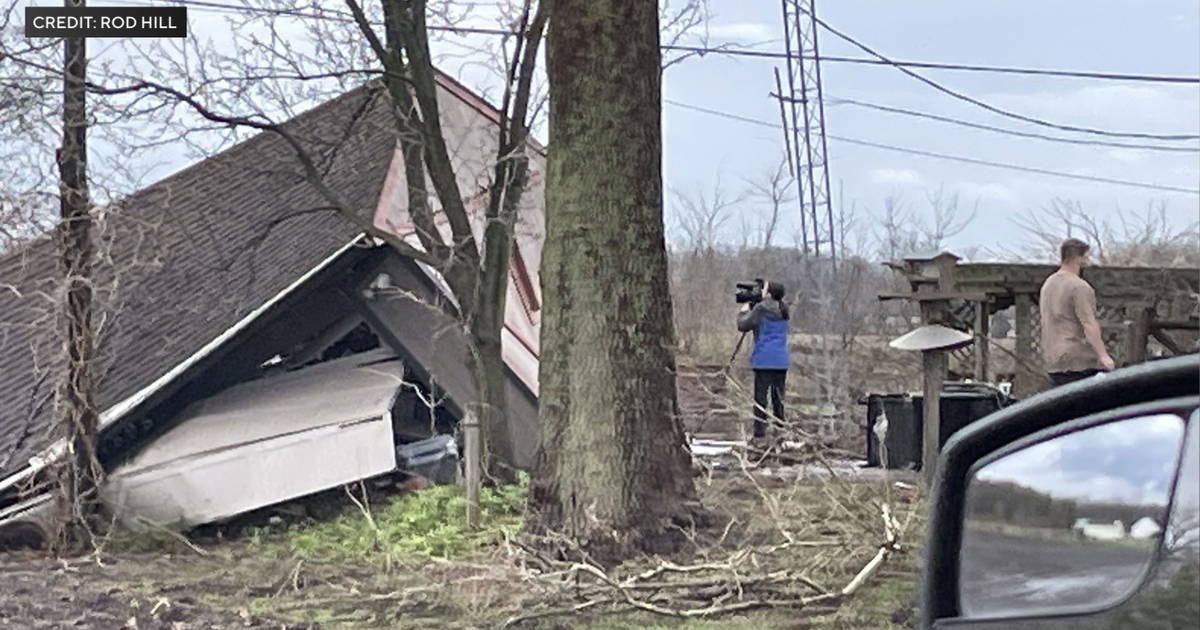
Severe weather hit areas south of Chicago earlier. Tornado warnings were issued downstate through the late afternoon and early evening hours.
A tornado warning was in issued Tuesday evening for central Ford and Iroquois counties not far south of the Chicago area. This tornado warning included parts of the I-57 corridor.
The tornado warning expired early, as the storm that prompted it weakened below severe limits.
Another tornado warning was issued farther downstate Tuesday evening, in central Piatt County west of Monticello.
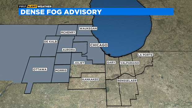
Meanwhile, a Dense Fog Advisory was extended to midnight. It was earlier set to expire at 9 p.m., as seen on the map below.
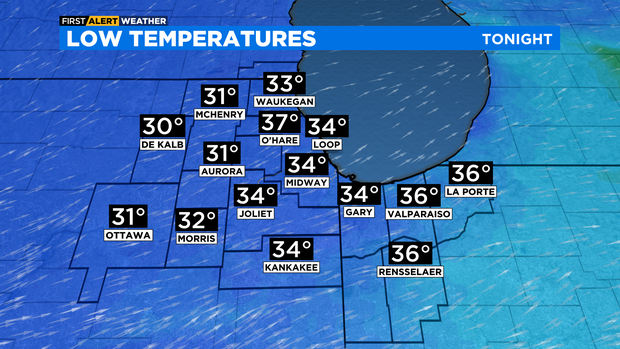
Rain chances and dense fog will fade after midnight as a cold front moves into the area. Lows overnight will be in the mid to upper 30s.
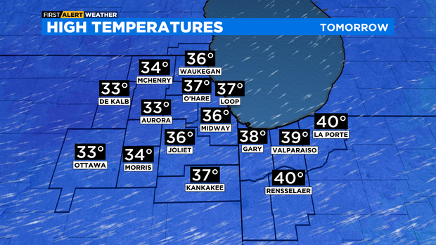
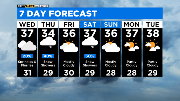
Colder Wednesday with highs in the mid 30s with a chance for sprinkles and flurries.
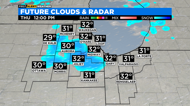
Scattered snow showers are possible on Thursday. A dusting to as much as an inch of accumulation is possible.
Temperatures remain chilly though the remainder of the week and weekend with highs in the mid 30s.
TONIGHT: Evening showers, storms and fog. Cloudy skies overnight. Low 37°
WEDNESDAY: Cloudy skies with a slight chance for flurries and sprinkles. High 37°
THURSDAY: Cloudy skies with a chance for scattered snow showers. High 34°