System weakens as showers and thunderstorms move into Chicago area


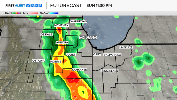
Widespread showers and thunderstorms move into the area late Sunday night, bringing rain and gusty winds.
A tornado watch was issued for much of the evening for some counties adjacent to the Chicago area, including Grundy, LaSalle, and Kankakee. The tornado watch to be in effect until 1 a.m., but was dropped early as the tornado threat diminished.
A tornado was reported by law enforcement west of Peoria late Sunday night, and the same line was moving toward the CBS Chicago viewing area at 10 p.m. But the active line of storms, which had multiple tornado warnings associated with it earlier, has weakened to the point where no tornado or severe thunderstorm warnings were active by 10 p.m.
However, heavy rain was still headed for the Chicago area Sunday night.
After 0.25" to 0.50" of rain in most areas, rain clears the area at sunrise Monday with gusty winds and cloudy skies.
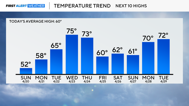
Temperatures hold steady — or even fall slightly — through the 50s Monday afternoon behind the system's cold front.
We will enjoy warmer temperatures Tuesday through the rest of the work week along with daily chances of a few showers and storms. A higher chance of rain comes in with a Friday cold front.
Next weekend looks dry and brisk behind it.
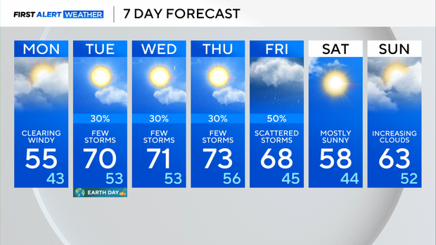
Forecast at a glance
Sunday night: Rain and thunderstorms. Windy. Low: 55
Monday: Clearing skies late. Cool and windy. High: 55
Tuesday: Warmer under a mix of clouds and sun. A few late-day thunderstorms. High: 70