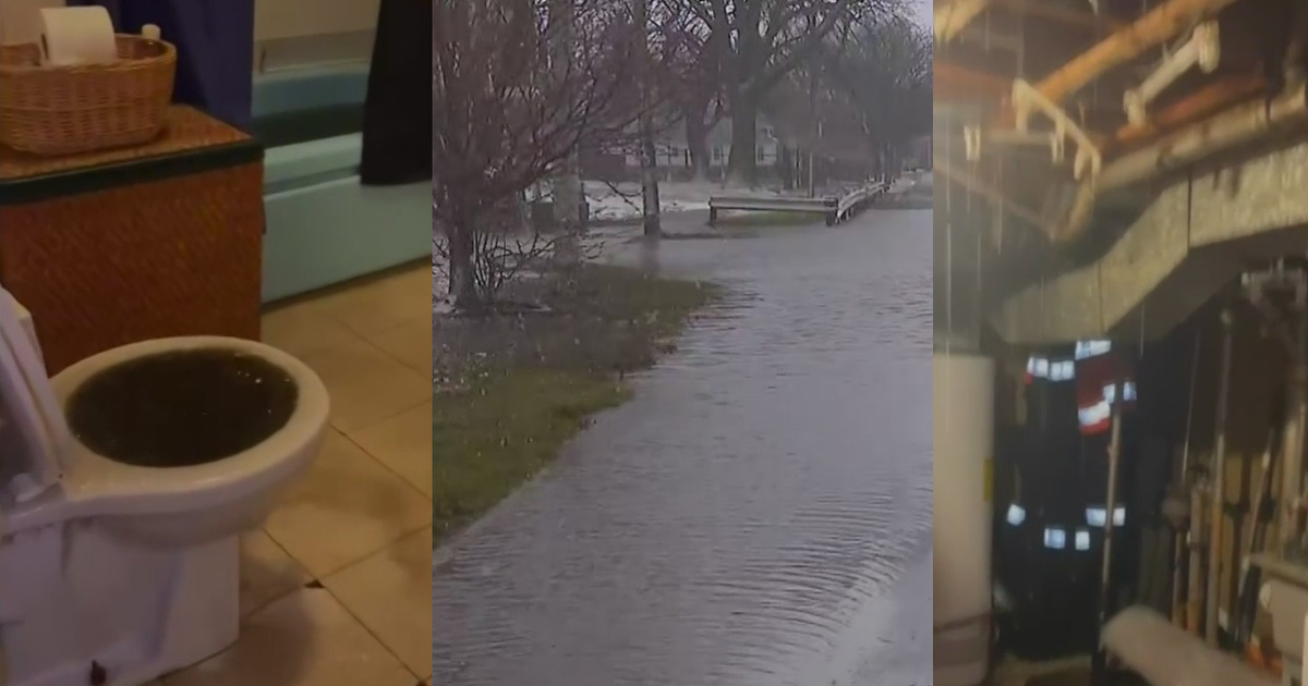
Flash flooding in south suburbs, Indiana as storms bring heavy rain to Chicago area and break heat


Flash flooding was reported in Kankakee County and Northwest Indiana Wednesday as storms with heavy rainfall moved through the Chicago area.
The storms originated to the west and moved east-northeast at about 25 miles per hour. One to two inches of rain were expected with these storms with some areas, especially to the south, which may see 3 to 5 inches of rain.
Another round of less severe, but equally rainy, storms followed late Wednesday, with rain continuing overnight and into Thursday morning.
A Flood Watch was in effect for Ford, Grundy, Iroquois, Kankakee, Livingston, and Will counties in Illinois; and Benton, Jasper, Lake, Newton, and Porter counties in Indiana until 7 p.m. Chicago time. An earlier Flood Watch that had been in effect for Boone, Cook, DeKalb, DuPage, Kane, Kendall, LaSalle, Lake, Lee, McHenry, Ogle, and Winnebago counties was cancelled.
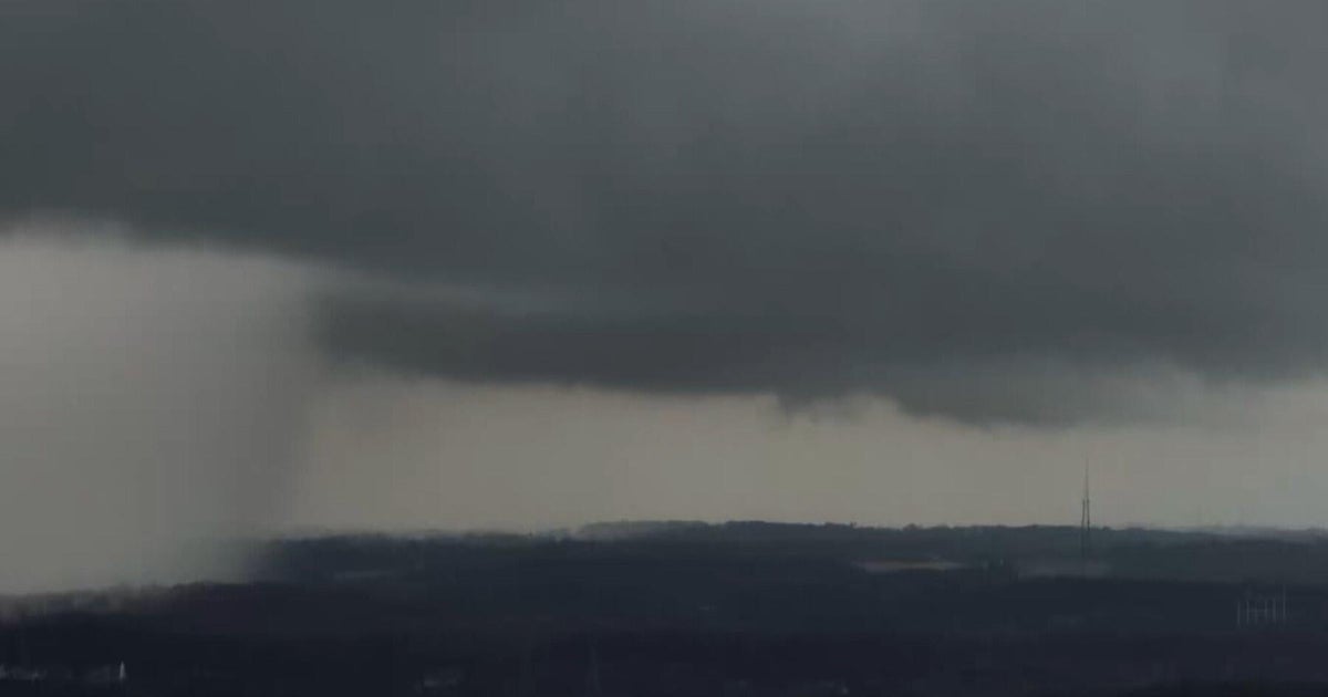
The first line of storms, which developed to the west around 11 a.m., brought torrential rainfall and a huge amount of lightning, with over 300 strikes recorded around noon in one cell alone. Lightning frequency is measured in 10-minute increments, so that means the cell produced around 30 strikes per minute or one lightning strike every other second. The storms also had the potential for wind gusts over 40 miles per hour.
See the latest 7-day forecast from our First Alert Weather team
The path of the first round of storms changed slightly, riding a boundary of higher atmospheric energy from Channahon to Park Forest, so the worst of the storm was expected to stay south of the city of Chicago.
After these storms have left the area, another round of storms developed. They were not expected to be severe in a widespread way, but could be stronger along the I-80 corridor into Northwest Indiana.
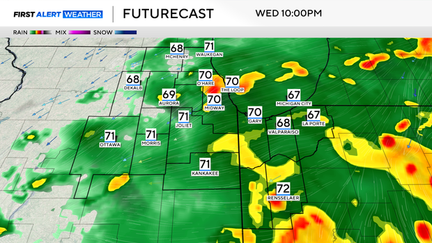
On-and-off scattered showers continue Wednesday evening, and then just a few patchy areas of rain will persist overnight. Lows will be in the mid-60s.
After an early morning shower on Thursday, expect a partly cloudy sky with cooler and drier air. A cold front will be breaking the oppressive heat and humidity and giving way to a much cooler and nicer weekend.
Temperatures will start falling into the 70s by mid-afternoon Wednesday.
There is also a Beach Hazards Statement in place for all beaches along Lake Michigan from 1 p.m. Wednesday through 4 p.m. Friday. Waves of 5 to 8 feet are expected.
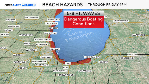
The high waves and dangerous rip currents make the lake a hazard for boaters and swimmers alike, so it is advised to stay out of the water.
Northerly winds will also bring in another plume of wildfire smoke from Canada. Hazy skies and reduced air quality are expected through Saturday. At times, air quality could jump into the unhealthy category.
While rain will end by Thursday morning and is not forecast over the weekend for Lollapalooza, festivalgoers should plan on getting muddy if they're going to be there on Thursday.
Temperatures will be in the low 80s, but cooler lakeside, for this weekend. Conditions will be warmer with more humidity and isolated chances of storms for next week.