Chicago First Alert Weather: Winter Storm Watch Begins Wednesday Night
CHICAGO (CBS) -- A Winter Storm Watch begins Wednesday night at lasts through early Thursday evening. Ice accumulation of 0.1" to 0.2" and snow accumulation of three to seven inches are possible.
According to CBS 2 Chief Meteorologist Albert Ramon, it'll be windy and mild Tuesday night with temperatures by Wednesday morning in the low to mid 40s.
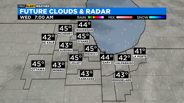
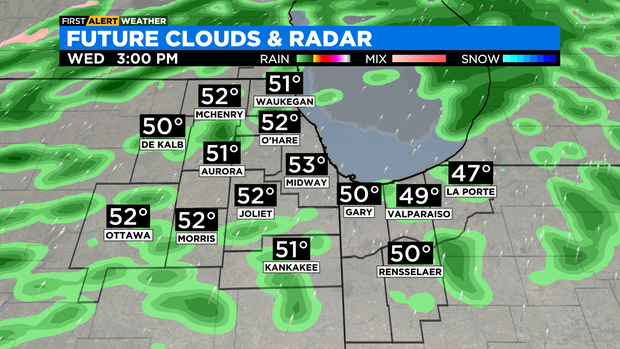
Rain chances increase Wednesday late morning through the evening hours. Some of the rain could be heavy, especially for areas along and south of IH-80. One to two inches of rainfall possible, with the highest totals expected to the southeast of Chicago in Jasper and Newton County, Indiana.
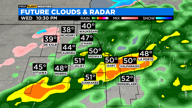
As cold air moves in on Wednesday night, there's a window for rain to transition to sleet and freezing rain through the early morning hours of Thursday. Ice accumulation of 0.1" to 0.2" possible.
Snowfall chances increase by late morning Thursday and lasts through the early evening. Some of the snow could be heavy. A strong north wind could create blowing snow, reducing visibility.
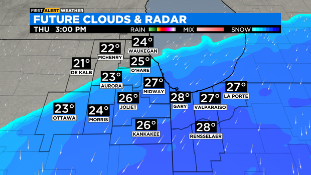
Snowfall amounts of 3 to 7 inches possible. Windy conditions will create large waves out on the lake. Some lakeshore flooding can't be ruled out.
TONIGHT: Partly cloudy. Morning lows in the low 40s. Windy, gusts as high as 40 mph.
WEDNESDAY: Rain chances increase by late morning. Heavy rain likely after sunset. Windy and mild. High: 52°.
THURSDAY: A chance for sleet and freezing rain in the morning, then snow likely in the late morning into the early evening. Windy and colder. High 30°.