Chicago First Alert Weather: Cloudy Saturday and rainy Sunday

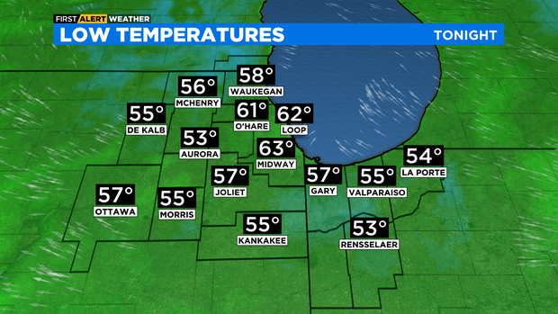
CHICAGO (CBS) -- It will be mostly clear and cooler tonight with lows around 60 degrees in the city, but as cool as low to mid 50s in the western suburbs.
A combination of a clear sky and light winds will allow for the development for patchy fog by Saturday morning.
Saturday will feature a partly cloudy sky and a southeast wind that will boost highs to the low to mid 80s. A weak lake breeze will develop in the afternoon, so highs in the upper 70s are expected near the lakeshore.

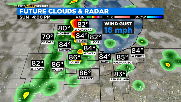
For Sunday, we'll start the morning off with a few isolated showers. A strong south wind will increase temperatures and humidity levels. Highs will be in the upper 80s. Scattered showers and storms will increase throughout the afternoon hours on Sunday, as a disturbance moves into the area from the west. A few storms on Sunday could produce gusty winds, small hail and cloud-to-ground lightning.
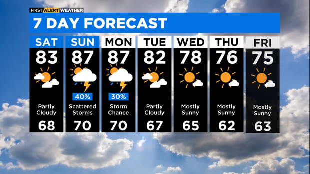
Storm chances linger into Monday ahead of a front that will move through the area late in the day. Storms that do pop up on Monday could also be strong, producing gusty winds and lightning. Highs will be in the upper 80s on Monday.
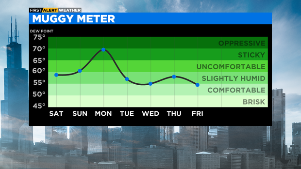
Behind the front, we'll look for cooler temperatures and drier air for Tuesday with highs in the low 80s. A persistent northwesterly flow will keep temperatures below average Wednesday through Friday with highs in the mid to upper 70s.
TONIGHT: Mostly clear skies and cool. Patchy fog. Low 61°
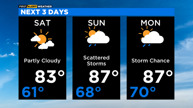
SATURDAY: Partly cloudy. High 83°
SUNDAY: Partly sunny with a 40% chance of showers and thunderstorms. High 87°