Weather warmup temporary after coldest, snowiest start to Chicago meteorological winter since 2016

Following Chicago's coldest and snowiest start to meteorological winter since 2016, warmer weather is settling in temporarily this week.
Day and night temperatures during the month of December averaged 27.0 degrees at Chicago O'Hare – a full 3.5 degrees colder than normal. The coldest temperature came Dec. 14 when the mercury dipped to -2 degrees. The city also had a snowy start to winter with 9.5" of snow last month, nearly 2 inches above average.
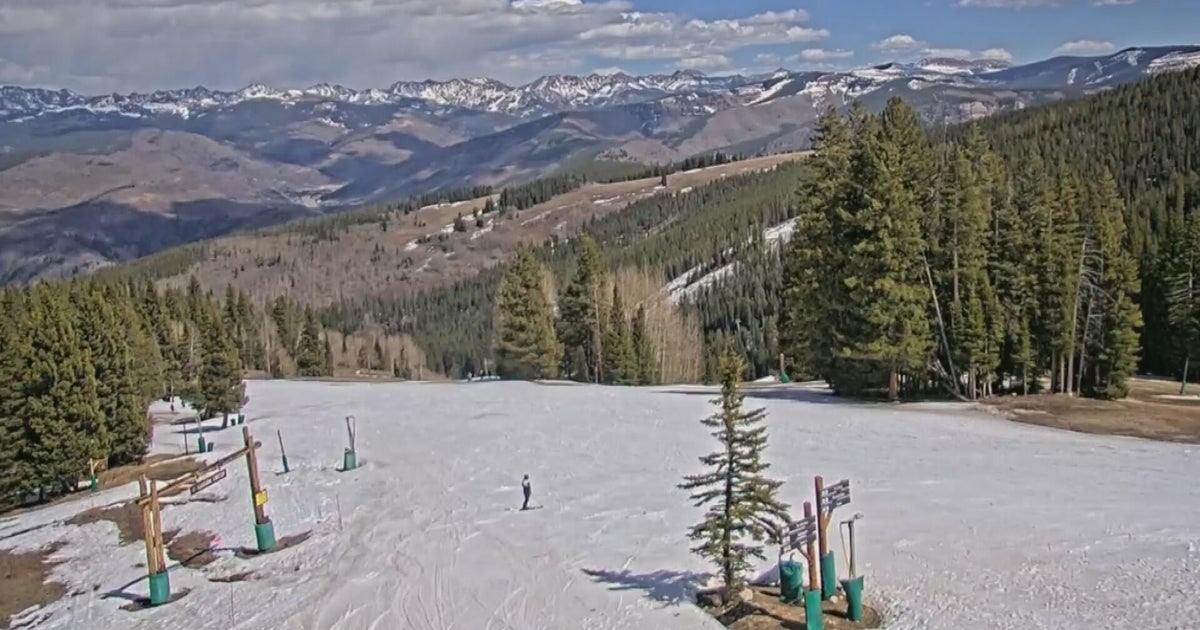
The same weather pattern that drove cold air and repeated winter storms into the Great Lakes region in December also led to record-warm, dry weather out west. Much of the western U.S. is currently experiencing its warmest-ever start to meteorological winter, leading to ski resorts without snow during peak season. This is due not only to the persistent ridge of high pressure across the west this winter, but also due to warmer baseline temperatures from climate change.
The weather pattern has changed this week, with a stormier/cooler pattern across the west and warmer weather locally. Southerly flow is expected to drive temperatures 20 degrees above normal by Thursday afternoon, topping 50 degrees in Chicago.
The change appears temporary, as colder, more typical January weather is slated to return this weekend into next week. Snow showers are possible in the Chicago area beginning Saturday.