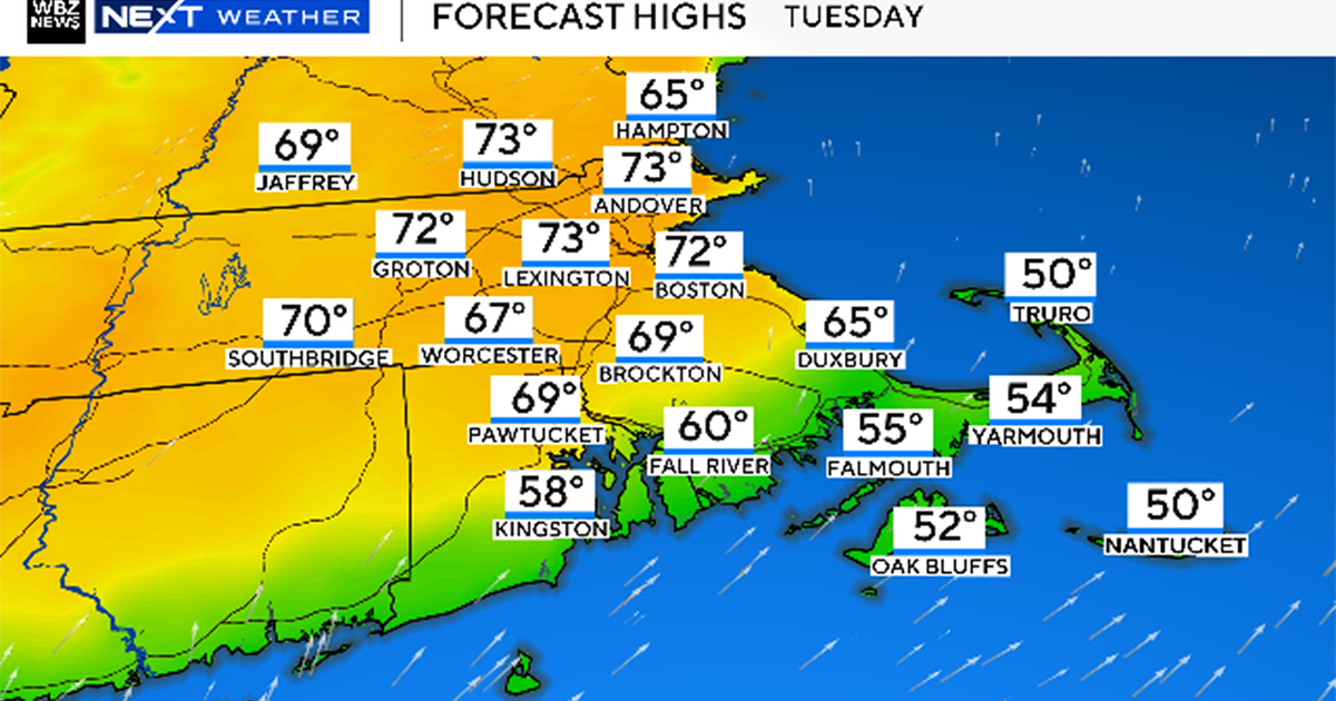
Heavy snow and extreme cold in Boston weather forecast this weekend, as monster storm impacts U.S.
The latest weather forecast shows the odds are increasing that Boston and much of the northeast may be included in the jackpot zone for heavy snow this weekend as a monster winter storm is set to impact a large portion of the United States.
Click here for the latest snow map that shows the potential for 20 inches of snow or more in Massachusetts.
Our WBZ Weather Team is highlighting the three-day stretch from Saturday through Monday with a NEXT Weather Alert for the likelihood of a major one-two punch of extreme winter cold and snow.
We are still days away from the storm's arrival here in New England and therefore, we anticipate several changes and tweaks to our forecast. The trends are definitely concerning and that is why we are raising the alert.
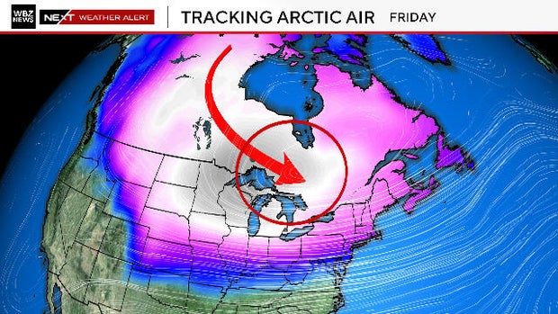
Coldest air of the season for Boston area
We can say with absolute certainty that the coldest air of this winter season will arrive Friday night. This is an air mass with origins in the Arctic region, near the North Pole.
Low temperatures on Saturday will range from the single digits to as much as 10 degrees below zero in southern New England. High temperatures on Saturday and Sunday will likely not make it out of the teens.
This Arctic air out ahead of the storm is an essential ingredient and will be a major factor in creating an historic winter storm across the United States.
Winter storm
This will be a rare combination and clash of very different air masses. A near-record cold and strong, Canadian high pressure system will collide with a moisture-laden, atmospheric river of air from the deep Pacific and turn the southern and eastern United States into an atmospheric battle zone.
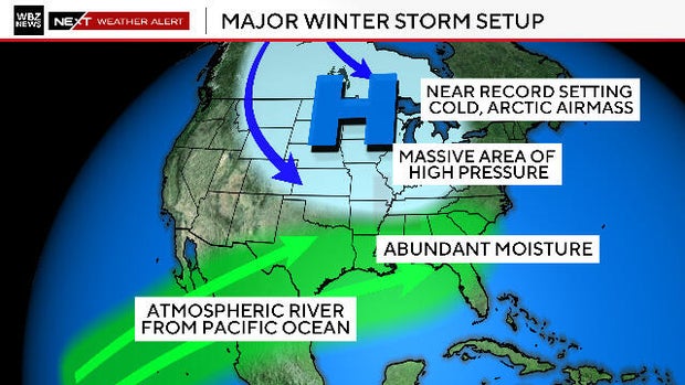
This will be the most impactful winter storm the United States has seen this winter and perhaps, in several years.
By Friday, we expect dozens of states to be under blizzard and ice storm warnings.
Travel across the country will be severely impacted and many airports will inevitably need to shut down.
This storm system will grow to be more than a thousand miles wide and by Sunday, will likely cover just about the entire eastern half of the country.
How much snow?
Current snow and ice estimates across the South and Mid-Atlantic are staggering.
There will be a swath of 1-2 feet of snow that will extend for 1,000 miles or more. Some major cities currently forecasted to be within that area through Sunday afternoon include Oklahoma City; Lexington, Kentucky; Washington, D.C. and Philadelphia.
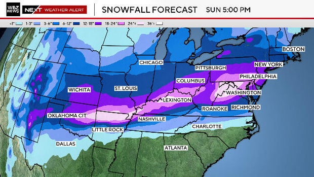
Just to the south of the snow shield, a very dangerous ice storm will be occurring in cities like Dallas, Little Rock, Arkansas; Nashville, Tennessee and Charlotte, North Carolina.
Anticipate hundreds of thousands of power outages and perhaps, several days before the lights come back on.
Boston weekend weather
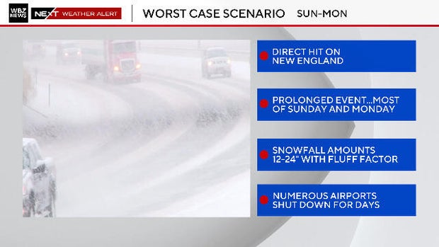
As for New England, the trend in the last 24 hours is for a more northern track and much higher impact in our area. What would that scenario mean?
Snow would likely begin lightly during Sunday morning and afternoon with the brunt of the snow and accumulation coming Sunday evening through a good portion of Monday.
Under a worst-case scenario, it may be snowing for nearly 36 hours. Should this occur, a foot of snow or more would not be out of the question across most of southern New England.
The fluff factor
With temperatures being so cold, the snowfall in our region would be very light and fluffy. That type of snow tends to stack up quickly. Many of our biggest snow storms and highest snow totals have occurred with Arctic airmasses in place.
To give you an idea of how much temperature matters: Let's say the storm drops a total of 1.0" of water (liquid equivalent). Under "normal conditions" with temperatures near freezing or slightly below, you get a ratio of 10:1, meaning 10" of snow for 1" of liquid.
With a true Arctic airmass in place, that ratio can grow to 20:1 or higher, meaning 20" or more of snow for the same 1" of liquid.
Would you believe, it has been nearly four years since Boston had a snowstorm of 6" or more? This is the second-longest such stretch on record.
So, it has certainly been a while for all of us. If the worst-case scenario plays out, this will be unlike anything we have seen or experienced in quite some time.
Finally, some good news: With many of our most infamous nor'easters and coastal storms, there is a major wind and coastal component. Not this time. Tides are astronomically fairly low and winds will be a bit gusty at the coastline, but not expected to be all that impactful.
This is definitely one of those storms that it is imperative to stay tuned to the forecast.
The WBZ NEXT Weather team will have you covered every step of the way. Stay tuned to WBZ-TV and WBZ.com for frequent updates.