Several inches of snow possible from holiday weekend storm in Massachusetts
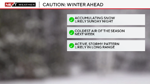
BOSTON - Winter in New England is about to take it up a notch. We've got some accumulating snow to kick things off. That will be followed by the coldest airmass of the winter season thus far.
For a look at the latest snow maps for Sunday's snowstorm, click here.
Finally, in the longer range, it appears that an active/stormy pattern is going to unfold over the next few weeks across the eastern United States.
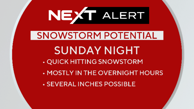
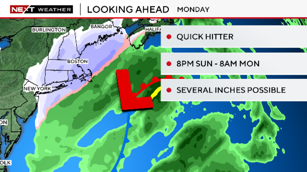
Quick hitting snowstorm
For now, we focus on part 1...the MLK Day snow.
The WBZ Weather Team has issued a NEXT Weather Alert for Sunday night through Monday morning.
Confidence is increasing that most of our area will see SOME snow Sunday night, but the finer details still need to be worked out.
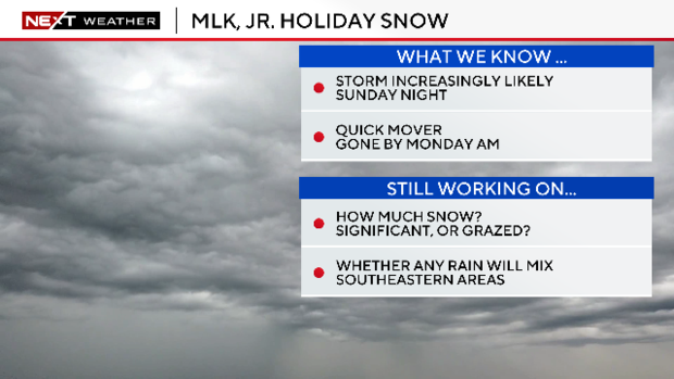
This will not be a major snowstorm; however, the bar has been set rather low in recent years.
Plowable snow likely
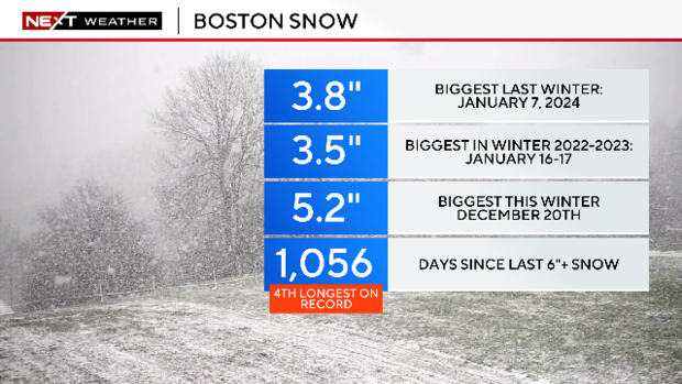
It has been nearly three years (1,056 days) since the city of Boston received 6" or more in one storm.
We have only had two plowable storms this winter, that said, I think it is likely that plows will be needed in many towns on Monday.
Models have made a notable shift westward with the track of the storm Thursday, thus raising the odds on an impactful snowfall in southern New England.
When will the snow arrive?
It will be a quick mover, in and out of here in 12 hours or so.
Most of the snow will be focused and fall between 8 p.m. Sunday and 8 a.m. Monday.
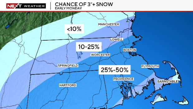
Boston snow forecast
Again, it is a bit too early for a snow forecast map, but we feel there is about a 25-50% chance of at least 3" of snow accumulation across a good portion of southern New England, including Boston and Worcester.
Chances of at least an inch are much higher, closer to 70-80% in any given area.
Because the storm is moving so quickly, the upper range is somewhat limited. Odds of 6" or more are fairly low, less than 25%.
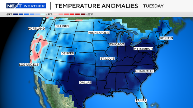
Coldest airmass of season
Following the storm, the coldest airmass of the season. Temperatures will be as much as 25 degrees below the normal across most of the eastern United States early next week.
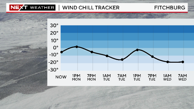
Locally, highs will be in the teens and low 20s Monday through Wednesday with overnight lows in the single digits.
As always, the WBZ NEXT Weather team will keep you updated with the latest snow and cold forecasts. Stay with us on WBZ-TV, CBS News Boston and WBZ.com for frequent updates.


