Hurricane Franklin could bring big waves, rip current risk to New England beaches
By Terry Eliasen, Meteorologist, WBZ-TV Exec. Weather Producer
BOSTON - I think most would consider this the true last week of summer. Meteorologically speaking, summer is over Thursday. . . you've got Labor Day weekend ahead and, of course, the start of school.
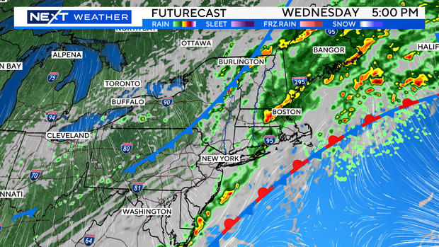
It is only fitting, after the wet summer we have had, that we get some rainfall to wrap up the season! We have showers in the forecast later Tuesday and Wednesday.
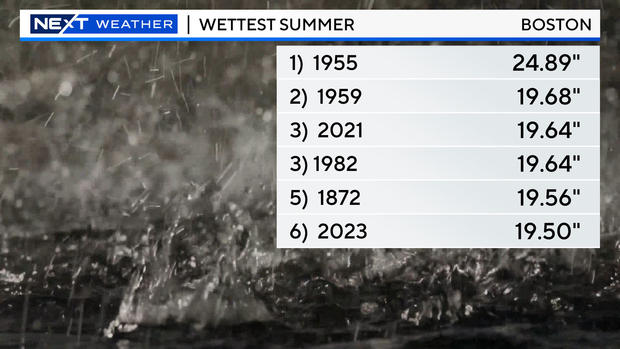
The only question at this point is, will the coming rain be enough to break the summer rainfall records in Boston and Worcester?
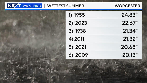
Worcester would need a little more than 2" of water. Possible but not likely.
Boston will likely finish in second place, well behind the 1955 summer with multiple hurricane hits.
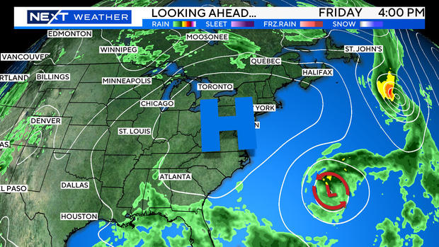
Greatest risk of significant rain this week comes on Wednesday - and there may even be a bit of a tropical connection with one or both of the hurricanes (Franklin and Idalia).
Speaking of the Tropics, that will be the main weather story this week.
View Hurricane & Tropical Storm Tracking Maps
Franklin is currently a Major, Cat 4 Hurricane and is heading well out to sea in the next several days.
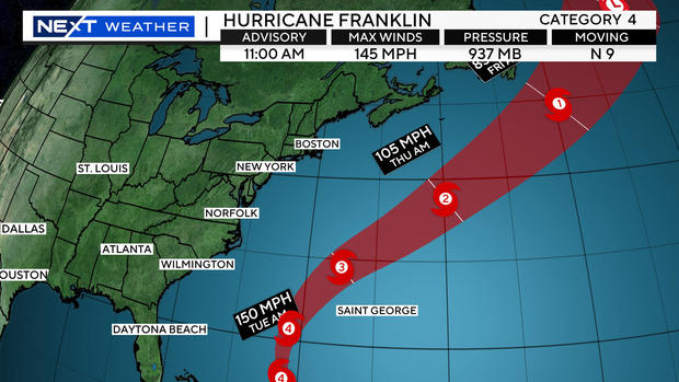
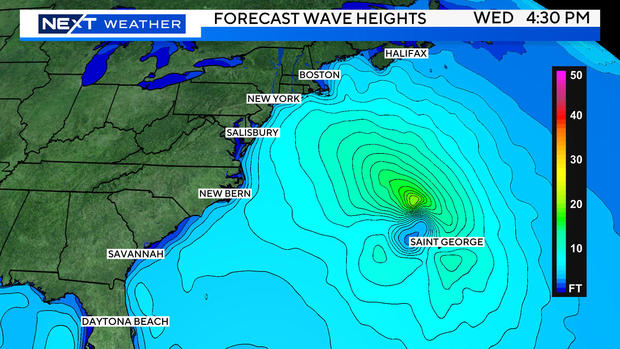
While the center of Franklin is forecast to pass more than 500 miles east-southeast of New England, it will still cause the seas to be quite rough, especially Wednesday and Thursday.
Current forecasts are for 3-to-6-foot waves and a high rip current risk as well at our local beaches, particularly over the Cape and Islands.
Tropical Storm Idalia is forecast to rapidly strengthen in the next 48 hours into a major hurricane just west of Florida.
The current forecast track is for landfall near the Cedar Key area of Florida, north of Tampa, Wednesday morning.
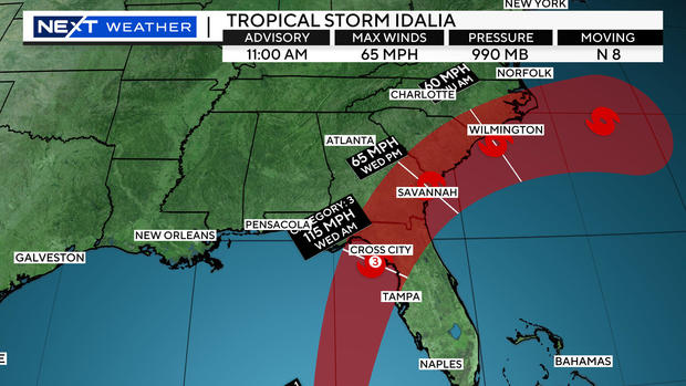
It will then cut a path through northern Florida and likely re-emerge off the Coastline of South Carolina by Thursday (in a much weaker state) as a tropical storm.
From there, it is likely to meander around off the southeast Coast for several days. We will be protected by a large area of high pressure this weekend, meaning lots of sunshine and a fall-feel at times!