'Ridiculous' rainfall, oppressive humidity defining New England's summer of 2023
By Terry Eliasen, WBZ-TV Meteorologist, Executive Weather Producer
Ahhh, the summer of 2023.
If it isn't the pouring rain, it is oppressively humid. On the days when we are lucky enough to see the sunshine, there is wildfire smoke in the air. The lasting images thus far from this summer in New England: Washed out, flooding or destroyed roads, swollen/raging rivers and brownish, smoky skies.
Makes you yearn for the days of a good ol' fashion drought doesn't it?
Take a look at the rainfall totals from the last 30 days. Yes, we are now starting to draw rainfall total maps that look like snowfall forecasts, just another summer of 2023 fun fact!

These numbers represent what would typically be the total rainfall for the entire summer, if not more. Fifteen inches of water in parts of New England in the past 30 days is about a third of what we average in an entire year!
In July alone, (and we are only about halfway through the month) we have seen ridiculous rainfall totals. You typically only see monthly totals like this in years when we get a tropical storm or hurricane passing through.

The city of Worcester is creeping up on its wettest July ever recorded.

The real kick in the pants has been the timing of a lot of the rain this summer. I don't have to tell you that the weekends have been brutal. It has rained on nine of the 14 weekend days in Boston going back to June 1.
I suppose you could say this is payback from last summer when the exact opposite happened.

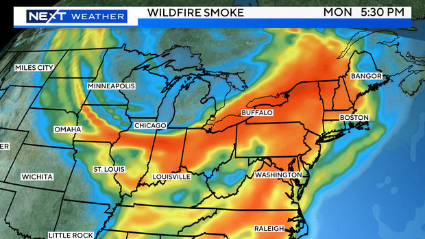
And then, you finally get a dry day, not only does it come on Monday but, we get a hazy, smoke-filled sky to boot.
Yup, that Canadian wildfire smoke is back..
Not expecting any major air quality concerns Tuesday, however there will be a brownish haze in the air at times.
Monday was likely our hottest day of the week.
Tuesday we will once again be watching the radar in the afternoon for a few downpours/thunderstorms, mainly west of Boston and I-495. Nothing nearly as widespread of impactful as Sunday.
Wednesday looks like a dry day with lower humidity as well - a very rare occurrence this summer!
BUT. . . the pattern returns late-week. Showers and storms are expected late Thursday into Friday. That is the next significant period of weather to watch as there could be another round of heavy rain and localized flooding.

We are cautiously optimistic about the upcoming weekend at this point. It appears as though the unsettled weather on Friday will NOT spill into the weekend. We will have more on that timing in the days ahead!


