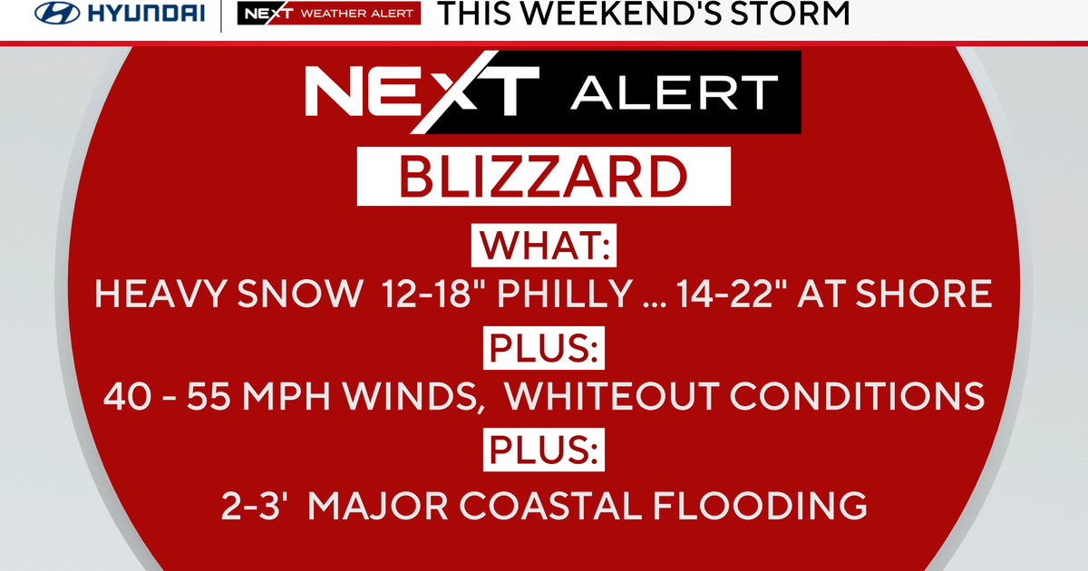
WEATHER BLOG: Weather The Storm, Nice Week Ahead
Hi Everyone!
Looks like another, potential, round of thunderstorms today. But later in this calendar day. The thinking, as I write this, is after dinner and before an early bedtime for those storms. We have a BIG cold front crushing into the unstable hot and humid air mass over us. Behind that front lay some FANTASTIC weather for the weeks end, and week end. Sunny, temps in the upper 70s dayside, and the upper 50's night time. LEGIT. Almost unheard of late August weather. Truthfully the weather for the period Thursday thought Sunday is about that easy. But let's discuss these potential storms forecast for later.
When we talk about the Storm Prediction Centers designations try not to get too hung up on words like "Marginal", or "Slight" . For as benign as those words sound it means we ARE in an AMPED UP situation. Yesterday we had a big storm rake Essex. And we were in a "Marginal" risk category. "Marginal." As you move out the I-70 corridor the risk moves up to "Slight." So let's see how this situation squares away later on. For sure we will be tracking this front as it moves our way.
MB!