WEATHER BLOG: Lovely Day
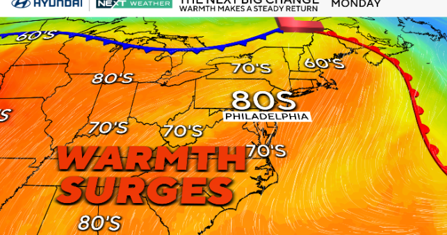
Upper level ridging will provide a fairly nice day today across the I-95 corridor with very mild temperatures. This will hold on before a weak piece of energy rolls in on Monday and provides a brief shower during the morning. There won't be much cold air being advected behind this system so temperatures will not drastically plummet.
By later Tuesday, a warm front will lift northward and bring us some rainfall late Tuesday and into Wednesday morning. Given the current track of this storm, all precipitation will be in the form of rain. Much of this is because very little cold
air was deposited by the system on Monday, as well as how progressive this pattern has become. Rain will continue through the morning and begin to taper off. Showers may last into the afternoon hours.
Chillier air is expected behind this system and this will continue into Thursday. Generally dry weather is expected for the later half of the work-week and going into the weekend, but some of the models hint at a system providing some snowfall from Thursday night into Friday. This is still a long way out and much will change between now and then. Regardless, anticipate a cold start to the weekend with the reinforcing Arctic clipper coming down Thursday night and Friday.