WEATHER BLOG: Beautiful Day
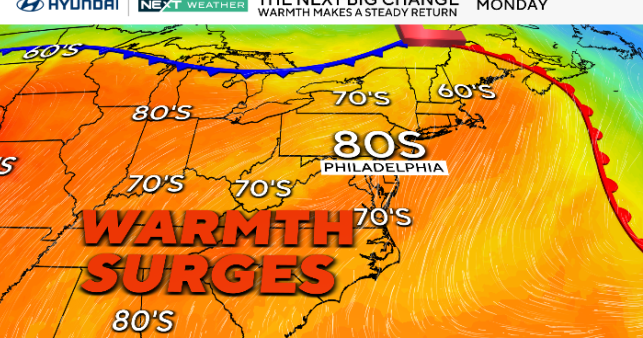
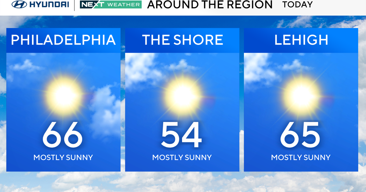
We have a beautiful day in store for us today, with temperatures climbing on a west-southwest wind and with plenty of sunshine today. High pressure well to our south will keep a storm system well to the north of our area today and provide for the warming conditions. Look for these to conditions to continue into Sunday for an even nicer second half of the weekend. Temperatures will near or into the 60s across the I-95 corridor and the sunshine will add to the warmth. You can't ask for much nicer on a winter day.
On Sunday night and into Monday morning, a disturbance passing over southern Canada will manage to reach into the area as high pressure of the southeast slackens. The front will be rather dry when it gets to the coast but a shower late cannot be ruled out. The front will kick winds out to the west but will fail to bring much cooler conditions. Monday should be rather mild for the time of year yet again.
Tuesday is the last day with an sort of confidence as we head into the rest of the week. An upper trough will be setting up to our west and a significant storm system may be brewing. At this point in time, the warm front looks to be north of us and the wet weather to our south and west, so Tuesday should be largely dry and mild. There is the outside shot of a shower in the warm advection pattern, although this right now is a mention at most.
On Tuesday night into Wednesday, that storm system does look to track west of us in some capacity. Depending upon your model of choice, you timing will change as does your storm duration, but the important information to know is that precipitation type will be very likely to be 100 percent rain. Depending how far north the low track is, we could even be looking some thunder. We look cooler as we head towards the end of the week, as the next high pressure system to bring us settled weather will drop down out of Canada and be associate with polar-continental air.
On Friday, the next chance for disturbed weather will come from a shortwave moving through the pattern. It looks right now like there is the chance for a quick shot of snow or at least wintry mix late this week, likely timed to the early morning hours, at least right now. We will have to watch as this system develops.