Winds gradually relax as cold air moves into Maryland Sunday evening

Chilly, windy weather continues across Maryland through early evening. Temperatures have cooled into the low to mid-40s and will continue to tumble overnight. A gusty breeze is making it feel even chillier this evening.
Colder weather will continue to blow into Maryland tonight and Monday ahead of the next chance of damp weather.
Chilly Sunday night across central Maryland
It'll feel like it's in the 20s before midnight in some areas. Temperatures continue to drop overnight, with a breeze and few clouds around.
Monday begins with temperatures in the low to mid-30s away from the bay; near 40° on the water. A morning breeze will have it feeling like it's in the 20s. Under quite a bit of sunshine, temperatures are forecast to peak in the upper 40s and lower 50s. A chilly breeze will be blowing all day long. While gusty, it won't be as windy as today.
Gloomy weather returns on Tuesday
An active weather pattern continues across the Mid-Atlantic through the workweek.
A fast-moving storm system will graze Maryland on Tuesday. Light rain showers will overspread our area during the day; most likely after 1 p.m. Only spotty rain is expected earlier in the day. A few snowflakes and sleet pellets could mix in weather the rain, especially as it begins. There won't be any wintry accumulation. Rainfall will be light; averaging less than .25". Though, a few spots could receive up to .50", especially south of Baltimore. Temperatures will remain in the 40s all day Tuesday in most communities.
Another storm system approaches later in the workweek, with a greater chance of wet weather. Temperatures trend warmer through the second-half of the workweek, heading into next weekend.
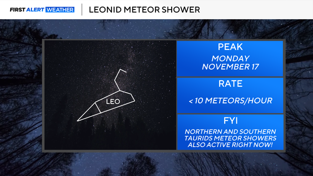
Leonid meteor shower peaks
Early in the week, the Leonid meteor shower will peak. Only up to 10-15 meteors per hour will be visible under ideal conditions . The shower peaks on Monday but you could see close to peak rates Sunday night and Monday night, as well.
Have a great week,
Cutter