First Alert Forecast: Warmer to end the week
BALTIMORE -- Sunshine will continue for the rest of today with temperature highs in the mid to upper 50s.
Clouds will increase across the region tonight with overnight lows in the upper 30s as a storm system approaches the area.
The bulk of the rain with the next system will stay well to our north in the Great Lakes, but a few showers will be possible during the afternoon and evening.
Winds will gust out of the south throughout the day Thursday over 20 miles per hour helping to warm highs into the low -to mid-60s.
It will be mainly dry for Friday with mild temperatures continuing. Skies will remain partly to mostly cloudy heading into the weekend. Saturday at this time looks dry with cooler high temperatures in the 40s.
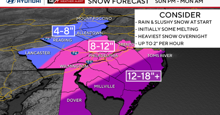
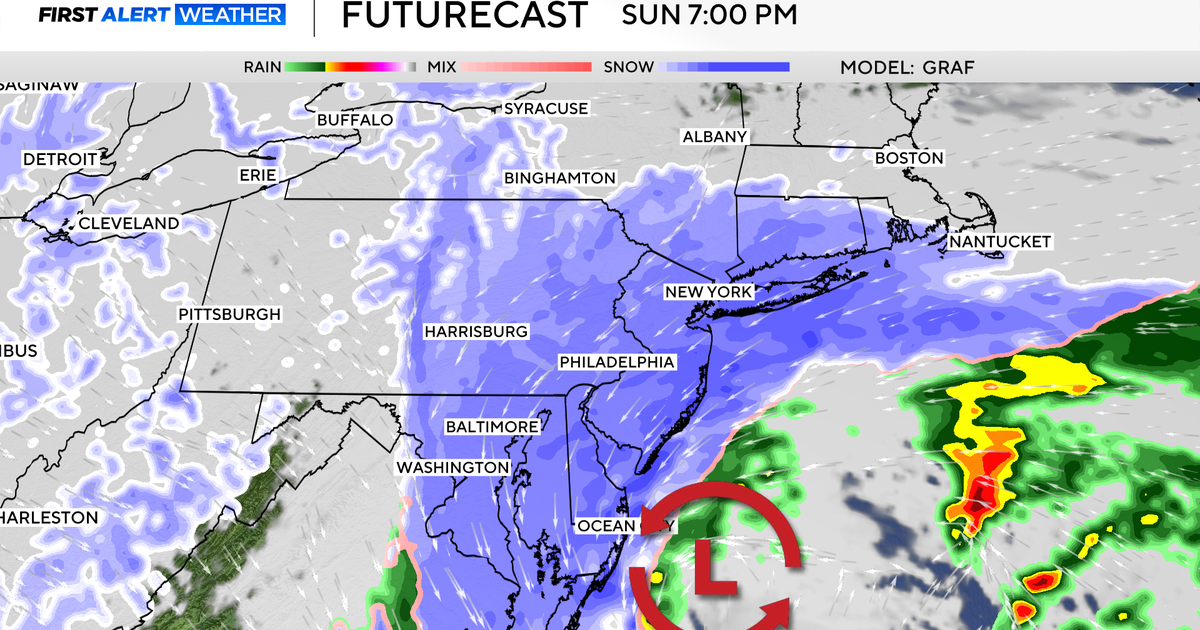
An area of low pressure will track just south of the region bringing a chance for rain to the area by Sunday afternoon and evening. It may be cold enough for rain to mix in with a little snow but the chances for this at this time look very low.
The region will begin drying out by Monday morning with a return to unseasonably mild weather through Valentine's Day with temperature highs returning to around 60 degrees by Wednesday.