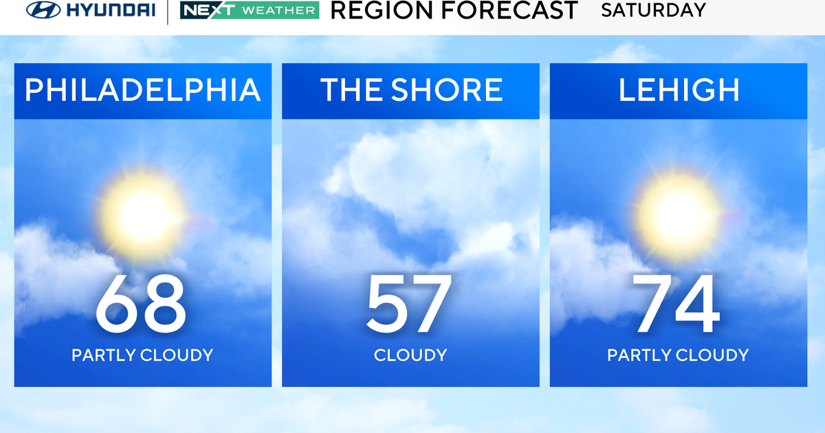
BLOG: Up And Down
SUNDAY: Showers associated with a low pressure system aloft and at the surface will pass south of the region Sunday while another batch of showers associated with a separate disturbance crosses southern New England . The metro region will be between these two systems, which will lessen the opportunity for rain. Nevertheless, there will be enough lingering moisture in the lower part of the atmosphere to keep skies cloudy and perhaps illicit a shower, especially Sunday morning.
SUNDAY NIGHT: Both disturbances depart the coast and a moisture-starved but vigorous cold front approaches from Canada. The front will cross the region around just after daybreak and cause winds to pick up late.
MONDAY: (WINDS ARE THE BIG NEWS) Cold front exits to our south and winds really pick up! The winds will average around 20-25 mph with gusts to around 40 mph. Despite ample sunshine, temperatures will only rise a few degrees from the morning ... struggling to hit 60 .... temps will fall in the late afternoon.
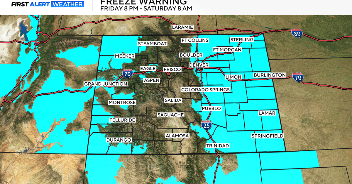
MONDAY NIGHT: (SUB-FREEZING TEMPS IS THE BIG NEWS) Winds will gradually subside as Canadian high pressure builds toward the NE States. But the big news will be the chill as temperatures slip to freezing in the city and into the upper 20s in some of the coldest suburbs.