BLOG: Rainy Day
BIG PICTURE ...
The unusual warmth ends, although temperatures will still be near to above normal for much of the upcoming forecast period. An important exception will be later Monday through early Tuesday as a shot of cold air from Canada dives into the Northeast on blustery winds. Temperatures will slip to near freezing in much of the region, especially outside of the city
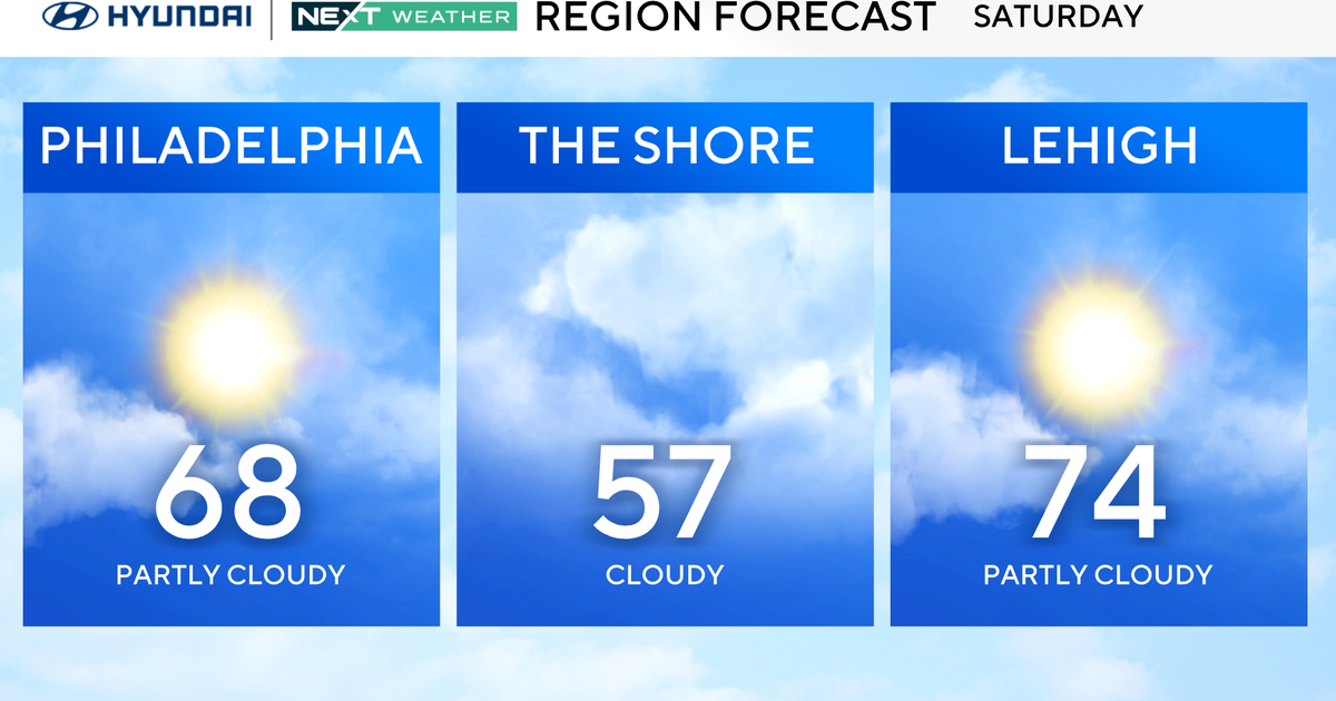
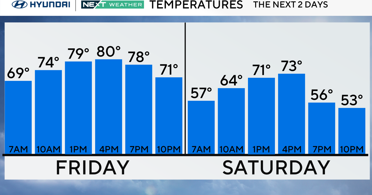
SATURDAY:
Clouds will blanket the region as breezes from off the Atlantic import cooler, relatively moist air. The upper level low pressure system that brought well over 6 inches of rain to the southeast Plains and lower Mississippi Valley and over 60 tornadoes to the Plains and parts of the Ohio Valley/Southeast earlier this week will plod from near Indiana Saturday morning to the central Appalachians. This will cause a batch of showers and a few thunderstorms to cross the region. The cooler flow from off the Atlantic and the overall weakening of this weather system should reduce the threat for severe weather, but there may still be some gusty thunderstorms, especially well west of the city.
SATURDAY Night-SUNDAY: Skies will remain cloudy and on and off again light showers will occur. Total rainfall should be under 0.40 inches in most places.