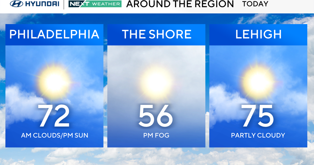
BLOG: Great Weekend
Saturday will be very similar to Friday . Breeze from the north-northwest will be a factor again and plenty of sunshine.
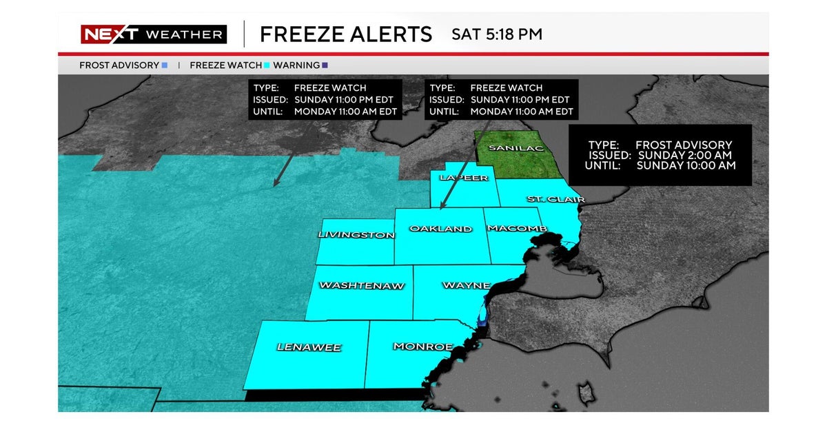
It will be chilly again at night with less wind and a mainly clear sky. Easter Sunday looks good (even several higher as far as temps go). You will have to be prepared for a chill for Easter Sunrise services, but temperatures will respond nicely with readings rising into the middle and perhaps even upper 60s. The wind will be a factor again Sunday.
The upper-level trough that we will be on the backside of Saturday and Sunday (helping to bring the breezy conditions from the north-northwest) will be closing off up over northern New England. As more energy feeds in from the west into to the south side of this then closed upper level low, the upper level low will retrograde westward and even southward as we head into Monday, Tuesday and Wednesday.
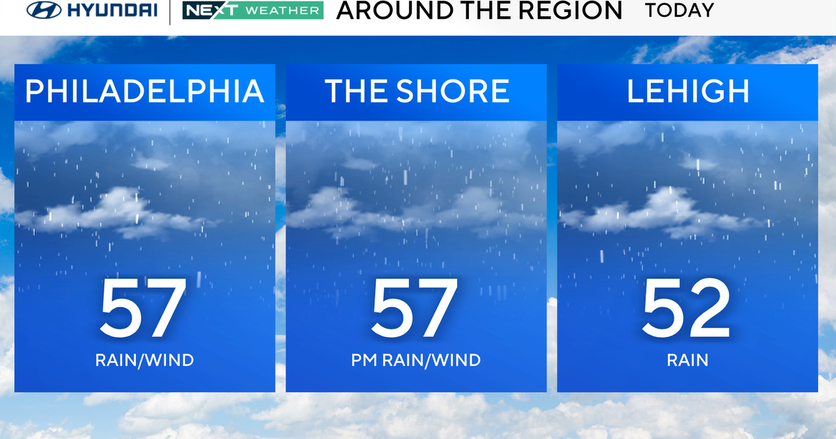
The energy feeding in from the west the upper levels could bring a shower to spots Monday afternoon (maybe even thunder). We will still be in the middle 60s for a high Monday ahead of this disturbance, but once it passes and the upper level low retrogrades and drops southward, temperatures will hold in the 50s most of Tuesday and in the 50s Wednesday. There could be a shower in the area Tuesday afternoon with the cold air aloft, then current models show the most moisture and instability for the best chance for a couple of showers Wednesday when the broad upper level low makes its closest descent on the area. So all in all, not looking like a steady rain Tuesday or Wednesday, but there will be some showers with the cold air aloft and moisture wrapping around the upper low, with the best chance coming Wednesday. Not a lot in the way of sunshine either of those days, and breeze will remain a factor.