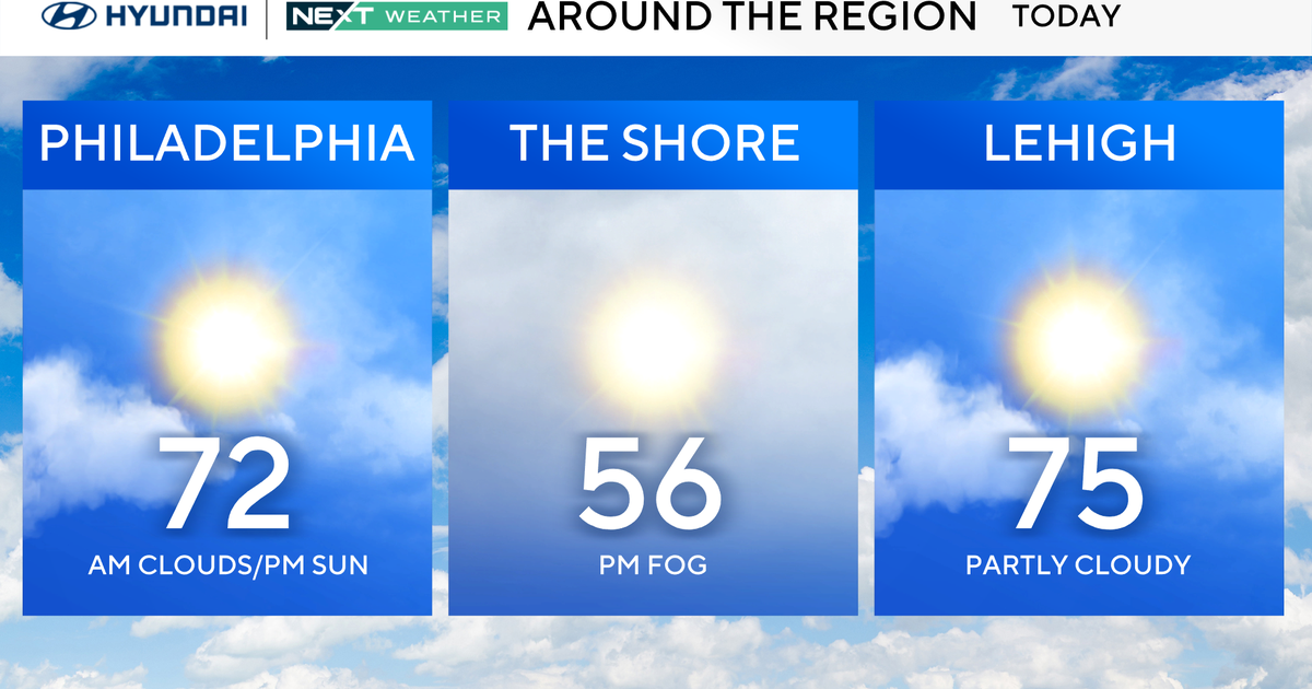
BLOG: Big Picture
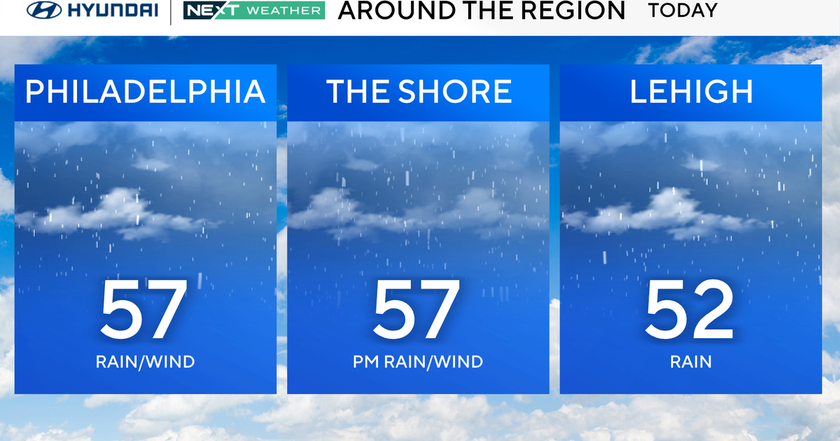
The dry, sunny, mild regime that has covered the region since the start of last week will continue through Easter Sunday. The weather will then transition to a cloudier and cooler regime for the balance of next week as a large zone of low pressure retrogrades (moves west instead of eastward) to eastern Canada and the Northeast. A few showers will accompany the clouds and cooler weather, but any showers should be brief and mainly light, however, a vigorous jet stream disturbance crossing the region late on Monday/Monday evening could bring a brief downpour along with a clap of thunder . In any event, rainfall for the upcoming week should average less than 0.25 over the area.
Current Weather Systems:
- A large ridge of high pressure extending from the surface to 20,000 feet stretches from Hudson Bay to the interior East. At the same time a large vortex is spiraling near Nova Scotia. The pressure difference between the two systems has brought gusty winds to the area the past few afternoons.
- Another low pressure system currently over south-central Canada has a cold front extending south into the Great Lakes and Ohio Valley. This front is surrounded by a 200-mile wide zone of clouds and some light showers. This system will weaken as it moves toward the East Coast, but it should serve to bring clouds to the skies tonight and perhaps a sprinkle.
- This low and cold front will then depart the coast and get absorbed into the low over Nova Scotia. A blocking high over Greenland and central Atlantic will cause this Nova Scotia low move slowly westward into Quebec and then eventually south into the Northeast.