Winter weather expected to develop Tuesday across much of Maryland

While the first day of December started off quiet and cold in Maryland, winter weather is expected to develop on Tuesday.
On Monday, the early morning wind chill started in the mid-20s and will climb into the upper 30s this afternoon. Look for a pleasant mixture of sunshine and clouds.
The first significant winter storm of the season is possible for the extreme northern and western parts of the WJZ viewing area Tuesday morning. There is another possible storm that could bring winter weather next Friday into Saturday.
Winter weather in Maryland Tuesday
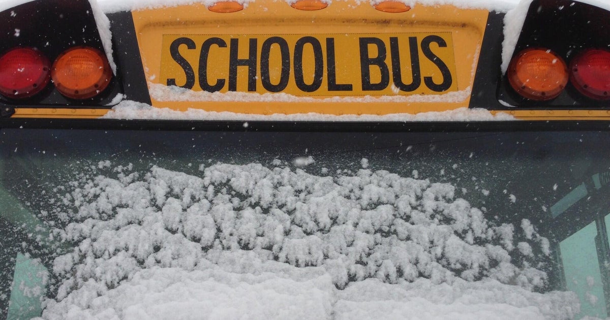
Tuesday is a WJZ First Alert Weather Day for accumulating snow and ice with a changeover to rain. Sloppy and slick travel conditions are likely Tuesday, especially during the morning and in areas north and west of Baltimore.
The start time for light snow, a wintry mix, and rain is between 3 a.m. and 7 a.m., with our western counties like Carroll and Howard experiencing the snow and mix first. All areas along and west of I-95 have the opportunity for a period of winter weather, including snow, sleet, and freezing rain. Areas along I-95 will see a changeover from a wintry mix to snow before 8 a.m.
The further north and west you head from the Baltimore Beltway, the longer the snow and wintry mix lasts. In these areas, there is the opportunity of travel delays, school delays and closings, along with tougher travel conditions. Meanwhile, areas east of I-95 should just be encountering wet roads.
Everywhere across the WJZ viewing area should experience a changeover to rain by lunchtime. The rain will continue for several more hours before tapering off before 6 p.m.
How much will it snow Maryland?
Areas east of I-95 will experience all rain and no snow and/or ice accumulation is expected.
Areas along and north and west of I-95, communities within the Baltimore Beltway or nearby may experience a quick coating of up to 1 inch of snow and sleet. This crusty coating of snow and ice will quickly be washed away by a changeover to rain before 9 a.m. Once the wintry mix changes to rain, the precipitation will stay rain should early evening.
Areas north and west of the Baltimore Beltway, across much of central and northern Baltimore County, northwestern Howard County, south-central Carroll County, and northwestern Harford County, including towns such as Ownings Mills, Reisterstown, Eldersburg, Lisbon amd Cockeysville, will likely see 1 to 2 inches of snow and ice before the changeover to rain. In these areas, a change to rain should happen between 9 a.m. and 11 a.m.
Up to 3 or 4 inches of snow may fall by Tuesday afternoon across portions of Frederick, Carroll and northwestern Baltimore counties.
Plan extra time for your Tuesday routine and expect a slower-than-normal Tuesday morning commute. The forecast dries out from west to east, Tuesday afternoon.
Small shifts in the movement of the storm can change a forecast from accumulating snow to heavy rain. Check back regularly as the WJZ First Alert Weather team tweaks the forecast as new information comes in.
Risk for winter weather Friday, Saturday
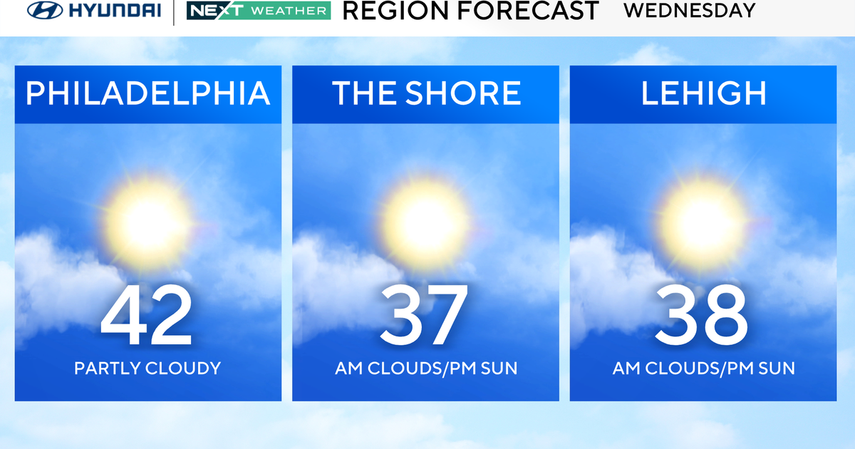
The weather quiets down after Tuesday's sloppy storm. We score a few enjoyable weather days Wednesday and Thursday with a mix of sun and clouds with highs in the 40s.
Friday and Saturday may end up being First Alert Weather Days, due to the risk of snow and ice as another storm system approaches. Most of Friday will be dry and cold, following a cold front Thursday. Temperatures remain in he 30s all day long. As of early Monday morning writing this discussion, some of the newest computer guidance has backed off the idea of a large and impactful winter storm, but this happens sometimes on our models, so we will continue to monitor.
We'll continue to keep an eye on the chance of wintry weather at the end of the week and let you know if Friday and/or Saturday will need to be upgraded to WJZ First Alert Weather Days.