A Wet Texas New Year's Eve For Some Before Temperatures Plummet Below Freezing This Weekend
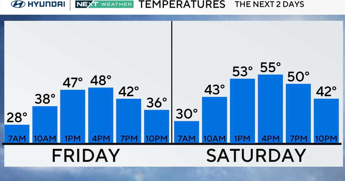
NORTH TEXAS (CBSDFW.COM) — Friday will be another warm day with highs in the mid 70s, cloudy skies, and spotty showers.
Rain chances increase this evening into early Saturday morning. So, it is going to be a wet New Year's Eve for some areas.
There is a marginal risk of isolated severe storms this evening, with hail and damaging winds the main concerns, but an isolated tornado can't be ruled out.
The risk of severe weather shifts into our eastern counties Saturday morning as the line heads out of North Texas.
We warm up ahead of a strong cold front on Saturday to near 70°. The front moves through early afternoon, bringing strong northerly winds and plunging temperatures through the evening hours.
By Sunday morning, temperatures are in the 20s, with wind chills in the single digits. Sunday will be a sunny afternoon but cold, highs only near 40°, but breezy northerly winds will keep things feeling like close to freezing.